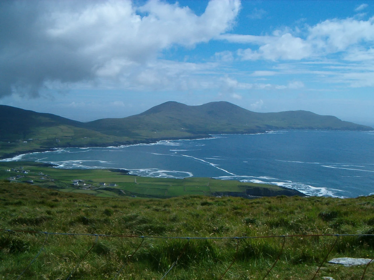

St. Finian's Bay
The bay is a clean crescent, with one headland to the north and another to the south, and the open Atlantic filling the gap between them. From the pier at the middle of the curve you can see Puffin Island just offshore and, on a clear evening, the silhouettes of Skellig Michael and Little Skellig further out to sea. The wind is almost always doing something. On calm days, divers slip into the water here for trips out to the Skellig Rocks. On wilder days, the surfers at Glen's Beach get the bay to themselves. The patron saint who gives the place its name watched over an older traffic - monks rowing eight miles offshore to a rock that became one of the most famous monastic sites in the Christian west.
The Saint and His Sea
Saint Finan Cam, whose name the bay carries, may have been the founder of the first monastic oratory on Skellig Michael, directly opposite this shore. The early Irish saints were a numerous and not always easily separated company, and the records of Finan are thin enough that scholars have debated which Finan founded which place. What is reasonably clear is that by the time written sources start describing this coast, there was a tradition associating this bay with the saint and the islands beyond it. When the Vikings began raiding Ireland in the late eighth and ninth centuries, the monastery on Skellig Michael became dangerously exposed, and tradition says the community moved its base back to the mainland. The walls of that mainland monastery, by the late nineteenth century, could still be made out in a sheltered corner at the head of the bay - the original from which the much later Killemlagh Church inherited its site.
Layers of Stone
St. Finian's Bay is one of those small, intensely layered Irish landscapes. At Rathkerin, near the back of the bay, the remains of an earth fort still register in the ground. Souterrains - the underground stone passages that often appear under early medieval Irish farmsteads - have been recorded in the area. There are stone graves whose builders left no names. Kilaboona, a tiny early Christian oratory, marks one of the older Christian sites in the district, and a well dedicated to Saint Buaine still rises near the western end of the settlement. South of Killemlagh Church stands the Pagan's Grave - an enclosure of standing stones that predates the Christian use of the area by thousands of years. Walking these few square miles you can move, in an hour, from Bronze Age stones to a twelfth-century Romanesque church to a working surf break. The geography of the bay has kept attracting people; the styles of attraction keep changing.
The Modern Bay
Today the bay sits on the Skellig Ring, the smaller and quieter alternative to the more famous Ring of Kerry. The Skellig Ring drive connects Portmagee at the northern end to Ballinskelligs at the southern end, and St. Finian's Bay lies on the open stretch between them. The pier in the middle of the bay is a working launch point for dive boats heading out to the Skellig Rocks, which are one of the most spectacular underwater sites in Europe - cliffs that fall straight down from the surface to depths of more than fifty meters, with kelp forests and walls of life that benefit from the same Atlantic exposure that makes the islands so difficult to land on. Glen's Beach, at the back of the bay, has become a known surf spot. The cliffs above it remain undeveloped. On a clear day with a clean swell rolling in, you can see five separate generations of human use from the same vantage point: the standing stones, the ruined church, the saint's well, the boat slip, and the wetsuited figures in the water.
Light at the End of Europe
St. Finian's Bay faces almost due west, which means it gets the full force of the Atlantic and the entire arc of evening light. Sunsets here have the quality that earlier generations of Irish writing tried to describe and largely failed - a yellow that goes orange that goes red that goes a long, low purple, with the silhouette of the Skelligs at the precise edge of the horizon during much of the year. Puffin Island in the foreground takes a hard black profile against the brighter sea. The visitors who stop along the Skellig Ring drive often do not know what saint named the place, or which century built which ruin. They stop because the light is doing something they want to watch. The saint, presumably, would have understood.
From the Air
Centered near 51.825°N, 10.358°W on the western edge of the Iveragh Peninsula. Recommended viewing altitude 1,500-3,000 feet AGL. The bay is a clear crescent between Puffin Island to the north and Ducalla Head to the south - both make obvious navigation references. Killemlagh Church and St. Finin's Well lie just inland; the Skellig Islands (Skellig Michael and Little Skellig) sit roughly 8-9 nm to the southwest. Nearest airport is Kerry (EIKY) about 35 nm to the northeast; a small grass strip exists on nearby Valentia Island (EIVT). The bay is fully exposed to Atlantic weather - expect strong westerlies and rapidly changing visibility. Beautiful late-afternoon light for photography, but watch for fog forming offshore.
Nearby Stories
- Dunlough Castle 2.6 km away
- Beara Peninsula 4.2 km away
- Dunbeg Fort 8.4 km away
- Pouldergaderry Sinkhole 13 km away
- HMHS Llandovery Castle 40 km away
- The Laki Eruption: The Volcano That Changed World History 1404 km away
- The Northern Lights: The Sky Show That Vikings Thought Was Bridge to the Gods 1505 km away
- Sao Miguel 1906 km away