.jpg)
St John's, Isle of Man
Once a year, on 5 July, the laws of the Isle of Man are read aloud from a small grass-covered mound in a village of fewer than a thousand people. The ceremony is older than most parliaments still in active use. Tynwald has met somewhere on this island for more than a thousand years, and for centuries that somewhere has been St John's - a village tucked into the central valley between Douglas and Peel, dominated by the steep flank of Slieau Whallian, threaded by the A1 road, and built around a small Anglican church from which the place takes its name. On Tynwald Day the population swells from a quiet thousand to a crowd of thousands, watching a Norse-era ritual unfold on a hill that was almost certainly chosen for the same reason traffic still passes through here: from St John's, you can reach every corner of the Isle of Man.
The Hill That Is Also a Parliament
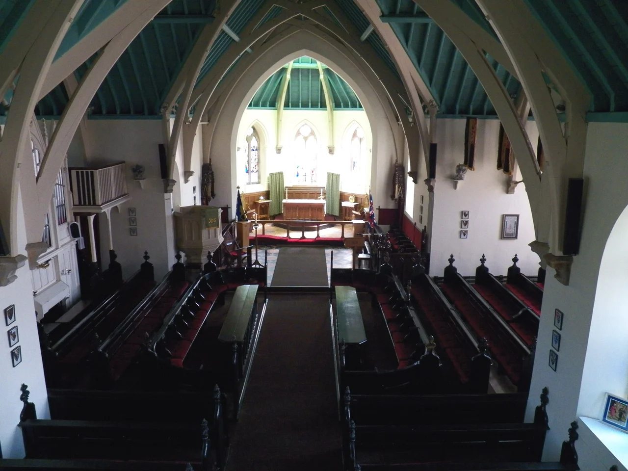
Tynwald Hill is not large. Four circular tiers of grass rise about twelve feet above the field beside St John's Chapel, and from the top tier the island's officers proclaim new legislation in English and in Manx. Until any new Act is read at Tynwald Hill, it is not fully law on the island - the ceremony is not theatrical, it is constitutional. The date matters too. 5 July aligns with the feast day of St John under the Julian calendar, which marked midsummer; the original Tynwald gatherings were midsummer fairs as well as legislative assemblies, blending market and law into one annual event. Within the church beside the hill, reserved pews carry name plaques for members of both branches of Tynwald - the elected House of Keys and the Legislative Council. The adjacent hall houses an exhibition tracing the assembly's history. The whole arrangement reads as a settlement designed around an idea: that government should be visible, audible, and outdoors at least once a year.
The Pound and the Pindar
Opposite the church sits the remains of an older kind of authority. The ancient pound was where stray animals were impounded and held until claimed, and the rules were specific. If an owner failed to retrieve a wandering beast within a year and a day, the animal became the property of the Lord of Mann. If the owner did reclaim it, the fee was split equally between the Lord and the pindar - the parish official who managed the pound. It is the kind of small medieval mechanism that reveals how much governance happened at the level of village squares and stray sheep. On the same site sit a cluster of large stones from a 2300 BC burial chamber found locally, set out for visitors. The pound and the burial stones share a few square metres and roughly four thousand years between them.
Manx in the Schoolhouse
St John's keeps watch over something else uncommon. Since 2003, the former St John's School building has housed the Bunscoill Ghaelgagh, the only primary school on the island that teaches the entire curriculum through Manx Gaelic. The language was effectively extinct as a community tongue by the late twentieth century - the last known native speaker, Ned Maddrell, died in 1974. The school is part of a deliberate revival, raising a generation of children who can read Tynwald's proclamations in the language they were once originally read in. The connection between the village's old role and its new one feels less like coincidence and more like geography insisting on continuity.
A Junction, Then and Now
Even before the modern road network, this central valley was the obvious place to converge. The A1 from Douglas to Peel runs straight through the village; the A3 cuts away southward to Foxdale and Castletown, northward to Kirk Michael, Ballaugh, Sulby and Ramsey. From St John's you can be anywhere on the island in under an hour. The village's railway station, long closed, was once the same kind of nexus - the meeting point of the Isle of Man Railway's Peel line, the Manx Northern Railway, and the Foxdale Railway. The trackbed is now the Steam Heritage Trail, a walking path that retraces the route by foot rather than by steam. The main commercial concern in the village is Tynwald Mills, which advertises itself as the island's only department store. It is a small place still doing several jobs at once: parliament, schoolhouse, junction, market, and once a year, the loudest village in the Irish Sea.
From the Air
Coordinates 54.2022 N, 4.6414 W in the central valley of the Isle of Man. Tynwald Hill is a small artificial mound beside the Anglican chapel - visible from low altitude as a circular feature in the field east of the village. The A1 east-west and A3 north-south intersect here. Slieau Whallian rises to about 1,094 ft just south of the village. Ronaldsway Airport (EGNS) is about 9 nautical miles southeast; recommended viewing altitude 1,500-2,500 ft AGL. Cloud often hugs the central ridge of the island.
Nearby Stories
- Ballywalter 14 km away
- Pasages (steam trawler) 15 km away
- SS Georgetown Victory 19 km away
- Celtic Array 31 km away
- Raeberry Castle 34 km away
- German submarine U-1051 36 km away
- St Bees Lifeboat Station 49 km away
- PS Rothsay Castle 73 km away