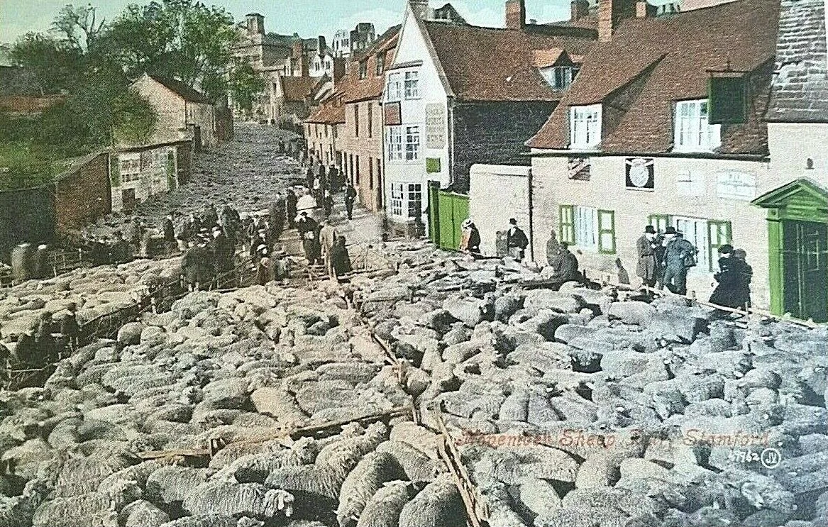

Stamford, Lincolnshire
In September 1967, two months after the Civic Amenities Act received royal assent, a Lincolnshire town became the first place in England to be designated a conservation area. The choice was not random. Stamford had spent the Industrial Revolution being quietly bypassed, kept intact by accidents of geography and stubborn property owners, and by the 1960s its grid of honey-coloured limestone houses and five medieval parish churches looked like something pulled out of the seventeenth century and dropped, almost unchanged, into modern Lincolnshire. The planner Kenneth Fennell of Kesteven County Council had been arguing for years that listed-building protection alone was not enough. Stamford needed the whole townscape saved at once. The new law made that possible. Stamford was first because Fennell had already done the work.
A Stony Ford
The name appears in the Anglo-Saxon Chronicle as Steanford in 922 and Stanford in 942, and again in the Domesday Book of 1086. It means stony ford. The Romans had crossed the River Welland just west of the modern town on Ermine Street, the great road from London to Lincoln, and in 61 CE Boudica's army followed Legio IX Hispana across the same water. The Anglo-Saxons made Stamford their town here, on a bigger river than the nearby Gwash, and King Edgar formally chartered it as a borough in 972. By the high medieval period Stamford was making woollen cloth called haberget, well-known as far away as Venice during the reign of Henry III. It was one of the Five Boroughs of the Danelaw and the only one that never became a county town.
The Lost University
In 1333 a group of students and tutors from Oxford, dissatisfied and tangled in the violent feuds between northern and southern factions at the university, walked out and tried to found a rival institution at Stamford. The runaways included men from Merton College and Brasenose Hall. Oxford and Cambridge petitioned the king. Edward III ordered the secessionists back, and after several attempts the rival college was suppressed by 1335. The oath that followed lasted nearly five centuries. Until 1827, every Oxford MA candidate had to swear that they would not lecture, or hear lectures, at Stamford as in a university or college general. The fragments of the rival college, now called Brazenose, became part of Stamford School. A door knocker preserved at Brasenose, Oxford, is said by tradition to have been retrieved from the Stamford breakaway. Whether or not that story is literally true, the school is the only English institution that can credibly claim to have been part of a fourteenth-century university secession.
The Bull Run and the Pogrom
For over six hundred years, until 1839, Stamford held a bull run on 13 November each year, St Brice's day. The tradition supposedly began when William de Warenne, fifth Earl of Surrey, watched two bulls fighting in the meadow under his castle, was charmed when one ran into town, and gave the meadow to the town's butchers on the condition that they keep providing a bull each year. The streets would be cleared, a bull released, dogs and men chasing it through the medieval lanes. The run was finally banned in 1839 by the new RSPCA, dragoons, and Home Office pressure. Stamford also has darker entries in its medieval ledger. On 7 March 1190, men at the Lent fair, raising spirits for the Third Crusade, led a pogrom against the town's Jewish community. Several Jews were killed. The survivors fled into the castle with their lives but lost their houses and money. It happened during the most popular fair of the year, and the law afterwards did not pursue the killers.
Five Churches and Six Hundred Buildings
What you see today is the town that the eighteenth and nineteenth centuries left alone. Stamford had its boom in the medieval wool trade, then a long stagnation, then in the 1660s the River Welland was made navigable and the malt trade revived the place. The Great North Road, today's A1, made it a coaching halt: Henry VIII, Elizabeth I, James I, Charles I all passed through. The George Hotel, the Crown, the London Inn, the Bull and Swan were famous inns. But the Industrial Revolution that hammered other midland towns into smoke and brick mostly missed Stamford. The result is over 600 listed buildings, five medieval parish churches inside the old walls, and a townscape of seventeenth- and eighteenth-century stone, mostly local limestone with Collyweston slate roofs. St Leonard's Priory on the edge of town is the oldest building in Stamford, with Norman pillars and arches from about 1090 and a west front from around 1150. The Corn Exchange on Broad Street was finished in 1859. Tolethorpe Hall, just outside town, hosts open-air Shakespeare each summer.
Filmed, Photographed, Lived In
Television and film crews love Stamford because the town does not need to be redressed. Pride and Prejudice, Middlemarch, Pride and Prejudice again, Belgravia, The Da Vinci Code: all have used the same Georgian streets. In 2013 the Sunday Times rated Stamford a top place to live. RAF Wittering sits just south of the town, the airfield that opened in 1916 as RFC Stamford, was renamed in 1918, and was until 2011 the home of the Harrier. The Stamford Mercury claims to be Britain's oldest continuously published newspaper, having printed since 1712. The first conservation area in England turned out to be a working town, not a museum, and that is exactly what Kenneth Fennell hoped for in 1967.
From the Air
Located at 52.65 degrees north, 0.48 degrees west, in southern Lincolnshire on the River Welland. Stamford sits where the A1 north-south road crosses the river, on the historic border between Lincolnshire and Northamptonshire. From altitude the town reads as a tight cluster of stone roofs around five medieval church spires. RAF Wittering (EGXT) lies 2 nautical miles south of the town centre, an active military airfield; transiting traffic should monitor Wittering operations and stay clear of the active runway. Cambridge City Airport (EGSC) lies 40 nautical miles south-southeast. Rutland Water is 7 nautical miles west. Best viewed from 2,000 to 4,000 feet in clear conditions; the Georgian street pattern is most legible against low-angle morning or evening light.
Nearby Stories
- 2022 Leicester Unrest 3.7 km away
- Trent Bridge 6 km away
- Ancaster, Lincolnshire 6.7 km away
- Murder of Una Crown 9.9 km away
- Wellingborough 15 km away
- RAF Witchford 16 km away
- Batemans Brewery 26 km away
- Canons Ashby House 27 km away