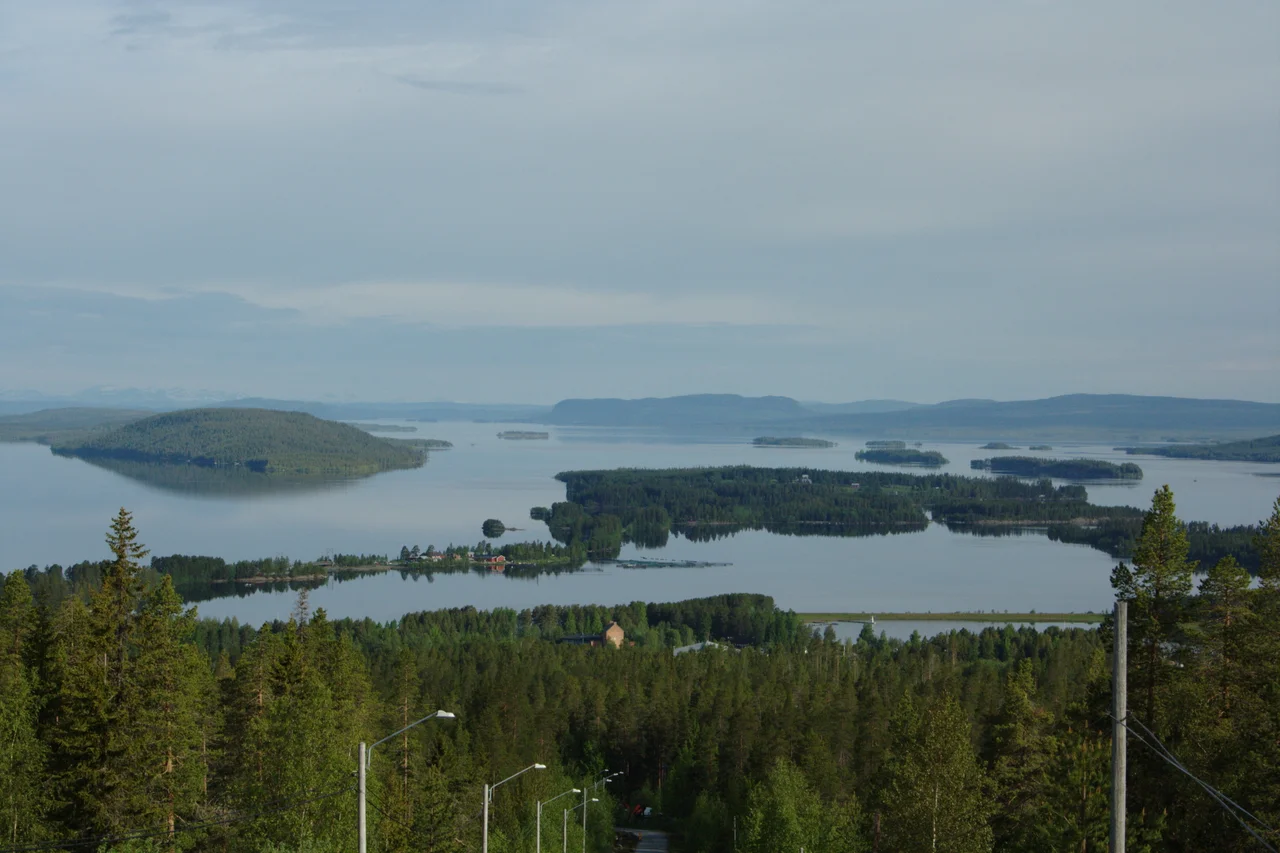

Storuman (lake)
Ask how wide Lake Storuman is and the only honest reply is another question: which end? At its northwestern extremity the lake is a slot barely five hundred metres across, winding thirty kilometres between mountainsides that rise five hundred metres straight out of the water — a fjord in everything but salt. Follow it southeast and the walls step back, the shores flatten, pale sandy headlands push out into open water, and the same lake spreads six kilometres wide. Two entirely different bodies of water share one name, one outflow, and one river running through them both.
The Slot
The northwestern arm is the half that looks carved rather than filled. Ice worked this trench down through the fells and left it deep out of all proportion to its width: the bed drops as much as 112 metres in places where the surface is only five hundred metres across, which means the water below a boat is several times deeper than the boat is far from either shore. The slopes above hold that scale — five hundred metres of mountainside, birch giving way to scree giving way to bare rock. Sightlines are short. The lake bends, and each bend closes the view behind you, so the arm reveals itself a few kilometres at a time rather than all at once.
The Basin
Southeast, the geology relaxes. The lake broadens to six kilometres and the shorelines run almost unbroken, backed by low, level ground rather than cliff. Sand replaces stone. Headlands built of it reach out into the water in long shallow spits, the sort of shoreline that reads as beach from a distance, and in the southern part of the lake lies the island of Luspholmen. At the far southeastern end the lake finally lets go of the Ume River, and the town of Storuman stands at that outlet. From the air the transition between the two halves is unmistakable: a thread of dark water tightening between mountains, then abruptly opening into something pale, wide and calm.
One Hundred and Forty-Eight Metres
The deepest sounding in Lake Storuman is 148 metres. Since the surface sits 351 metres above sea level, the lake floor lies a little over 200 metres up — a hole punched most of the way down through the highland it occupies. That number is newer than it looks. Older reference works credit the lake with maximum depths in the 120s and 130s, and the correction was startling enough that a 2012 report in Svenska Dagbladet ran under the headline "The lake became 26 metres deeper." It is a reminder of how recently the interiors of northern Sweden were properly measured. The lake covers 171 square kilometres, which by area places it among the country's larger inland waters, but it is the depth that distinguishes it — few Swedish lakes go down further.
Water on a Leash
The Ume River flows through Storuman, and the Ume River is one of the workhorses of Swedish electricity. The lake serves the power stations downstream as a reservoir, its level rising and falling by as much as seven metres as demand and season require. Seven metres is not a subtlety. On a lake with wide, flat, sandy margins, a drawdown of that scale leaves broad expanses of exposed bed where there was water in June, and the shoreline a visitor sees in one month is not the shoreline of the next. This is the bargain inland Lapland struck during Sweden's industrialisation, when hydroelectricity, timber and ore turned the north into the engine room of a modernising country — power exported south, consequences kept local.
Luspen
The settlement at the outlet has a Southern Sámi name, Luspie, and a Swedish one that came later. Swedish settlers reached the spot around 1741, and for a long time nothing much happened: by 1912 the community called Luspen amounted to roughly forty people spread across eight farms. Then the railway arrived. A station on the Inland Line opened around 1924, and the place changed character within a generation, becoming a centre for hydroelectric construction and the timber trade before tourism found it. Today the town holds a couple of thousand residents, sits on the Blue Highway running east to west across the top of Scandinavia, and looks out over a lake that most travellers cross without registering that they are seeing only one of its two halves.
From the Air
Lake Storuman lies at 65.2358°N, 16.7783°E in Storuman Municipality, Västerbotten County, at a surface elevation of 351 m (1,152 ft). It is a superb navigational feature: 171 km² of water forming a narrow, winding 30 km northwestern arm hemmed by 500 m mountainsides, opening southeast into a basin up to 6 km wide with pale sandy spits and the island of Luspholmen. The Ume River enters and leaves it, and the town of Storuman marks the southeastern outlet. From 6,000–9,000 ft MSL the contrast between the two halves is obvious in a single glance. Because the lake is a hydro reservoir with up to 7 m of level variation, exposed shoreline can be extensive outside high water. Nearest fields: Storuman (ESUD, elev. 279 m) about 20 nm east at Gunnarn, Lycksele (ESNL, elev. 215 m) to the southeast, Vilhelmina (ESNV, elev. 350 m) to the south, and Hemavan (ESUT, elev. 458 m) to the northwest. Expect subarctic weather, valley fog over the water on calm mornings, and very short daylight in midwinter.
Nearby Stories
- Matsdal 15 km away
- Vindelfjällen Nature Reserve 40 km away
- Lapland (Sweden) 40 km away
- Lapplandsleden 88 km away
- Stora Blåsjön 101 km away
- Kungsleden 155 km away
- Kallak Mine 185 km away
- Umeå City Fire 199 km away