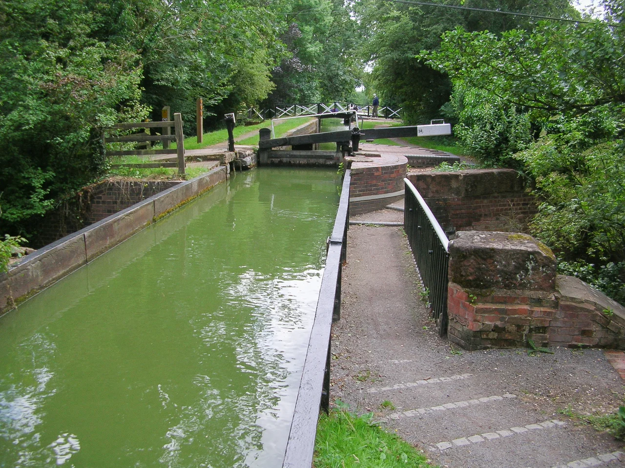

Stratford-upon-Avon Canal
On 20 May 1947 Tom Rolt deliberately picked a fight with the Great Western Railway. The railway had replaced a faulty lift bridge over the Stratford-upon-Avon Canal with a fixed bridge so low no boat could pass beneath it - in effect closing the canal without going through the legal trouble of formally closing it. Rolt, a founder of the new Inland Waterways Association, announced he would navigate his boat through the obstruction on a specified day, with the national press in attendance. The GWR, faced with the publicity, jacked the bridge up onto heavy timbers. The accompanying boat the railway provided promptly got stuck. Rolt's did not. He passed through, the photographs ran in the newspapers, and a derelict canal became, almost overnight, a cause.
Coal Routes Around Birmingham
The Stratford-upon-Avon Canal was conceived in the 1790s as part of a network that would let coal from the Dudley and Stourbridge canals reach Oxford and London without paying tolls to the Birmingham Canal Navigations - whose management was widely considered high-handed. An Act of Parliament passed on 28 March 1793 authorised construction from a junction with the Worcester and Birmingham Canal at Kings Norton, in what is now suburban south Birmingham, to Stratford-upon-Avon on the River Avon. The engineer was Josiah Clowes, who had also worked on the Dudley Canal. Cutting began that November. By May 1796 the main line had reached Hockley Heath, one mile short of the first lock at Lapworth, when the company ran out of money. The £120,000 initially raised by share issue was gone.
Eighteen Locks and Three Iron Aqueducts
Work eventually resumed under William James, a shareholder since 1793 with broad interests in turnpike roads, railways, and coal mining; he became chairman and bought the Upper Avon Navigation outright in 1813. A further Act of Parliament in 1815 authorised the canal's final connection to the River Avon at Stratford, along with reservoirs at Earlswood to supply water. The canal reached Stratford in June 1816 at a total cost of about £297,000. It runs for 25.5 miles in two sections divided by Kingswood Junction, where it connects with the Grand Union Canal. The Lapworth flight of eighteen locks descends from the Birmingham summit level; three iron aqueducts carry the cut over road and stream; the Wilmcote flight of eleven locks delivers the canal into the bowl of the Avon valley above Stratford. Bancroft Basin, the terminal, joins the River Avon through a single barge lock at the foot of the town.
Railways Take the Traffic
The canal was acquired by the Oxford, Worcester and Wolverhampton Railway in 1856, the typical fate of nineteenth-century waterways that found themselves competing with steam. By 1863 the railway company had been absorbed by the Great Western Railway, and traffic on the canal declined as the GWR diverted long-distance loads to its trains. Receipts fell faster than tonnage; the canal was being run down deliberately rather than developed. By the late 1930s the southern section between Lapworth and Stratford had become derelict, though the GWR continued to maintain a water supply because it still needed canal water for its engine shed in Stratford. The northern section was never officially closed, but traffic had virtually ceased by 1939 and the Tunnel Lane lift bridge at Lifford had been replaced with a fixed bridge that no boat could pass.
The Volunteers Who Refused to Let Go
Rolt's 1947 demonstration saved the northern section by making its closure politically embarrassing. The southern section was saved by an entirely different effort. The National Trust took over its management in 1959, and between 1961 and 1964 David Hutchings and the Stratford Canal Society - working with prisoners from local jails, soldiers on weekend training exercises, and an army of volunteers - restored 25 miles of derelict waterway by hand. They cleared silt, repaired locks, rebuilt bridges. The southern Stratford-upon-Avon Canal became the first canal in the United Kingdom to be restored primarily by volunteer labour. When the reopening came in July 1964 it was Queen Elizabeth the Queen Mother who cut the ribbon at Stratford, and what had been a derelict ditch began carrying narrowboats again. Responsibility for the canal was transferred to British Waterways in 1988.
King's Norton's Guillotine and the Brandwood Tunnel
The canal has its idiosyncrasies. At Kings Norton Junction, where it leaves the Worcester and Birmingham Canal, it passes through what is believed to be the only guillotine-gated stop lock on a British canal - two vertical wooden gates lifted by counterweights to admit boats. A short distance further south the canal enters the only tunnel on the line, at Brandwood, 352 yards long and built without a towpath. Horses walked over the hill while boatmen pulled their narrowboats through by hand using an iron handrail bolted into the tunnel wall, parts of which can still be seen. Earlswood Lakes, the canal's three feeder reservoirs - Terry's, Engine, and Windmill Pool - were built in 1821-22 and hold 210 million gallons. A beam engine pumped their water into the canal until 1936, and its engine house still stands. The Stratford Canal today is one of the busiest leisure waterways in England, its 56 locks worked by hire boaters who probably do not know they are owed the experience by a man in 1947 with a press release and a clear plan.
From the Air
Located at 52.29N, 1.73W where the canal meets the River Avon at Stratford-upon-Avon. The waterway runs 25.5 miles northwest to Kings Norton in south Birmingham, descending through the Lapworth flight of locks; from low altitude the line of the cut is visible against the rolling Warwickshire farmland. The M40 motorway crosses the canal at the bottom of the Lapworth flight. Nearest airports: EGBJ (Wellesbourne, 4nm E of Stratford), EGBB (Birmingham, 17nm N), EGBE (Coventry, 19nm NE). Best viewed at 2,000-3,500 ft AGL.
Nearby Stories
- Stowe House 2.5 km away
- Wolverhampton 3 km away
- Althorp 3.9 km away
- Droitwich Spa 4.3 km away
- Tewkesbury 5.4 km away
- Tamworth Castle 11 km away
- Uppingham School 23 km away
- Woodstock Palace 26 km away