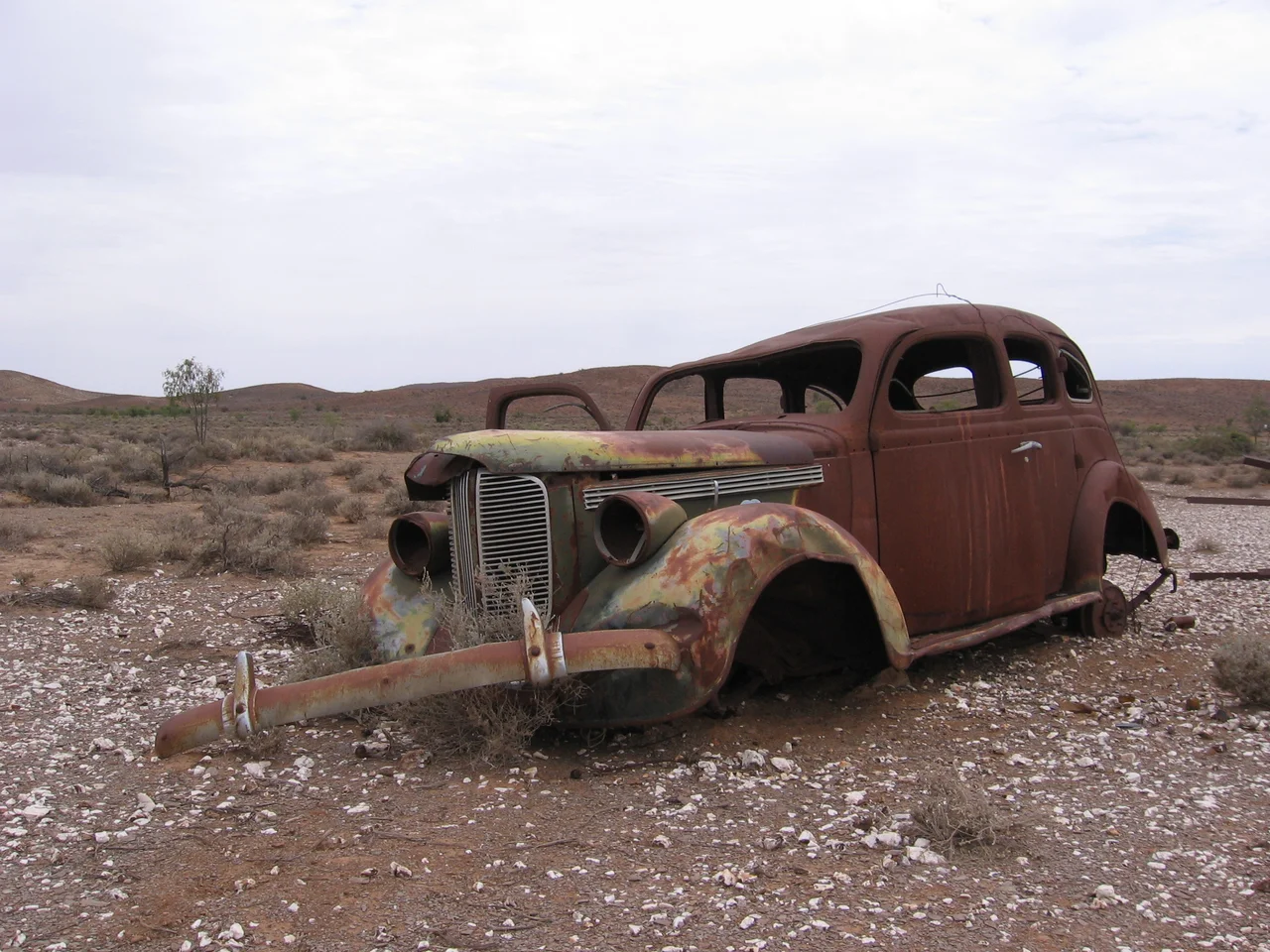

Strzelecki Track
Top up the tank at Lyndhurst, because there is nowhere else. For the next 472 kilometres of red gibber, sand and bulldust between here and Innamincka, the only fuel stop is a single detour into the gas town of Moomba. The Strzelecki Track does not forgive forgetfulness. It is named for a Polish explorer, Sir Paul Edmund de Strzelecki, who never drove it, and it was first blazed by a cattle thief who did not want to be found. Today it is one of South Australia's great outback drives, a corridor through some of the driest, emptiest, most quietly beautiful country on the continent.
The Driver's Reality
This is a route to respect rather than fear. In dry weather a careful high-clearance vehicle can manage the main road, but a 4WD is strongly recommended, and rain changes everything. A single storm can turn the surface to deep, axle-grabbing mud and close the track entirely, sometimes for days. Expect corrugations that loosen every bolt in the car, stretches of soft sand, low dunes, and bulldust holes that swallow a tyre near Strzelecki Creek and again closer to Innamincka. Carry more water than you think you need, a spare tyre or two, a compressor, recovery gear and food. There is no mobile coverage out here at all, so a satellite phone is genuine safety equipment, not a luxury. Check current road conditions before you leave and again each morning; the Department for Infrastructure and Transport posts closures, and a sealing project is gradually upgrading sections of the southern end.
Moomba: A Town That Isn't Quite a Town
Roughly midway, the track brushes past Moomba, a closed company settlement run by Santos in the heart of the Cooper Basin gas and oil fields. It is the only fuel between Lyndhurst and Innamincka, but Moomba is a working facility, not a tourist stop, and casual visitors are not welcome to wander in. Gas was first discovered nearby at Gidgealpa in 1963, and the plant now gathers production from more than a hundred fields, piping it south to Adelaide and east to the cities of the seaboard. Flares glow on the horizon at night. It is a strange, modern apparition in country that otherwise feels almost untouched, a reminder that this emptiness sits on top of one of Australia's most important energy reserves.
Cooper Creek and the Dig Tree
The track's reward waits near its northern end. Where Innamincka sits on the broad, tree-lined channels of Cooper Creek, the country softens into one of the inland's great oases, a ribbon of water and river red gums in a sea of stone. The name Innamincka comes from the Yandruwandha words for 'your waterhole', and these channels sustained Aboriginal people for thousands of years. A short drive across the Queensland border brings you to the Burke and Wills Dig Tree, the coolabah where, in 1861, a relief party buried supplies and carved the word DIG into the trunk. The doomed explorers returned to find the camp deserted, having missed rescue by a single afternoon. Standing at the waterhole, with the boardwalk and the old blazes, it is impossible not to feel the weight of the place.
Where the Track Connects
The Strzelecki is one piece of a larger outback puzzle. At Lyndhurst it meets the bitumen toward the Flinders Ranges and the railhead history of the old Ghan line. At Innamincka it links to the Birdsville Track to the west and routes onward into Queensland's Channel Country. Many travellers stitch these together into a grand loop, sleeping under skies so dark the Milky Way throws shadows. Time it for the cooler months, autumn through early spring; summer here is brutal, with daytime heat that can kill and nights that still drop toward freezing. Drive it patiently, help anyone you find stranded, and the Strzelecki rewards you with a kind of solitude that is getting harder to find anywhere on Earth.
From the Air
The Strzelecki Track runs roughly southwest to northeast between Lyndhurst and Innamincka in far northeastern South Australia, centred near 27.73 degrees S, 140.73 degrees E. From the air it appears as a thin pale line scratched across red gibber plains and dune fields, with the green ribbon of Cooper Creek and its waterholes marking the northern end near Innamincka, and the flares and infrastructure of Moomba visible roughly midway. The nearest airfields are the Moomba airstrip (YOOM) serving the gas operations and Innamincka Airport (YINN); Leigh Creek Airport (YLEC) lies to the south near Lyndhurst. Best viewed at 3,000 to 6,000 feet AGL in clear, dry conditions; heat haze and dust storms can dramatically reduce visibility over the plains.
Nearby Stories
- Malkumba-Coongie Lakes National Park 21 km away
- Ballera gas plant 47 km away
- Coongie Lakes 60 km away
- Arrabury 70 km away
- Wilson River (Queensland) 86 km away
- Dingo Fence 118 km away
- Sturt National Park 154 km away
- Mungerannie 158 km away