
Sturt National Park
Drive four hours north of Broken Hill, past where the bitumen surrenders to dirt, and the country starts to change. The plains flatten and redden. Mesas rise like broken tables on the horizon, the worn stumps of an ancient mountain range. This is Sturt National Park, more than 3,250 square kilometres of arid New South Wales reaching to the very northwest corner of the state, where three borders converge and the longest fence on Earth runs straight off into the heat. It is named for a man who came here certain he would find an inland sea.
A Land of Jump-Ups and Gibber
The park stages several deserts at once. In the east lie floodplains, scattered trees, and small rocky gorges cut by creek beds that run only after rain. Toward the centre rises the Olive Downs country, the "jump-ups": flat-topped mesas standing as much as 150 metres above the plains, the eroded remnants of an old mountain range, their tops scattered with granite and their flanks dropping to open valleys. Push west and the gibber plains give way at last to the rolling sandhills of the Strzelecki Desert. The scale is hard to absorb. Founded in 1972 and assembled largely from former sheep stations, the park is so visually striking that it featured in the BBC's landmark series Planet Earth, the kind of landscape that needs no narration to impress.
Red Kangaroos and the Long Fence
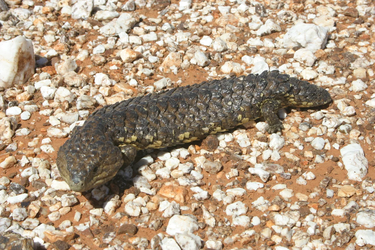
At least 31 species of mammals, 67 of reptiles and nearly 200 birds have been recorded here. The animals you are most likely to meet are the icons: red kangaroos, the largest marsupials on Earth, lounging in whatever shade they can find, alongside western and eastern grey kangaroos and the stocky euro. Emus stride across the gibber in loose family groups. Central bearded dragons bask on the rocks, and shinglebacks, the slow blue-tongued lizards, trundle across the tracks. Threading through it all is the Dingo Fence, which forms part of the park's northern and western edge at Cameron Corner. Standing beside that wire, watching it run dead straight to the horizon in two directions, is one of the park's defining experiences, a line drawn across the desert to keep one predator out of the south.
The Explorer Who Found No Sea
The park carries the name of Charles Sturt, the British colonial explorer who led repeated expeditions into inland Australia and who, in 1845, built a stockade called Fort Grey beside Lake Pinaroo in what is now the park's northwest corner. Sturt was convinced a great inland sea lay at the heart of the continent, convinced enough to haul a whaleboat across the desert. The corner of the country he helped open instead turned out to be among the driest and harshest on the continent. Lake Pinaroo, near Fort Grey, is the park's ecological jewel: a Ramsar-listed wetland that floods only rarely and then erupts with waterbirds, a flash of blue in a land of red and ochre. Much of what there is to see in the park speaks to how people scraped out a life here in the late nineteenth and early twentieth centuries.
Coming to the Corner
Reaching Sturt is part of the experience. The Silver City Highway runs paved as far as Tibooburra, then turns to dirt, and from there the park spreads out in long looping drives like the Gorge Loop Road, which passes the old Mount Wood sheep station, now a place to stay the night, before winding back to the highway. There is no mobile coverage in the park and no fuel or food within its bounds; the warnings to carry ample water and avoid driving at night are not decoration but survival advice in country this empty. Yet that emptiness is the whole point. To stand at Cameron Corner, one foot in each of three states, with the gibber stretching unbroken to every horizon and the fence line running into the shimmer, is to feel the genuine, humbling vastness of the Australian outback.
From the Air
Sturt National Park spans the far northwest corner of New South Wales, centred near 29.21 degrees south, 141.97 degrees east, bordering both Queensland and South Australia. From the air the park is a layered desert: flat-topped jump-up mesas casting long shadows in the central Olive Downs, red Strzelecki dunes rolling across the west, pale gibber plains, and the bright clay basin of Lake Pinaroo (often dry) in the northwest near Cameron Corner. The Dingo Fence and the converging state borders at Cameron Corner are the clearest navigational lines. Airstrips exist at Tibooburra (YTIB) on the park's southern approach and at Cameron Corner, neither with scheduled flights; Broken Hill (YBHI) lies roughly 300 km south. Best appreciated from 2,000 to 5,000 feet AGL. Conditions are extreme: severe summer heat, turbulence and haze over the gibber, with crisp visibility and dramatic low-angle light on the mesas in the cooler months.
Nearby Stories
- Albert Goldfield Ruins 7.4 km away
- Lake Pinaroo 21 km away
- Dingo Fence 32 km away
- Cameron Corner Survey Marker 83 km away
- Dr Ludwig Becker's Grave 105 km away
- Lake Callabonna 125 km away
- White Cliffs, New South Wales 161 km away
- Noccundra Hotel 163 km away