.jpg)
Sutter National Wildlife Refuge
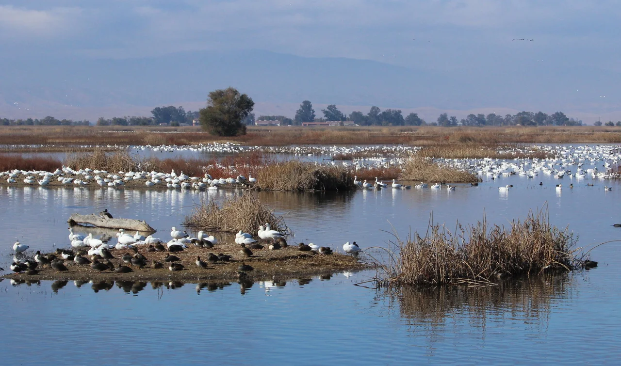
Every winter, the Sacramento River reminds this stretch of valley who really owns it. Floodwater pours through the Sutter Bypass, submerging up to 80 percent of the refuge under as much as 12 feet of water. For most landscapes, that would be a disaster. For Sutter National Wildlife Refuge, it is the entire point. These 2,600 acres at the southern end of the Sacramento National Wildlife Refuge Complex exist because of flooding, not in spite of it -- a patchwork of wetland impoundments, riparian forest, and grassland that transforms each autumn into one of the most densely populated bird habitats in the western United States.
The Winter Congregation
The numbers are staggering for such a modest acreage. In a typical winter, more than 175,000 ducks crowd the refuge's shallow impoundments -- pintails, mallards, teal, and widgeon jostling for space on water that may be only inches deep. Another 50,000 geese join them, their arrival announced by the sound of honking V-formations that fill the Sacramento Valley sky from October through February. The birds come because the Central Valley's remaining wetlands have shrunk to a fraction of what they once were. Before agriculture reshaped the landscape, the valley floor held roughly four million acres of seasonal wetlands. Today, refuges like Sutter preserve fragments of that original habitat, and the birds concentrate accordingly. What was once a diffuse migration across a vast floodplain now funnels through a handful of protected sites.
A Forest in the Floodplain
Beyond the open water, Sutter's mixed riparian forest tells a different ecological story. Cottonwoods, willows, and valley oaks line the channels and higher ground, creating a canopy habitat that serves breeding and migrating songbirds -- the passerines that travel the Pacific Flyway each spring and fall. The forest also supports one of the region's large heron and egret rookeries, where great blue herons and snowy egrets build stick nests high in the canopy, their colonies visible as clusters of white against dark branches. Rookeries need two things: tall trees near water and relative isolation from disturbance. The refuge's annual flooding cycle, which discourages development and limits human access during the wettest months, inadvertently provides both.
Endangered Ground
Beneath the spectacle of massed waterfowl, Sutter harbors species whose survival depends on exactly this kind of habitat. The giant garter snake, one of North America's largest native garter snakes, hunts through the wetland margins -- a species listed as threatened under both federal and California law, squeezed by decades of wetland conversion to agriculture. Winter-run chinook salmon pass through the adjacent waterways on their improbable journey from the Pacific to upstream spawning grounds, a population so diminished that every stretch of functional habitat matters. Swainson's hawks nest in the riparian trees, hunting the surrounding grasslands for the rodents and insects that sustain their chicks. The yellow-billed cuckoo, a secretive bird that requires dense riparian thickets, finds some of its remaining California habitat in forests like the one that borders the refuge's wetlands.
Living with the Flood
Sutter Refuge occupies an unusual position in California's water infrastructure. The Sutter Bypass, built in the early twentieth century as part of the Sacramento River Flood Control Project, was designed to divert dangerous high water away from downstream communities. The refuge sits squarely within this engineered floodway, which means its inundation is not accidental -- it is planned, predictable, and essential. When the Sacramento River rises, levees direct overflow into the bypass, and the refuge fills like a bathtub. This annual cycle recharges the wetland soils, distributes nutrients, controls invasive vegetation, and creates the shallow-water feeding habitat that draws the winter flocks. Managing a wildlife refuge inside a working flood bypass requires constant coordination between the U.S. Fish and Wildlife Service and the agencies that control the river. The result is a landscape where civil engineering and ecology have learned, over decades, to share the same ground.
From the Air
Located at 39.083N, 121.756W in the flat Sacramento Valley, roughly 50 miles north of Sacramento. From the air, the refuge is visible as a patchwork of wetland impoundments and riparian corridors within the broader Sutter Bypass floodway, which appears as a wide, levee-bordered channel running parallel to the Sacramento River. During winter floods, much of the refuge is underwater and highly reflective. The distinctive Sutter Buttes rise about 10 miles to the northwest -- an unmistakable volcanic remnant in otherwise pancake-flat terrain. Nearby airports include Yuba County Airport (KMYV) approximately 15 miles northeast and Sacramento Executive (KSAC) about 50 miles south. Best viewed at 2,000-3,000 feet AGL when winter flooding makes the wetland boundaries clearly visible.
Nearby Stories
- Griffith Mansion 13 km away
- A Dam Built for Ghosts 14 km away
- Postlegate: The Scandal That Shook Poker's Trust 17 km away
- The Canyon That Burned on Independence Day 21 km away
- The Pawnee Fire 23 km away
- The Yuba County Five 31 km away
- Oroville Dam Crisis 34 km away
- August Complex Fire 52 km away