
Swash Channel Wreck
In March 1990, a Dutch dredger called Scaldis was working near Buoy No 3 in the Swash Channel, just outside the mouth of Poole Harbour. It hit something. The crew brought up substantial timbers and a single iron cannon, which was eventually carted off to the Poole Museum store. At the time, the local maritime archaeologists were busy with another wreck, and nobody followed up. The timbers had been resting in sand for nearly four centuries: the remains of an armed merchantman built around 1628, probably Dutch, which had gone down outside the harbour with its forecastle and elaborate baroque carvings still attached. It would be another twenty years before the truth of what had been found became fully clear.
What the Wood Knew
When archaeologists eventually examined the timbers, dendrochronology gave them a date. The wood had been felled around 1628, in forests on the border between what is now the Netherlands and Germany. The vessel had been about forty metres long, perhaps six hundred tonnes, a substantial merchant ship for the early seventeenth century. Its design and construction pointed to a specific kind of voyage. The small number of guns and the position of the galley suggested high-status cargo rather than naval combat. The wooden sheathing on the hull was the standard protection against tropical shipworm, the boring molluscs that destroyed ships in warm seas. Only one row of knees, the curved structural braces that held the hull's frames in place, was present. The conclusion was that the wreck was a high-status merchantman bound for the tropics, probably the East Indies or the Caribbean, at the very start of the era when European merchants began trading globally.
Rediscovery in 2004
Fourteen years after the Scaldis hit the obstruction, in 2004, Wessex Archaeology was hired by the Poole Harbour Commissioners and Poole Borough Council to conduct a geophysical survey of the area. Side-scan sonar picked up an anomaly in roughly the same place. In 2005 Wessex Archaeology returned for a formal designated site assessment commissioned by English Heritage. They mapped a structure about twenty metres long, with hints that more wreck lay beyond what they could see. Crucially, the forecastle survived, complete with its galley and gunports. This is extraordinarily rare. The upper works of wrecked ships are almost always destroyed in the wrecking itself or by subsequent storms. The Swash Channel ship had laid down on her side in sand and stayed there, almost intact, for centuries. The trouble was that the structure was now visibly exposed, and visibly degrading. What had survived four hundred years underwater was about to be lost to currents and seawater chemistry within a generation.
The Largest Underwater Excavation Since the Mary Rose
In 2010, English Heritage agreed to fund a full excavation. The project went to a Bournemouth University team led by marine archaeologists, and it became the largest underwater excavation in the United Kingdom since the raising of Henry VIII's Mary Rose three decades earlier. The wreck site was divided into six-metre grids. Two teams worked the sediment, recovering the small finds, photographing each grid in turn to assemble a photomosaic of the entire site. A third team focused on the bow castle itself, recording it in detail, then dismantling it ready for raising. In May 2011 the bow castle came up. In 2013 the eight-metre carved rudder followed. In March 2017, after years of further research, the ship was identified as the Fame. She had been protected since 2004 under the Protection of Wrecks Act 1973, in the hope of saving her from divers attracted by the publicity of her rediscovery.
Mermen and Cherubim
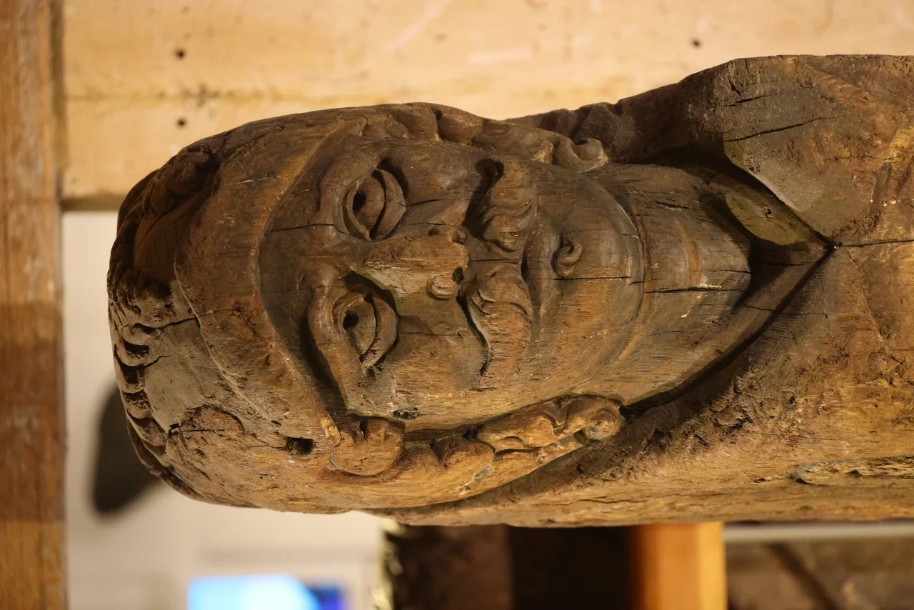
More than a thousand artefacts came up from the sand by 2010, and that figure grew as the excavation continued. Rigging blocks, barrels, pottery, leather shoes worn by long-dead sailors, wooden bowls and pewter tankards used in the galley. But the carvings were what stunned the archaeologists. Five baroque sculptures emerged, including two mermen, cherubim, and a classical head carved on top of the rudder post. They are the kind of ornament that high-status seventeenth-century ships carried as a statement of wealth and seriousness: not naval armament but commercial confidence, the visual language of a merchant trading with the wider world. The carvings are now being conserved by the York Archaeological Trust, with funding from Bournemouth University and the Maritime Archaeology Sea Trust, against the slow chemical damage that waterlogged wood faces once it leaves the seabed.
The Edge of Globalisation
The Fame went down at the moment when European trade was becoming global for the first time. Dutch East India ships, English East India ships, Spanish galleons all crossed the same oceans now. A merchantman built on the Dutch-German border in 1628, sheathed against tropical worms, with mermen at her stern, was a small piece of that vast new commerce. She did not arrive wherever she had been going. Her crew, her cargo, her captain's name: most of these are still unknown. What survived was the wood, the carvings, the personal belongings of people whose lives ended somewhere off the chalk cliffs of Studland. The Swash Channel Wreck is a Protected Wreck managed by Historic England, and the long work of conservation, study and interpretation continues. The dredger that struck her in 1990 had no idea what it had touched.
From the Air
The wreck site lies at 50.66 degrees North, 1.93 degrees West, in the Swash Channel just outside the entrance to Poole Harbour, between Studland and Sandbanks. The site itself is underwater and not directly visible from the air, but the entrance to the harbour and the Sandbanks peninsula are unmistakable landmarks. Bournemouth Airport (EGHH) is 6 nm northeast. From 3,000 to 5,000 feet the buoyed channel into Poole Harbour can be traced as a paler line through the darker shallows.
Nearby Stories
- Maiden Castle, Dorset 2.1 km away
- Battle of Portland 6.1 km away
- Carisbrooke Castle 7.1 km away
- Winchester Castle 11 km away
- Wardour Castle 13 km away
- Fleet Air Arm Museum 14 km away
- HMS Warrior (1917) 22 km away
- D-Day: The Longest Day 157 km away