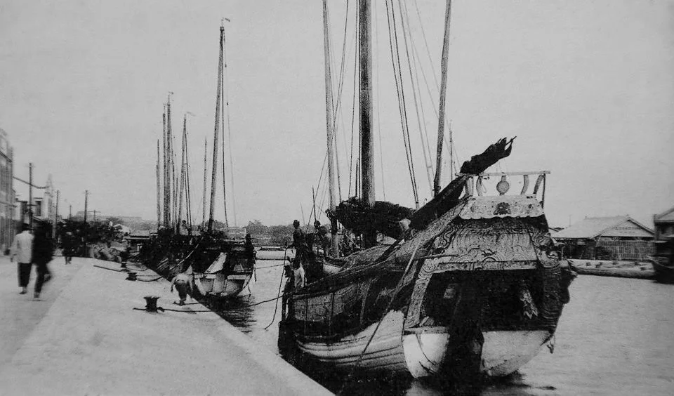

Tainan Canal
Silt ended the first Tainan Canal. Built in 1823 during the Qing Dynasty to funnel trade between Anping Harbor and the city's markets, it spent eighty years slowly choking on the sediment that the Zengwen River kept delivering until boats could no longer pass. The canal that replaced it — engineered, precise, constructed between 1922 and 1926 under Japanese colonial engineers — drew a cleaner line through the low-lying city to the Taiwan Strait. That canal still exists today, though the goods have long since stopped flowing and the barges have been replaced by tourist boats threading their way beneath six bridges.
Two Canals, Two Eras
The original canal was a product of the Qing Dynasty's commercial ambitions in southern Taiwan. Completed in 1823, it linked Anping Harbor — then the island's most important port — directly to Tainan's busy urban core, letting merchants move sugar, salt, and rice without hauling overland. Flooding, siltation, and the gradual migration of the Zengwen River combined to undo it. By the early 1900s the old waterway had become impassable, its channel silting into irrelevance.
The Japanese colonial government responded with the modern canal, breaking ground on April 16, 1922. Engineer Matatarō Matsumoto oversaw the project, which was completed in March 1926. The new canal was straighter and more precisely dredged, designed to let vessels navigate directly into the city and bypass the worsening silting problems at Anping Harbor. It worked — for a while. By the 1970s, competition from the larger Kaohsiung Port and bridges built across the channel that blocked taller ships had together ended commercial traffic. What remained was water, and the memory of commerce.
The Canal Goes Quiet
Losing its trade function didn't erase the canal from the city — it just changed what the canal meant. The remnants of the nineteenth-century waterway were transformed into a green corridor, a strip of parks and walking paths that locals use for morning exercise and evening strolls. The modern canal itself became a visual marker of the city's western edge, its water reflecting the shifting light off Taiwan Strait clouds. Warehouses and boatyards that once lined its banks gave way to residential and commercial development. The canal contracted into something more intimate: a neighborhood feature rather than an economic artery. The bridges stayed; they just carried different traffic now.
Dragon Boats and Tourist Routes
Every summer the canal reclaims some of its old energy. Dragon boat races, a tradition with more than three hundred years of history in Tainan, take place annually between Anyi Bridge and Chengtian Bridge during the Dragon Boat Festival. Teams from across Taiwan and abroad compete on the water the old traders once used, drawing large crowds to the banks.
For the rest of the year, a private operator runs sightseeing boat tours along three routes. The Golden Waterway Route passes beneath all six of the canal's bridges. The weekend-only Anping Harbor Route extends out to the sea, reaching sites including Anping Lighthouse, the Eternal Golden Castle, and Yuguang Island — as well as the decommissioned warship TDD-925, the former USS Sarsfield. The Full Canal and Harbor Route combines both. The boats move slowly, deliberately, through water that once moved faster because it had somewhere urgent to go.
The Star Diamond Project
Tainan has not finished with the canal's future. The Tainan Canal Star Diamond Project, an urban renewal initiative driven by the city government, targets the former shipbuilding yard and school sites along the canal's banks. It has already required the relocation of two schools — Jincheng Junior High and Xinnan Elementary — and added two new bridges, New Lin'an Bridge and Jinhua Bridge, to the canal's span. The project is projected to generate NT$4 billion (approximately US$130 million) in economic benefits, transforming the waterfront into a mixed-use district. What was built for colonial commerce, then abandoned, then repurposed for recreation, may yet become something else entirely. The canal, at least, is patient.
From the Air
The Tainan Canal runs northeast to southwest through Tainan's urban core at approximately 22.998°N, 120.164°E, connecting inland Tainan to the Port of Anping and the Taiwan Strait. From the air at 2,000–4,000 feet, the canal is a distinct linear feature cutting through the city's dense building fabric, with Anping Harbor visible to the west. The nearest major airport is RCKH (Kaohsiung International), approximately 25 km to the southwest. RCNN (Tainan Airport) is the closer regional option, roughly 5 km to the north. Visibility is typically good in the dry season (October–April); summer monsoon months bring haze and low cloud.
Nearby Stories
- Chung Li-ho Museum 0.7 km away
- Jingzaijiao Tile-paved Salt Fields 8 km away
- Wanchin Basilica of the Immaculate Conception 9.3 km away
- Namasia District 16 km away
- Battle of Penghu 21 km away
- Shoushan (Kaohsiung) 21 km away
- Penghu Air Raids 62 km away
- Daya Bay 512 km away