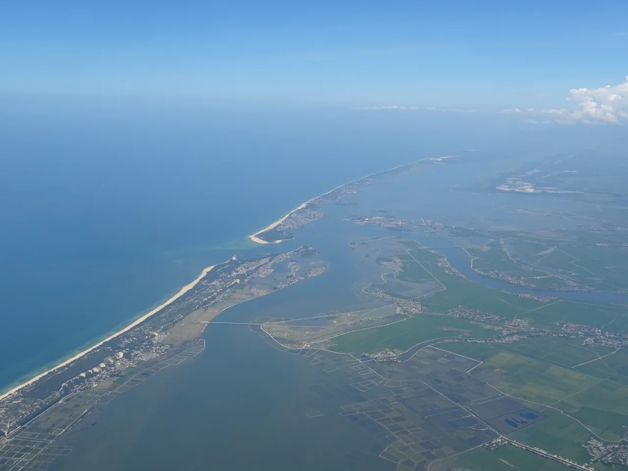

Tam Giang–Cau Hai Lagoon
Seen from the air, it looks like the coast hasn't quite made up its mind. A long strip of land separates the South China Sea from an enormous body of sheltered water — not a lake, not a bay, but something in between: a lagoon system stretching nearly 70 kilometers along the coast of Huế in central Vietnam. This is Tam Giang–Cau Hai, and at 22,000 hectares of water surface, it is the largest lagoon system in Southeast Asia. Generations of fishing families have built their lives on its shallow, brackish waters, navigating its channels before dawn and returning by the time the coast road fills with motorbikes.
A Chain of Connected Waters
The name covers six distinct bodies of water strung together along the coast: Tam Giang, Thanh Lam, Sam Chuon, Ha Trung, Thuy Tu, and Cau Hai. Each has its own character, its own depth, its own relationship to the sea. The whole system connects to the South China Sea through two inlets: Thuan An, near the center, and Tu Hien, at the southern end. These openings govern everything — the salinity of the water, the tidal rhythms, the movement of fish. The lagoon is generally shallow, between one and three meters deep across most of its expanse, though it deepens dramatically near the Thuan An inlet, where the channel reaches 11 meters. At that inlet, the meeting of lagoon and sea is turbulent, the water churning between tidal forces pulling in opposite directions.
Where the Perfume River Arrives
The Perfume River — Sông Hương — carries the weight of Huế's imperial history for 30 kilometers before it releases into this lagoon. That arrival is quiet. The river, which has been moving almost imperceptibly slowly by the time it reaches the coast, simply widens into the lagoon's northern reaches. The distinction between river and lagoon blurs. Other smaller rivers and streams feed the system from the west, bringing freshwater down from the Annamite mountains, mixing with the brackish tidal flows from the sea. This constant exchange between fresh and salt water creates conditions that support an enormous variety of aquatic life — the lagoon's productivity is one reason so many people have historically chosen to live on its margins and its floating villages.
Life on the Water
For the communities that have lived alongside the Tam Giang–Cau Hai lagoon for centuries, the water has never been a backdrop — it has been the floor of daily life. Floating villages cluster on the lagoon's surface, clusters of homes and boats so integrated that the distinction between dwelling and vessel sometimes disappears. Fishermen work the shallows with traditional cast nets and long-lines, targeting shrimp, crab, and the various fish species that breed in the brackish shallows. The lagoon's enclosing sandbar — the thin strip of land between the water and the open sea — supports a string of coastal villages whose residents have always lived between two bodies of water, neither fully of the sea nor of the land. The system's productivity has attracted aquaculture operations in recent decades, with fish and shrimp ponds carved into the margins, though the relationship between traditional fishing and modern aquaculture has not always been easy.
The Scale That Surprises
Numbers help here: 22,000 hectares of water surface is roughly the size of a medium-sized city's metropolitan footprint. Nearly 70 kilometers in length means a traveler driving Vietnam's coastal Highway 1 passes alongside this lagoon for the better part of an hour without reaching its end. The visual effect from the road is striking — the lagoon opens to the west, flat and still in the morning hours, while the narrow sandbar blocks any view of the sea to the east. Villages appear along the shore at irregular intervals, boats anchored in the shallows, the occasional fishing platform extending on wooden stilts over the water. The lagoon is not a wilderness; it is a working landscape, shaped by centuries of human use. But its scale — the wideness of the water, the lowness of the horizon — gives it a quality of openness that the mountainous interior of central Vietnam does not.
From the Air
The Tam Giang–Cau Hai lagoon system lies along Vietnam's central coast at approximately 16.56°N, 107.63°E, stretching from near Huế southward for nearly 70 km. From altitude, it is unmistakable: a long, pale silver body of water separated from the darker South China Sea by a thin coastal sandbar. The Thuan An inlet, near the center of the system, appears as a gap in the sandbar where the water colors mix and shift. The nearest major airport is Phu Bai International (VVPB), serving Huế, approximately 10–15 km northwest of the lagoon's northern end. Da Nang International Airport (VVDN) is about 50 km to the southeast. A viewing altitude of 8,000–12,000 feet offers a clear overview of the full lagoon system's length and its relationship to both the coast and the Perfume River's delta to the north.
Nearby Stories
- Battle of Cua Viet 5.4 km away
- A Sầu Valley 10 km away
- Quảng Trị Citadel 16 km away
- Vietnam's Green Corridor 18 km away
- Sơn Trà Mountain 25 km away
- Hội An wreck 72 km away
- Hien Luong Bridge 76 km away
- Hainan Island Incident 337 km away