_-_%E9%96%80%E5%8F%A3%E6%AD%A3%E9%9D%A2.JPG)
Tapung Old Fort
The fort is not large. Eight meters long, six meters wide, it sits on top of Mount Lidong in the mountains of Hsinchu County as if gripping the peak — which, in a sense, was always the point. The Tapung Old Fort was built in 1912 at the culmination of a brutal military campaign against the Atayal people who had lived in these mountains for generations before Japanese colonial rule arrived. It was built by an occupying power, contested by the people it was meant to control, and it survives today as a ruin that holds two histories at once: the history of those who built it, and the history of those who fought back.
The Treaty That Changed Everything
In 1895, the First Sino-Japanese War ended with the signing of the Treaty of Shimonoseki, under which the Qing government ceded Taiwan to Japan. For the lowland Han population of Taiwan, the transition brought its own upheavals. For the Indigenous peoples of the mountains — including the Atayal, who inhabited the high valleys and ridges of the Central Range — it brought something more direct: a colonial administration determined to extend its control into territory it viewed as ungoverned and, in the language of the era, uncivilized. The mountains the Atayal called home were resource-rich. The Japanese colonial government wanted the timber and the camphor. What stood between the government and those resources was the sovereignty of the people who lived there.
Five Years of Campaigns
On 11 April 1906, Sakuma Samata became Governor-General of Taiwan. He moved quickly. Within months, he launched what would become a five-year military campaign directed primarily at the Indigenous peoples of the mountains — the campaign the colonial government called 'aboriginal pacification,' a term that concealed the reality of systematic armed violence. For the Atayal and other groups targeted, this was not pacification but invasion. Sakuma's campaign was characterized by the use of modern military technology — rifles, artillery, the systematic cutting of trails into mountain territory — against communities that had long defended their autonomy. The fighting was fierce and the casualties significant on both sides. In 1911, after heavy combat that inflicted serious losses on the Japanese forces, the Japanese army secured Mount Lidong. The Atayal people who had lived there and defended it paid a profound price for their resistance.
The Fort on the Mountain
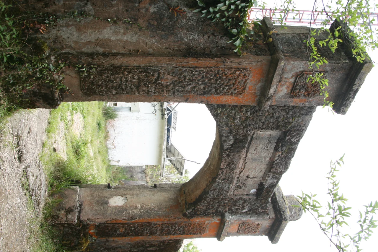
Construction of the fort began in 1912, the year after the fighting on Mount Lidong. Its purpose was blunt: to hold ground that had been taken at great cost and to serve as a garrison point from which Japanese military and police power could project into the surrounding mountains. The structure is small but engineered with care. Built in a quadrangle shape — eight meters long, six meters wide — it features bastions on its eastern and western walls for flanking fire. Its walls are reinforced armored-concrete and clay, with buttress pillars on the interior side. Thirty-one loopholes were cut into the walls, each one a position from which the garrison could fire on anyone approaching from below. Everything about the design speaks to a constant expectation of attack — because the people whose land had been seized were not subdued, only outgunned.
The Counter-Attack
The Atayal resistance did not end when the fort was built. Later in 1912, two Atayal tribes joined forces and attacked the fort during a typhoon — using the cover of the storm and the disruption it caused to press their assault. The fort fell. It was a significant moment: a small, fortified position taken not by an equal army but by people fighting for their homeland against colonial occupation, choosing their moment and their weather with tactical intelligence. The Japanese recovered, counter-attacking the tribes the following year and retaking the position. They rebuilt the fort and reinforced it. But the episode had demonstrated something that colonial administrators often preferred to overlook: that the people they characterized as primitive or in need of 'civilization' were neither. They were fighting, with whatever means they had, for what was theirs.
What Remains on Mount Lidong
The Tapung Old Fort — also called the Mount Lidong Fort — survives today as a historical site in Jianshi Township. The walls still stand, the loopholes still visible in the concrete and clay. It sits at roughly 24.693°N, 121.303°E, on a mountain summit reached by trail through the forests of Hsinchu County. Reaching it requires effort, which perhaps is appropriate: the history it holds is not easy history. Taiwan has grown increasingly attentive in recent decades to the experiences of its Indigenous peoples under both Japanese and later Nationalist Chinese rule. Sites like Tapung are part of that reckoning — places where the physical evidence of colonial violence has been preserved, not as a celebration of the victors but as a record of what happened and who was here. The Atayal people remain. Their communities continue in the mountains. The fort, crumbling on its hilltop, is the colonial project's ruin; the people it was built to suppress are not ruins at all.
From the Air
Tapung Old Fort is located at approximately 24.6929°N, 121.3034°E on Mount Lidong in Jianshi Township, Hsinchu County, Taiwan. Elevation is significant — the mountain summit requires a hike from trailhead. The surrounding terrain is rugged Central Mountain Range topography. Nearest major airport is Taoyuan International (RCTP), approximately 65 km northwest at 33 meters elevation. Pilots transiting the area should note the Central Range terrain rising above 3,000 meters in the vicinity; Jianshi Township's valleys are visible from cruising altitude as the range descends toward the Hsinchu coastal foothills.
Nearby Stories
- Toufen 3.5 km away
- Lin Family Mansion and Garden 5.6 km away
- Dahu, Miaoli 9.8 km away
- Xueshan Range 24 km away
- 2022 Chinese Military Exercises Around Taiwan 56 km away
- Sinking of MV Sewol 1097 km away
- Yellow Sea 1150 km away
- Twin Forts of Romblon 1319 km away