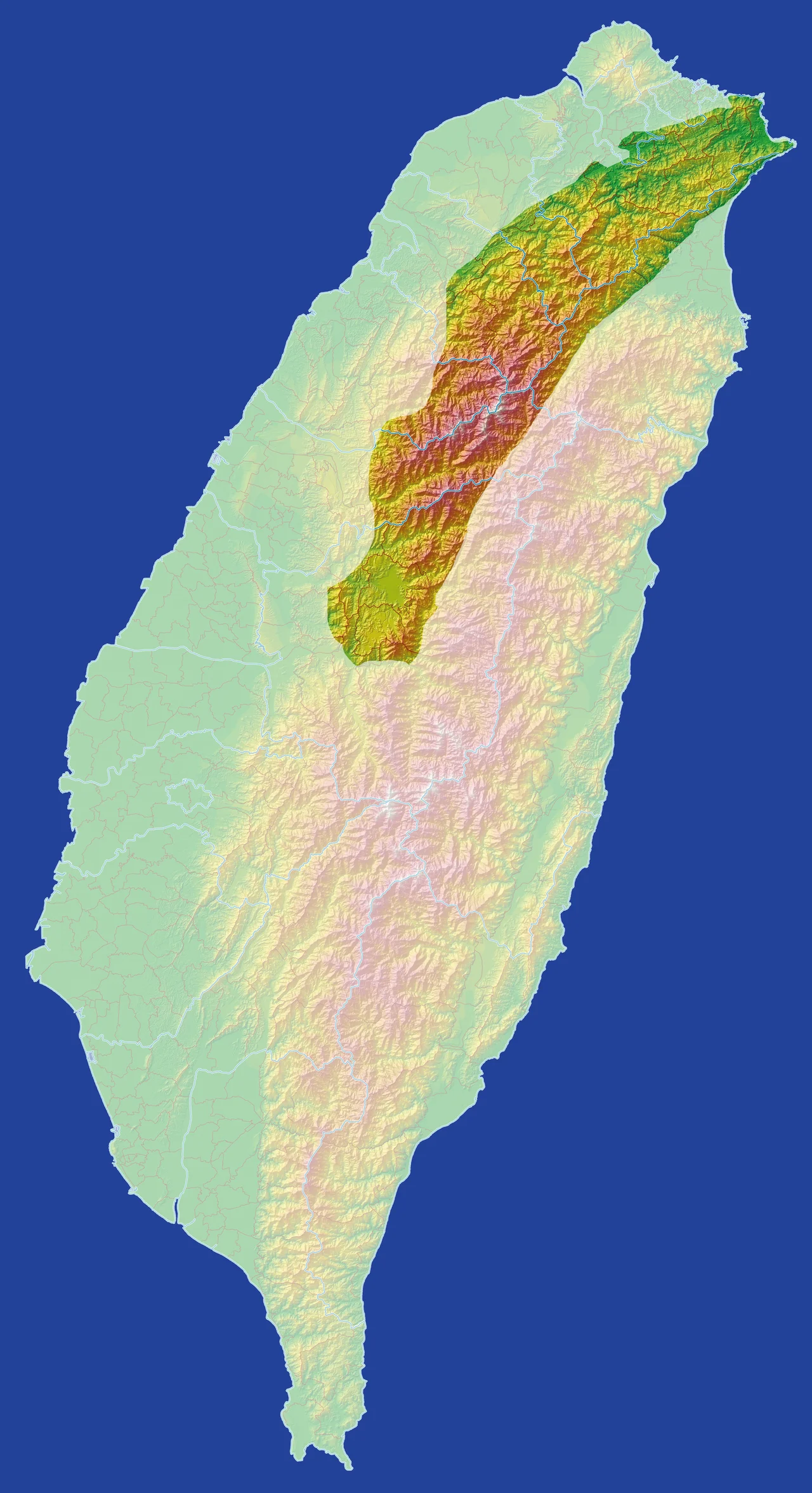

Xueshan Range
Taiwan gets the mountains. It often surprises visitors how seriously — the island is only 394 kilometers long but contains more than 260 peaks above 3,000 meters, a concentration that rivals ranges far more famous. The Xueshan Range is where much of that drama concentrates. Stretching across northern Taiwan and bordered to the southeast by the Central Mountain Range, this is a world of glacially carved cirques, raked ridgelines, and rivers falling toward both the Pacific and the Taiwan Strait. The highest point, Xueshan itself at 3,886 meters, is Taiwan's second tallest peak — Snow Mountain, as the name translates, and in winter it earns that name completely.
A Range of Many Names
Naming a mountain range requires naming it from somewhere, and the Xueshan Range has been named by many: the Atayal people who lived among its peaks for generations, the Qing dynasty officials who mapped it from administrative distance, the Japanese colonial authorities who renamed everything, and the postwar Republic of China government whose romanization conventions gave the range its current name. Xueshan itself — the Snow Mountain — was called Sekuwan or Babo Hagai by Atayal speakers, Tsugitakayama ('second-highest mountain') by the Japanese, and Mount Sylvia by some Western visitors. The range fared similarly: under the Qing it was variously the Middle, Western, or Dodds Range. This multiplicity of names reflects a multiplicity of relationships to the same stone — each group looking up at the same peaks and seeing something shaped by who they were and what they needed from the mountains.
Fifty-Four Peaks Above Three Thousand Meters
The numbers alone are staggering. The Xueshan Range contains 54 peaks taller than 3,000 meters, of which 19 appear on Taiwan's prestigious list of the 100 Peaks — a mountaineering challenge that draws climbers from across Asia. Xueshan Main Peak at 3,886 meters leads the list, followed by Xueshan Northern Peak at 3,703 meters, Dajianshan at 3,594 meters, and Pintianshan at 3,524 meters. Each peak requires a multi-day permit trek through Shei-Pa National Park. Taiwan's northernmost high-altitude national park, Shei-Pa takes its blended name from two of its most famous features: the Snow (雪, Xuě) of Xueshan and the Pa of Dabajianshan. Entry to the high zones requires advance permits and experienced mountain guides. The terrain is genuine alpine — not just high but technically demanding, with ridge sections that drop sharply on both sides.
The Holy Ridge
Between Xueshan and Dabajianshan runs a traverse that Taiwanese mountaineers call the Holy Ridge — 聖稜線, Shènglíng Xiàn. Japanese mountaineer Numai Tetsutaro named it in a 1928 article, and the name has stuck for nearly a century. The route stays above 3,000 meters for its entire 15-kilometer length, crossing Xueshan Main Peak, Xueshan Northern Peak at 3,703 meters, and multiple subsidiary summits before arriving at the sheer vertical face of Dabajianshan. It takes a minimum of four days and is rated among the most demanding multi-day routes in Taiwan — razor-thin ridges, sheer drops on both sides, sections of technical rock scrambling, and the possibility of snow and ice even in summer. It is the kind of route that separates those who have completed it from those who are still planning to.
The Tunnel That Remade an Island
For most of Taiwan's history, crossing the Xueshan Range was the problem. Yilan County on the eastern side was effectively cut off from Taipei by the mountains — a two-hour drive on winding roads in good weather, much longer when typhoons closed the highway. The Hsuehshan Tunnel changed that permanently when it opened on June 16, 2006, after fifteen years of construction. At 12.941 kilometers, it was one of the world's five longest road tunnels when it opened — bored entirely through the heart of the range, following the route of National Freeway No. 5. Travel time between Taipei and Yilan dropped from roughly two hours to about thirty minutes. Property values on the eastern side shifted. Tourism patterns shifted. The relationship between the two coasts shifted. A mountain range that had defined the edge of accessible Taiwan for generations became, on a weekday afternoon, something you drove through in less time than it takes to watch a television episode.
Snow and Season
Xueshan's high zones receive snow from roughly October through April, and the cirques on the northern and eastern faces hold it longest. The peak sits in a classic alpine cirque — a bowl carved by glacial action into the rock, now filled with alpine grasses, dwarf rhododendrons, and, during snowmelt, wildflowers that appear for only a few weeks before the next winter. The Atayal name Sekuwan — 'cracking into gravel' — speaks to the freeze-thaw cycling that breaks rock apart here, a constant geological process visible in the scree slopes below every major cliff. In clear weather, Xueshan is visible from the coast, from Taipei, from the flight path used by aircraft approaching from the north. It catches weather coming off the Pacific, builds its own clouds when conditions are right, and in winter wears a cap of white that makes the name Snow Mountain feel less like translation and more like observation.
From the Air
The Xueshan Range spans northern Taiwan, centered approximately at 24.38°N, 121.23°E. Xueshan Main Peak at 3,886 m (12,749 ft) is Taiwan's second-highest point and a significant terrain hazard for any aircraft flying over the Central Mountain Range. From altitude, the range appears as a massive ridgeline running roughly northeast-southwest, with the gorge country dropping toward Yilan County to the east and lower terrain toward Taichung and Miaoli to the west. The nearest major airport is RCTP (Taiwan Taoyuan International Airport), approximately 60 km to the west-northwest. Hualien Airport (RCYU) lies approximately 60 km to the southeast. Mountain weather in this range can change rapidly; MSA above the highest peaks exceeds 13,500 feet. The Hsuehshan Tunnel is visible on approach maps as the major road link between New Taipei and Yilan.
Nearby Stories
- Lukang Ai Gate 3.1 km away
- Gaomei Lighthouse 5.1 km away
- Beipu 7.6 km away
- Kavalan Distillery 13 km away
- 1916–1917 Nantou Earthquakes 15 km away
- Qingshui Cliff 15 km away
- 1951 East Rift Valley Earthquakes 21 km away
- Taiwan Strait 70 km away