Qingshui Cliff
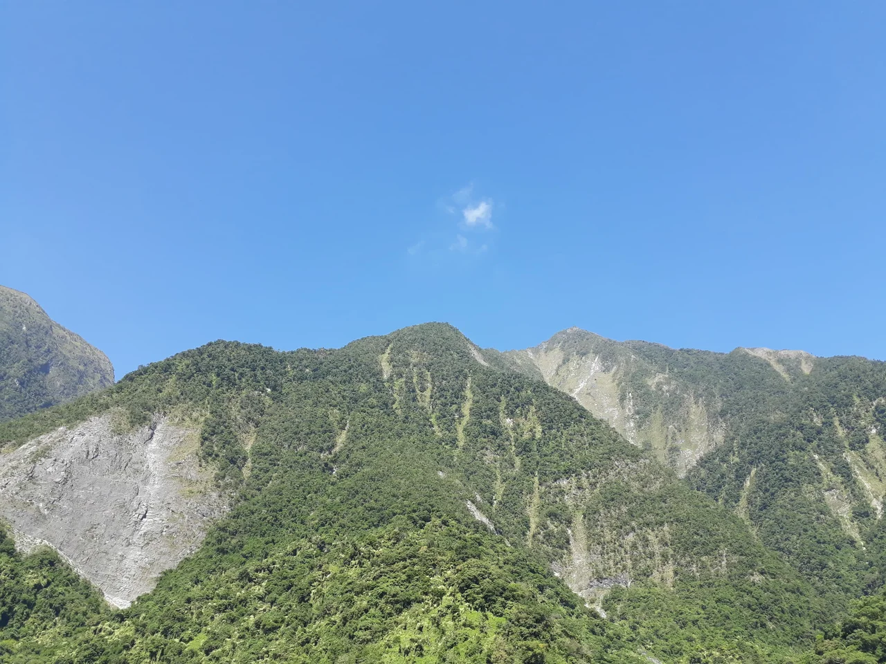
Qingshui Mountain does not slope to the sea. It falls. Rising 2,408 meters directly from the Pacific Ocean, the peak creates a 21-kilometer wall of coastal cliff that is the highest in Taiwan and among the most dramatic anywhere on Earth. The rock face is marble - metamorphosed limestone thrust upward by the collision of the Philippine Plate and the Eurasian Plate, then carved by waves, earthquakes, and typhoons into a near-vertical surface that glows white and pale green against the deep blue water below.
The Suhua Highway, connecting Yilan County to Hualien along Taiwan's eastern coast, threads across this cliff face like a pencil line drawn on a cathedral wall. Drivers who glance left see rock rising beyond sight. Drivers who glance right see nothing but ocean, hundreds of meters below. It is one of the most beautiful and most terrifying stretches of road in Asia.
Collision Zone
The geology that produced Qingshui Cliff is violent and ongoing. The Philippine Sea Plate pushes northwest into the Eurasian Plate at roughly eight centimeters per year, and eastern Taiwan sits directly on the suture. The resulting orogeny - mountain-building through tectonic compression - has uplifted metamorphic rock that formed deep in the earth's crust: marble, gneiss, and green schist, classified as part of the Dananao metamorphic complex. These are rocks that have been heated, pressured, and chemically transformed over millions of years, then shoved skyward and exposed to the Pacific.
The cliff face is not stable. Earthquakes shake loose enormous slabs of rock. Typhoons pound the base with storm waves that undercut the softer strata. The beaches at the foot of the cliff are carpeted with marble stones in every size, from boulders the size of cars to grains of polished sand. The cliff is simultaneously being built by tectonic forces and dismantled by erosion - a landscape in constant, slow-motion conflict with itself.
The Road Across the Wall
The Suhua Highway is an engineering marvel born of necessity. Eastern Taiwan's coastal mountains leave almost no flat ground between the peaks and the Pacific, and for much of its length the road is carved directly into the cliff face or threaded through tunnels blasted through the rock. The section crossing Qingshui Cliff is the most exposed: a narrow lane with the cliff above and a sheer drop to the ocean below, protected by guardrails that seem absurdly modest against the scale of the landscape.
Driving the Suhua Highway requires nerve and attention. Rockfalls are common, especially during or after heavy rain and seismic events. Sections close periodically when slides block the road or undermine its foundation. Yet the highway remains one of Taiwan's most celebrated scenic routes precisely because of the danger that makes it famous. The views from the road - looking down at turquoise water meeting white marble cliffs, looking up at the mountain vanishing into cloud - are the kind that make photographs seem inadequate.
A Border Even Frogs Cannot Cross
Qingshui Cliff is more than scenery. It is a biogeographic barrier - a wall so sheer and so long that it separates populations of animals on either side into distinct genetic lineages. Research on the brown tree frog, Buergeria robusta, has demonstrated that populations east and west of the cliff belong to different clades, their gene pools diverging because the cliff prevents movement between them. What would be a minor geographic feature at lower elevation becomes, at this scale, an evolutionary boundary.
The cliff's significance extends into geopolitics as well. In 2012, China's newly issued passport featured a depiction of Qingshui Cliff among its pages, a move that triggered diplomatic protest from Taipei. The inclusion of a Taiwanese landmark in a Chinese government document touched a nerve far more sensitive than cartography. Qingshui Cliff, it turns out, is not just a geological formation. It is a symbol potent enough to start arguments between governments - a wall that divides more than frogs.
Within Taroko's Embrace
Qingshui Cliff lies within the boundaries of Taroko National Park, one of Taiwan's most visited protected areas. The park encompasses the Taroko Gorge - a marble canyon carved by the Liwu River - along with the high mountain terrain to the west. The cliff forms the park's eastern edge, where the mountains meet the Pacific with no transition, no coastal plain, no gradual descent. Just rock, and then water.
From sea level, the cliff is overwhelming. From above, its full scale becomes apparent: 21 kilometers of unbroken wall, the marble face catching sunlight and throwing it back in shades of white and pale jade, the ocean darkening from turquoise to indigo as the continental shelf drops away. The Suhua Highway is a thread. The tunnels are pinpricks. The cliff itself is the landscape, and everything else - the road, the cars, the human ambition that put them there - is decoration on its face.
From the Air
Located at 24.22°N, 121.69°E on Taiwan's eastern coast within Taroko National Park. The 21km cliff face is unmistakable from the air: a massive wall of pale marble rising from deep blue Pacific water, with the Suhua Highway visible as a thin line carved into the rock face. Qingshui Mountain reaches 2,408m. Hualien Airport (RCYU) is approximately 30km south along the coast. Taipei Songshan Airport (RCSS/TSA) is about 100km northwest, over the Central Mountain Range. The terrain drops nearly vertically from peak to ocean with no coastal shelf - expect strong updrafts along the cliff face. Weather can deteriorate rapidly; fog and low cloud are common. Best viewing from offshore, looking west at the cliff face.
Nearby Stories
- Hehuanshan 1.5 km away
- Nanao (Taiwan) 3.1 km away
- Mount Dabajian 4.8 km away
- 1951 East Rift Valley Earthquakes 12 km away
- 1999 Jiji Earthquake 35 km away
- Sinking of MV Sewol 1142 km away
- Yellow Sea 1206 km away
- Sibuyan Island 1278 km away