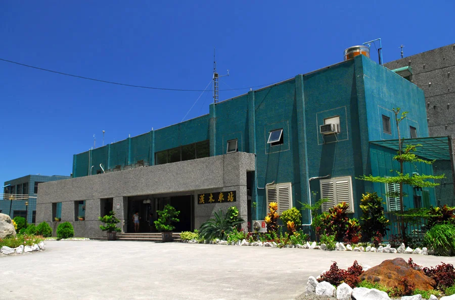

Nanao (Taiwan)
Provincial Highway 9 runs along the coast of southeastern Yilan County with the Pacific on one side and sheer cliffs on the other, and at roughly the 130-kilometer mark it reaches Nan'ao. The township occupies the largest area in Yilan County — 740 square kilometers — while holding one of its smallest populations. This arithmetic of space and people is what Nan'ao is: an enormous landscape, thin on tourists, thick on geography. The mountains here drop to the ocean within a few kilometers. Rivers carry meltwater down from peaks above 2,000 meters into gorges cut through grey marble. The Atayal people have lived in these valleys for generations, and their presence shapes everything about what Nan'ao is today.
Atayal Country
Nan'ao is designated a mountain indigenous township, and the Atayal are its primary community. Two Atayal dialects are spoken here: Ts'oli' in the villages of Nan'ao, Bihou, Jinyue, and Wuta, and Squliq elsewhere. The foundational concept of Atayal life is gaga — an untranslated term that encompasses morality, communal harmony, and mutual responsibility, the framework within which individual lives are understood. Atayal weaving has been passed mother to daughter for generations; competence at the loom once determined a woman's social standing. Facial tattoos, required for adulthood and marriage eligibility in traditional practice, were prohibited by Japanese colonial authorities in 1930. A quiet revival has been documented since the 2000s, with younger community members choosing to reclaim the practice. Among the stories specific to Nan'ao's Atayal history is the Sayun Incident of 1938: a seventeen-year-old Atayal girl named Sayun Hayun disappeared — presumed drowned — while helping carry her Japanese teacher's baggage through a storm. A 1943 Japanese film was built around her story, an early example of colonial narrative shaping how indigenous lives were remembered.
The Hot Springs
Four hot spring sources run along Nan'ao Creek, fed by geothermal activity deep in the mountain rock. Two are accessible by road following the first several kilometers of the river gorge; the other two require significant effort. Bihou Hot Spring is the closer and more visited. Laka Hot Spring lies about three kilometers upstream from the end of the access road — a ninety-minute hike through a gorge where the water turns from comfortable to scalding and deposits brightly colored minerals on the surrounding rock. Twenty minutes further upstream, a pool of blue-green water sits below a small waterfall, the color a result of the mineral content in the water catching the light. The most remote spring, Yading, requires a three-day camping trip into the mountains' interior. The hot springs are part of the same geological story as everything else in Nan'ao: water moving through rock under pressure, picking up chemistry, emerging changed.
Aohua Falls and the Mystery Beach
In Aohua Village, near the Yilan-Hualien county border, the Aohua Waterfall drops 47 meters in a single vertical plunge into a deep pool. The approach is a ten-minute walk along a 300-meter paved path lined with Jiuxiong trees. The pool at the base is deep enough for swimming and cliff diving. Beyond the first waterfall, a second and third require increasing skill to reach — the geography becoming progressively more demanding. Elsewhere on Nan'ao's coastline, the Mystery Beach stretches for seven kilometers of gravel shores bordered by steep cliffs and the open Pacific. It is accessible only at low tide or via four-wheel drive across the rocky foreshore. Light pollution here is minimal, and on clear nights the Milky Way is visible over the water — a combination of remoteness and geography that is becoming increasingly difficult to find anywhere on the island.
Cueifong Lake and Quiet
At an elevation of 1,900 meters in the mountains above Nan'ao sits Cueifong Lake — Taiwan's largest alpine lake, normally covering approximately 20 hectares. In July 2022, it became the world's first designated Quiet Trail and Sound Sanctuary, an international recognition of its near-total absence of human-made noise. The designation acknowledges something that people who have visited without knowing the title already understand: there is a particular quality to the silence above 1,900 meters in a forest where the wind moves through trees and the lake surface reads the weather before you can feel it. The Nan'ao Broadleaf Forest Nature Reserve surrounds the area — established in 1992, receiving approximately 5,000 millimeters of rainfall annually, one of the wetter zones of an already wet island.
Getting There and the Road That Made It
The North-Link Line of the Taiwan Railways Administration opened February 1, 1980, connecting Yilan County's coast to the network. It is an engineering record: 91 tunnels and 16 bridges through terrain that resisted every easier solution. Stations in Nan'ao Township include Dong'ao, Nan'ao, Wuta, and Hanben. The railway was electrified in 2003 and double-tracked in 2005. Highway 9's coastal section through Nan'ao has a longer history. The original path was cut as a Qing Dynasty footpath between 1874 and 1876; the Japanese colonial government converted it to a vehicular road, opened in May 1932. For decades the Suhua Highway, as this section is known, ran along cliff faces high above the Pacific — a road with views and with danger, regularly closed by typhoons and landslides. After Typhoon Megi killed over twenty people on the highway in 2010, the Suhua Highway Improvement Project replaced the three most vulnerable sections with new tunnels, completing in 2020. The road that once made Nan'ao precarious to reach is now more reliable. The township it leads to remains, by design and by geography, still genuinely remote.
From the Air
Nan'ao Township is located at approximately 24.46°N, 121.80°E in southern Yilan County, eastern Taiwan. The township occupies the zone where Taiwan's Central Mountain Range meets the Pacific coastline — dramatic terrain visible from altitude as a series of ridges dropping sharply to the sea. The nearest airport is RCSS (Taipei Songshan Airport), approximately 75 km to the northwest via the Hsuehshan Tunnel route. Hualien Airport (RCYU) is approximately 45 km to the south-southeast along the coast. The coastline around Nan'ao is exposed Pacific facing; winds can be significant. The mountains immediately inland exceed 2,000 meters within a very short horizontal distance from the shore. Aircraft approaching from the east should maintain MSA above 9,000 feet when transiting the coastal mountains.
Nearby Stories
- Shihmen Dam 5.3 km away
- Jiaoxi 6.1 km away
- Mount Dabajian 6.9 km away
- Hehuanshan 8.5 km away
- Qingshui Cliff 13 km away
- Sinking of MV Sewol 1105 km away
- Yellow Sea 1167 km away
- Sibuyan Island 1317 km away