
Teniky
It takes researchers eight hours on foot from the nearest village to reach Teniky, scrambling across the steep sandstone of the Isalo massif to a site that has puzzled outsiders for over a century. What waits there does not look Malagasy. Niches cut cleanly into the cliffs, terraces and quarries, carefully fitted stone walls, rock-cut basins - an architecture with no parallel anywhere else in Madagascar or along the East African coast, spread across nearly eight square kilometers of remote highland. The local Bara people have long woven stories around its caves. Archaeologists, meanwhile, have spent decades asking a sharper question: who built this, and why here, more than 200 kilometers from the sea?
The Stones That Don't Belong
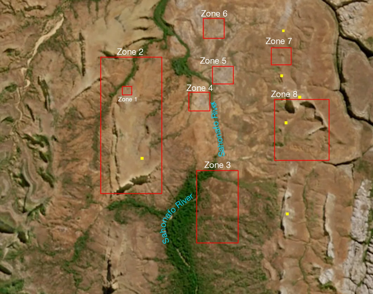
Teniky's strangeness is precise rather than crude. Whoever worked this rock cut terraces into the slope, carved rectangular niches into the cliff faces, shaped boulders, and built stone walls arranged in a way that looks defensive - as if the place were meant to be held against attack. The Sahonafo River threads through the complex, past geological flourishes including a heart-shaped natural amphitheater. The best-known feature, the Grande Grotte in what researchers label Zone 8, has been documented since at least the late nineteenth century, when early observers reaching for an explanation dubbed it the "Grotte des Portugais," the Portuguese Cave. Nobody really knew. The name was a guess dressed as an answer, and it stuck for generations.
A Thousand-Year-Old Puzzle
Modern science has begun to pin down the timeline. Radiocarbon dating of charcoal from man-made structures places their construction in the tenth to twelfth centuries CE. Shards of Chinese and Southeast Asian pottery scattered at the site date to the eleventh through fourteenth centuries - proof that the people here, despite their isolation deep inland, were plugged into the medieval Indian Ocean trade networks that linked Madagascar to ports across Asia. A team led by geologist Guido Schreurs of the University of Bern published their findings in 2024 in the journal Azania: Archaeological Research in Africa, drawing together excavation, dating, and the imported ceramics into the fullest account yet of who lived at Teniky and when.
The Persian Hypothesis
The boldest claim concerns the cliff niches. The 2024 study found that their closest architectural parallels are not in Africa at all but in first-millennium Zoroastrian funerary niches in Iran, particularly the Fars region - the heartland of ancient Persia. From that resemblance comes a striking hypothesis: that Teniky may have been a necropolis, a city of the dead, built by settlers of Zoroastrian origin who carried their way of housing the dead across thousands of miles of ocean. It is a theory, openly framed as one. The researchers themselves propose comparing Teniky with contemporaneous sites in northern Madagascar - Mahilaka, Vohemar, Kingany, Nosy Mangabe - and a further expedition was planned to test the idea. The mystery is not solved. It has only become far more interesting.
What the Bara Remember
Long before archaeologists arrived, the people of nearby Sahonafo kept their own accounts of Teniky, and these deserve their own respect. In one story, the Grande Grotte was home to a devouring ogre who lived there with his wife and their child, Tenika; when the child broke a water jug and fled in fear to a smaller cave, the family's calls in the dusk gave the place its name. Such malevolent beings populate Isalo's caves throughout Bara tradition. But another local memory is harder to dismiss: an elder named Tsimangataka recounted a "protohistorical" war between the people of the Isalo valley and long-robed strangers the Malagasy called Vazaha - foreigners - whose leader is said to have slept in the smaller cave. Foreign builders, robed and remembered as outsiders, a thousand years ago. The oral history and the Persian hypothesis, arrived at by utterly different routes, brush unsettlingly close.
From the Air
Teniky sits in deep isolation within the Isalo massif at 22.30 degrees south, 45.31 degrees east, in Madagascar's Ihorombe region and over 200 km from the nearest coast. There is no airfield nearby and the site is reachable only on foot across rugged sandstone terrain; the nearest airstrip is at Ranohira (ICAO: FMSO), with Toliara (Tulear) Airport (ICAO: FMST) the closest larger airport, roughly to the southwest. From the air, look for the eroded sandstone canyons of the Isalo massif and the thread of the Sahonafo River cutting through the highland; the man-made terraces and walls are subtle and hard to spot from altitude. Fly at 3,000-5,000 feet over the massif for terrain context. The region is hot and dry, with the clearest viewing in the cooler dry season and rains possible from roughly November to March.
Nearby Stories
- Ilakaka 20 km away
- Analavelona 57 km away
- Makay Massif 71 km away
- Aloalo 104 km away
- Anja Community Reserve 118 km away
- Andringitra National Park 122 km away
- Anosy 188 km away
- Morondava 191 km away