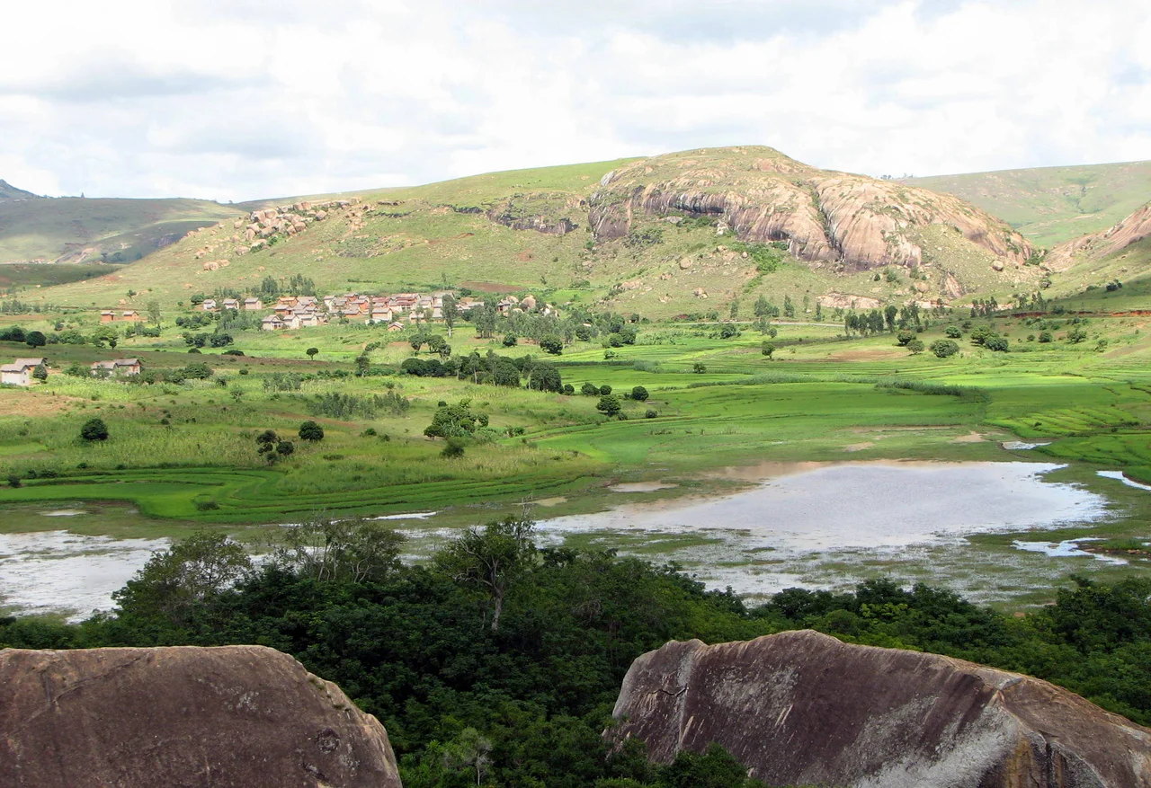

Anja Community Reserve
The lemurs were almost gone. Across Madagascar, the ring-tailed lemur the Malagasy call maki had collapsed, with an estimated ninety-five percent of the population lost. In the village of Anja, south of Ambalavao, people had long held a taboo against eating the maki, but they had sold them to outsiders who held no such belief. Watching the forest empty, the community made a different choice. In 2001 they fenced off a pocket of woodland beneath a towering granite cliff and declared it a reserve, and in doing so created what is now thought to be the largest single gathering of ring-tailed lemurs anywhere on Earth.
A World Among the Boulders
Anja is small but spectacular. The reserve covers roughly thirty hectares at the foot of a sheer rock face, and much of its floor is a jumble of fallen boulders the size of houses, shed from the cliff over uncounted years. In the sheltered gaps between them, a tangled forest has taken root, fed by a freshwater lake and shaded from the highland sun, so that the temperature drops noticeably as you step in among the stone. Two small caves shelter bats and owls. Trails wind through the chaos of granite, and visitors can choose a gentle one-to-two-hour loop or commit up to six hours to the steep scramble onto the cliff top, where the view opens across rice paddies to the mountains beyond. A local guide is required, and that requirement is the whole point: the fee goes straight back into the village that saved this forest.
Lemurs Within Arm's Reach
The ring-tailed lemurs of Anja, around three hundred of them, are the stars. Habituated to people over two decades, they let visitors approach within a few meters, lounging in forks of branches with their black-and-white tails curled like question marks. Feeding them was once allowed but is now forbidden, a small rule that keeps the animals wild. Watch closely and the guides will point out stranger residents too: the rosy-winged nymphs of the Flatida rosea planthopper, clustered under white waxy threads, and the Malagasy lantern bug, its head drawn out into an absurd orange snout. Lizards bask on the warm rock, from girdled lizards to Barbour's day gecko.
Conservation Run by the Village
What makes Anja remarkable is who owns it. The reserve is run entirely by the local Betsileo community through the Association Anja Miray, founded in response to the forest's decline. Ecotourism revenue funds the things a village needs, schools, clinics, reforestation, and has nudged the local economy toward fish farming and tree nurseries rather than clearing more land. The United Nations Development Programme backed the effort at its start, but the work and the decisions stayed local. Scholars have even floated the idea of UNESCO World Heritage status for a place this important, and the model has been studied as proof that conservation can pay the people who live alongside the wild.
A Stop on the Long Road South
Anja sits 13 kilometers south of Ambalavao on Route Nationale 7, the artery that carries travelers from the capital, Antananarivo, down into Madagascar's deep south. That makes it one of the most visited stops on the route, an easy pause between the cattle town of Ambalavao and the granite heights of Andringitra further on. Tour buses pull in through the day, and yet the place rarely feels overrun, because the trails swallow visitors among the boulders and the lemurs go about their business unbothered. For many travelers it is their first close encounter with a wild lemur, and the encounter is made richer by knowing the story behind it: that this forest survives not in spite of the people around it, but because of them, and that the entry fee in your hand is the reason the next generation of maki will still be here.
From the Air
The Anja Community Reserve lies at approximately 21.85 degrees south, 46.84 degrees east, beside Route Nationale 7 about 13 km south of Ambalavao in Madagascar's southern highlands. From the air the defining feature is the large granite cliff and the boulder-strewn forest pocket at its base, set against a patchwork of rice paddies. A viewing altitude of 5,000 to 8,000 feet AGL frames the cliff and its surroundings well. The nearest major airport is Fianarantsoa Airport (ICAO: FMSF), roughly 70 km to the north; Ihosy Airport (ICAO: FMSI) lies to the south. The reserve is compact, so approach low and slow; clear morning air offers the best light on the rock face.
Nearby Stories
- Andringitra National Park 7.2 km away
- Fianarantsoa 26 km away
- Canal des Pangalanes 82 km away
- Teniky 114 km away
- Isalo National Park 130 km away
- Makay Massif 132 km away
- Moramanga 246 km away
- Mantasoa 321 km away