
Thargomindah
The locals call it Thargo, and they will tell you, given half a chance, that their town was lit by electricity before most of the world had managed it. In 1893, when fewer than a thousand people lived out here on the banks of the Bulloo River, Thargomindah's streetlamps came on, powered not by coal or diesel but by water roaring up out of the ground under its own pressure. The proud local boast names the company it claims to have kept: Paris, London, and then Thargomindah. Historians can't quite confirm that ranking, but stand in this far-southwest corner of Queensland and you understand why a town this remote would hold the story so tightly.
Water That Made Light
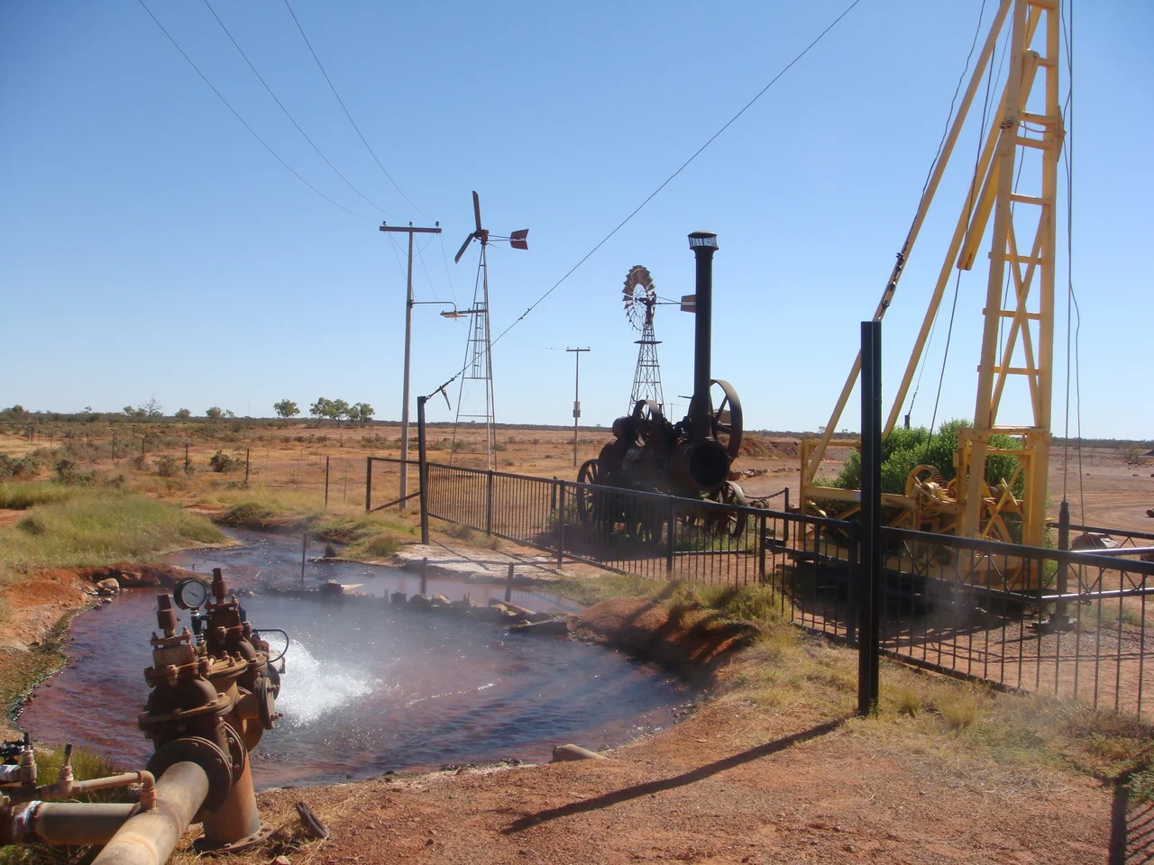
The trick was the Great Artesian Basin, the vast underground reservoir that lies beneath much of inland Australia. Drilling began here in 1891, and in 1893 the bore struck a powerful flow at around 808 metres down, the water surging to the surface at a scalding 84 degrees Celsius. That pressure was pure energy. Engineers coupled the bore to a water turbine, and the turbine to a generator, and the streets of Thargomindah glowed. It was Australia's first hydroelectric scheme built to light a town, and the same bore brought reticulated water to residents by 1895. The dedicated power station building was finished in 1898, and it still stands beside the river, a small stone monument to a very large idea.
A Grand Plan in the Dust
Thargomindah was laid out in 1874 with ambitions that the surrounding country never quite repaid. The pioneers of the 1870s pictured a continent fully settled, every corner ticking over with prosperous sheep stations, and they planned Thargomindah as a proper town to serve that future. Wool was the engine: bullock and camel teams hauled bales through here on the long road toward the Darling River, where paddle steamers carried them on to the southern ports. The grid of streets was drawn generously, the visions were enormous, and then the dry reality of the Mulga country reasserted itself. What remains is a town that still wears the bones of that grand plan, a little big for the people who live in it.
Cobb & Co and Kidman Country
This was country crossed by the great names of the outback. Cobb & Co coaches once rattled through on their long mail and passenger runs across the southwest, and the cattle king Sidney Kidman built his empire over these same plains; in 1912 he bought the old Leahy House, a building dating to 1885, for his travelling manager. Far to the southwest, in the same vast Bulloo Shire, stands the Dig Tree, scarred by the doomed Burke and Wills expedition of 1860 whose failure ironically opened this country to settlers. Thargo sits in the middle of all of it, the kind of place where the legends of pastoral Australia stop being stories in a book and become the road you are actually driving.
The Long Road West
Getting here is part of the experience. The sealed road runs in from Cunnamulla by way of Eulo, narrowing in places to a single lane, so that meeting an oncoming vehicle means easing one wheel off onto the gravel and trusting the other driver to do the same. From New South Wales you come up unsealed from Bourke through Hungerford, raising a long plume of red dust behind you. The town itself is only a few blocks square, a kilometre's walk from the airstrip to the centre, and the line between sealed street and open dirt blurs as you go. Keep heading west and the road simply continues, on toward who-knows-where, the way outback roads always seem to.
Staying in Thargo
For all its remoteness, Thargomindah looks after travellers. There are a handful of places to stay, though in a town this size a single big event, a wedding, a race meeting, can fill every bed at once; it is worth a phone call ahead, and the owners will happily tell you whether there's room. The town keeps two payphones, one outside the post office, which opens weekdays and Saturday mornings until eleven. East lie Eulo and the wetlands of Currawinya National Park, and the relative bustle of Cunnamulla beyond. But the reason to stop is here, by the river, where a stone shed once turned hot water into light and a remote town earned its place in the history of electricity.
From the Air
Thargomindah sits at roughly 28.00°S, 143.82°E on the Bulloo River in far southwest Queensland's Mulga Lands. Thargomindah Airport (ICAO YTGM) lies about a kilometre from the town centre, with Cunnamulla (YCMU) to the east and Quilpie (YQUP) to the northeast as the nearest larger strips. The braided line of the Bulloo River is the clearest landmark in otherwise featureless red country, and the historic stone Hydro Power Plant building stands beside it. Visibility out here is enormous and the air typically clear; expect few visual references away from the river. A pass at 1,500–3,000 ft AGL frames the town, the river, and the long ribbons of road running out toward Eulo, Hungerford, and the empty west.
Nearby Stories
- Yowah 16 km away
- Dr Ludwig Becker's Grave 31 km away
- Quandamooka People 55 km away
- Nockatunga Station 72 km away
- Currawinya National Park 74 km away
- Adventure Way 87 km away
- Koroit opal field 88 km away
- Zero Obelisk 139 km away