
Tiryns
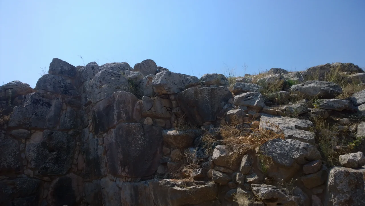
The geographer Pausanias visited Tiryns in the 2nd century AD and wrote that two mules pulling together could not budge even the smaller stones of its walls. He was not exaggerating for effect — he was making a practical observation. The walls of Tiryns, built during the Mycenaean period around 1300 BC, are up to 17 meters thick at the tunnels, constructed from limestone blocks so large that the Greeks of the Classical period could only explain them by crediting the Cyclopes, giants of superhuman strength who alone could have lifted such weight. Homer agreed: he called the city 'mighty-walled Tiryns,' and the epithet has lasted three thousand years.
The Cyclopean Walls
What makes Tiryns immediately overwhelming is scale. The citadel sits on a low hill — only 18 meters high, 300 meters long — but the walls that crown it were originally estimated at 9 to 10 meters tall and still stand in places to 7 meters. Their thickness ranges from 6 meters at the main sections to 17 meters where they encase the corbelled stone tunnels that run through their base. These galleries, covered with triangular stone roofs, served as storehouses and refuges for the lower city's inhabitants during siege. Walking through them today, the ceiling presses close and the worked stone fits without mortar, each block shaped and laid with a precision that seems almost impossible given the tools available. The walls are not continuous: transverse walls divide the acropolis into sections, the southern containing the royal palace, the northern reserved for the hilltop proper. Three springs were engineered into the compound, two accessible through tunnels in the northern wall, ensuring the garrison could survive a prolonged blockade.
Home of Heracles
Myth embedded itself in Tiryns early. Greek tradition names it as the birthplace of Heracles, or at least his residence during the performance of the Twelve Labors — the hero operating from this fortress while carrying out impossible tasks across the known world. The connection with Heracles gave Tiryns a founding legend that tied it to Argos and Mycenae through an elaborate family tree: Acrisius, king of Argos; his brother Proetus, who fled to Lycia, returned with Lycian help, and fortified Tiryns using the Cyclopes; and Perseus, Acrisius's grandson, who founded Mycenae. The story is almost certainly a later political construction — an attempt by Argos, in the early historical period, to knit together the mythic origins of its rivals under a single genealogy that Argos could claim to dominate. But the myth stuck, and it accurately reflects the reality that these three cities of the Argolid were profoundly interconnected throughout the Bronze Age.
Palace of the Bronze Age
Inside the citadel's southern section stood the Mycenaean palace, its plan similar to that at Mycenae: an outer portico with two columns, an anteroom, and the great megaron — the throne room — with a circular central hearth bordered by four wooden columns in the Minoan style. The throne was placed against the right wall of the megaron. Walls were decorated with frescoes; floors bore painted geometric patterns. The entrance to the citadel was always on the east side and evolved through three construction phases, the second featuring a gate in the form of the Lion Gate at Mycenae — a narrow corridor flanked by tower and wall, forcing attackers to approach single-file under fire from above. At its peak around 1300 BC, the citadel and lower town held an estimated 10,000 people across 20 to 25 hectares. Even after the palace was destroyed around 1200 BC in the general collapse of Mycenaean civilization, the population continued to grow, reaching some 15,000 by 1150 BC as refugees perhaps flooded in from other ruined centers.
Excavations and Aftermath
Heinrich Schliemann came to Tiryns in 1876 and initially dismissed what he found as medieval, very nearly destroying the ruins while digging for deeper Mycenaean treasure. He returned in 1884 with better judgment and worked for five months. Wilhelm Dörpfeld, director of the German Archaeological Institute, followed with more systematic excavations continuing into 1938. In 1915, a deposit now called the 'Tiryns Treasure' was found in a cauldron in the lower town: gold and silver objects along with a fifteenth-century BC Minoan signet ring, hidden within a house foundation — evidence of the cosmopolitan reach of this Mycenaean world. Tiryns' end came in 468 BC, when Argos, having finally eliminated Mycenae as well, razed the city and transferred its remaining residents. The site fell silent. In 1999, UNESCO designated Tiryns a World Heritage Site jointly with Mycenae, recognizing both the exceptional quality of the surviving architecture and what these places represent about the origins of Greek civilization.
From the Air
Tiryns lies at approximately 37.60°N, 22.80°E, on the flat plain of Argos just 4 kilometers north of Nafplio and roughly 20 kilometers south of Mycenae. The site sits low on a slight hill in the middle of agricultural land — the ancient citadel mound is visible from the road and from altitude as a distinct elevated feature among flat fields. From the air, the massive extent of the Cyclopean walls is readable against the surrounding plain. The Argolic Gulf is visible to the south, with Nafplio's distinctive peninsula clearly identifiable. Nearest major airport is LGAV (Athens International), approximately 110 km northeast. Best viewing altitude is 1,500–3,000 feet AGL in clear conditions, typical throughout most of the year in the Argolid.
Nearby Stories
- Kastanitsa 2.3 km away
- Heroon at Nemea 3.4 km away
- Psari, Trikolonoi, Arcadia 4.2 km away
- Siege of Gardiki-Arcadia 8 km away
- Cleitor 12 km away
- Troezen 15 km away
- Cave of Euripides 24 km away
- SS Heraklion 94 km away