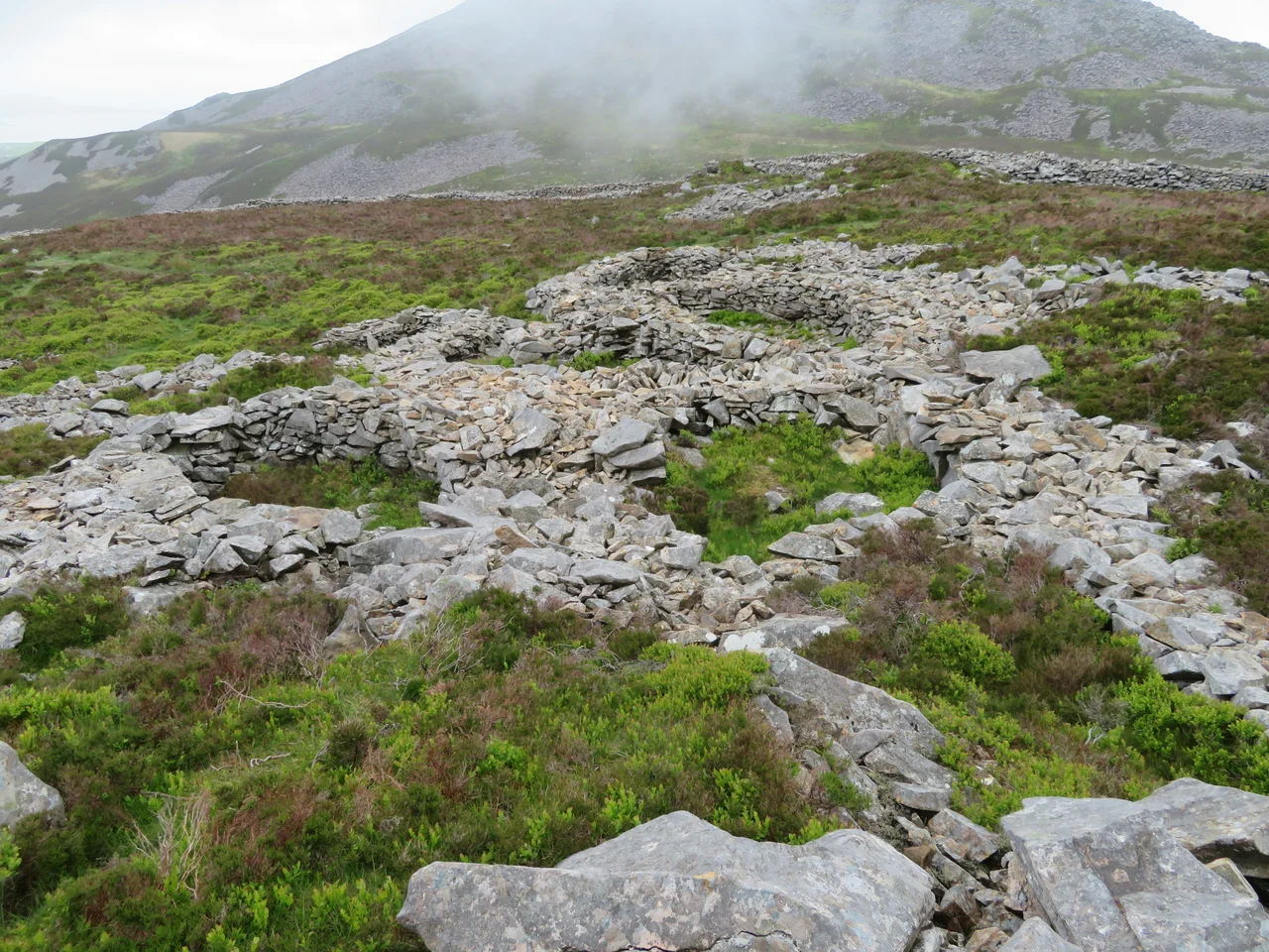

Tre'r Ceiri
Cewri is the plural of cawr -- the Welsh word for giant -- and the people who came later, finding 150 stone houses ringed by walls four metres tall on a mountain summit 485 metres above the sea, decided no ordinary builders had done this work. Tre'r Ceiri, the Town of the Giants, sits on the southeastern peak of Yr Eifl on the north coast of the Llyn Peninsula. It was built around 200 BC, and most of what archaeologists have found there dates from AD 150 to 400 -- meaning the Iron Age fortress kept living through the Roman occupation of Britain, even as Roman power crept up the coast below.
The Builders Who Vanished
Nobody knows who they were, exactly. The Iron Age people of north Wales left no written record of themselves -- only this extraordinary settlement and a few others scattered across the hills of Gwynedd. What they left at Tre'r Ceiri tells a clear story even without names. They picked the most defensible peak on a peninsula already famous for its peaks, and they built. The drystone walls run all the way around the summit, in places still standing four metres high, two thousand years after the last person turfed their roof and walked down for the winter. Inside the wall: roughly 150 stone hut circles, the foundations of houses that once had timber and turf roofs. During the Roman period, the site may have held up to 400 people. The historian John Davies suggested most were probably summer shepherds -- pastoralists who drove flocks up the mountain in May and wintered in the lowlands when the snow came.
Living Alongside Rome
The Romans arrived in Wales in the AD 70s, building their fortress at Segontium near modern Caernarfon and another, much later, at Caer Gybi on Holyhead. They did not depopulate Tre'r Ceiri. The finds inside the walls -- pottery, brooches, fragments of Roman trade goods -- show people kept living here through the second, third, and fourth centuries. That is the remarkable thing about this place. While Britain to the east was being remade as a Roman province, with villas and towns and tiled roofs, the people of the Llyn Peninsula kept climbing to their mountain town. They wove the Roman world into their own, took what they wanted from it, and held onto a way of life that had begun centuries before the legions ever marched.
The View from the Wall
Stand on the summit today and you understand the choice of site immediately. To the south stretches the curve of Cardigan Bay, all the way to the Pembrokeshire coast on clear days. North across the water lies Anglesey, the great sacred island the Romans burned in AD 60 to break the druids. Inland, the peaks of Eryri -- Snowdonia -- rise in serried ranks. Behind you, the central peak of Yr Eifl, Garn Ganol, climbs to 561 metres, the highest point on the whole Llyn Peninsula. On a perfectly clear day you can see Ireland, the Isle of Man, the Lake District of England. Few places in Britain command such a sweep. The Iron Age builders did not pick this peak for the views, but they got them anyway. The wind comes off the Irish Sea unfiltered.
What Pennant Found
Tre'r Ceiri sat in obscurity for most of its post-Roman afterlife, known to local shepherds and forgotten by everyone else. Then Thomas Pennant, the Welsh naturalist and travel writer, climbed up in the late eighteenth century while preparing his Tours of Wales. He recognized what he was looking at -- not a medieval ruin, not a folly, but something far older and intact in a way that European prehistoric sites almost never are. His descriptions brought visitors. A formal archaeological survey followed in 1956. Conservation work continues today, footpaths shoring up and walls being stabilized against the weather, the visitors, and the unrelenting wind. The site is one of the best-preserved Iron Age hillforts in Europe -- not just in Britain. Few other places let you walk inside the foundations of two-thousand-year-old houses and look out through gaps that the original builders left in their walls.
From the Air
Located at 52.97N, 4.42W on the southeastern peak of Yr Eifl, about 9 miles north of Pwllheli on the Llyn Peninsula. The summit sits at 485 metres (1,591 ft); the central peak of Yr Eifl rises higher to 561 metres just to the northwest. Nearest airport: Caernarfon (EGCK) 9 nm northeast; Llanbedr (EGOD) further south. Visible terrain feature on the north Llyn coastline -- three distinct peaks dropping to Caernarfon Bay. Best viewed at 2,500-4,500 ft AGL with the mountains to your right when flying southwest along the coast. Weather often clearer at altitude than at sea level here; cloud caps form on the peaks regularly.
Nearby Stories
- GeoMôn 1.9 km away
- Battle of the Conwy 3.2 km away
- Irish Sea Bridge 5.2 km away
- Ysbyty Ifan 10 km away
- Machynlleth 16 km away
- Barmouth Lifeboat Station 23 km away
- Irish Sea 27 km away
- HMS Tyler 32 km away