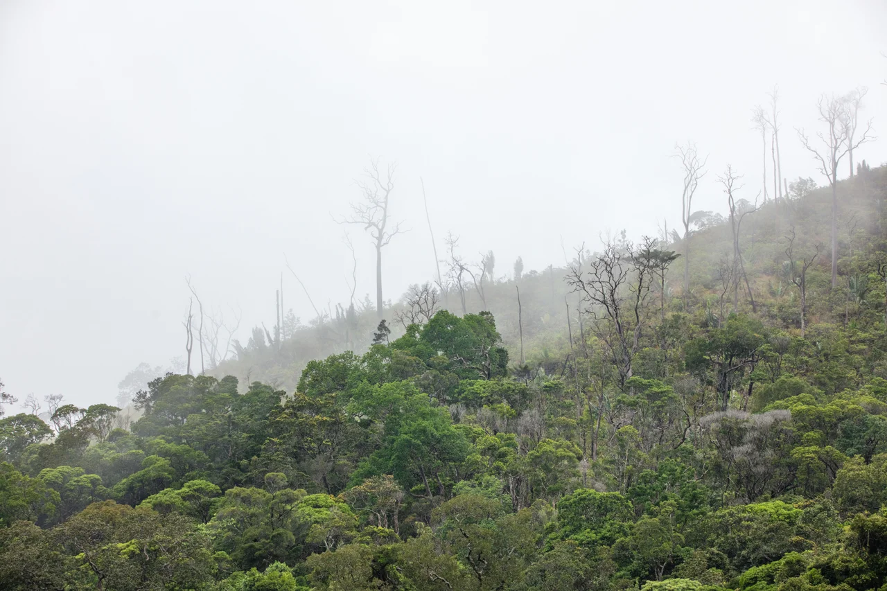

Tsitongambarika
Almost nowhere else in southern Madagascar does humid forest still cling to the lowlands. Drive a few kilometers north of Fort-Dauphin and the ridges of Tsitongambarika rise in waves from southwest to northeast, their slopes carrying the last significant stands of low-altitude rainforest the south of the island has left. Most of Madagascar's surviving humid forest hides high in the mountains; Tsitongambarika, almost uniquely, holds it below 800 meters, with real forest even under 400. That detail sounds technical until you grasp what it means: this is a kind of forest that has been erased nearly everywhere else, surviving here on borrowed time.
A Refuge Below the Mountains
Tsitongambarika protects 58,597 hectares along a massif of parallel ridges, with the Manampanihy river running north along its western edge. The nearest town, Fort-Dauphin, sits just nine kilometers to the south. What makes the place extraordinary is its elevation: humid rainforest in Madagascar has retreated upslope as the lowlands were cleared, so a low forest like this is a living rarity. BirdLife International recognized its importance early, naming it an Important Bird Area in 2001, and since the mid-2000s the Malagasy conservation group Asity Madagascar has worked alongside local communities to defend it. Yet even with legal protection arriving in 2015, BirdLife still flags Tsitongambarika as an Important Bird Area in danger, because protection on paper and protection on the ground are not the same thing.
Still Full of the Unknown
Few forests anywhere are still handing scientists brand-new species, but this one is. Tsitongambarika is recognized as an Alliance for Zero Extinction site, meaning it holds creatures found here and nowhere else on Earth, among them the Anosy mouse lemur and a brilliantly named red-legged fire millipede. Since conservation work intensified in 2016, researchers have turned up species new to science: endemic plants, amphibians, chameleons, snakes, and lemurs. An expedition organized by Britain's Royal Botanic Gardens, Kew, climbing the isolated peak of Mount Ivohibe in 2010, counted twenty species of palm, sixteen of them rare or threatened, and judged the mountain a site of major significance for palms. The forest also shelters birds with names like music: the scaly ground-roller, the nuthatch vanga, the Madagascar blue-pigeon.
The Forest That Pours the Water
For the people of the Anosy region, Tsitongambarika is not a postcard; it is plumbing. The forest is the principal watershed of the area, catching the rain that feeds two of the region's major rivers, the Manampanihy and the Efaho, and supplying the water that irrigates rice on the coastal plain and runs the taps of Fort-Dauphin town. It gives far more besides: firewood, charcoal, timber for houses, bushmeat, medicinal plants. In a region where most people live by subsistence and poverty runs deep, these are not luxuries but the materials of daily survival. The forest keeps the rivers flowing and the rice growing, which is exactly why its loss would fall hardest on the families with the least to fall back on.
A Slow Emergency
The danger here is not a single catastrophe but a steady unraveling. The Malagasy word is tavy, the slash-and-burn clearing of forest for a few seasons of crops, and it bites deep into Tsitongambarika. Fires set to open cattle pasture escape their bounds; loggers take the best trees. None of it is dramatic on any given day, which is precisely the problem, the kind of loss that never makes a headline yet adds up to a vanishing forest. The deforestation rate here ranks among the highest in the country. Set against that is a quieter effort: communities and conservationists trying to hold the line on the south's last lowland rainforest, betting that a place still revealing new life is a place worth saving before the last of it burns.
From the Air
Tsitongambarika stretches north of Taolagnaro (Fort-Dauphin) in Madagascar's southeast, centered around 24.70°S, 47.00°E, along a massif of southwest-to-northeast ridges with the Manampanihy river on its western flank. From the air it appears as dark, ridged rainforest, increasingly broken by the pale scars of slash-and-burn clearings and pasture fires toward its edges; Mount Ivohibe (677 m) stands out as an isolated forested peak. The nearest airport is Tôlanaro (Marillac), ICAO FMSD, roughly 9-15 km south of the forest's southern edge. Best viewed from 3,000-7,000 ft to read the contrast between intact forest and encroaching clearings. Expect cloud buildup and rain over these humid slopes much of the year; the drier months (roughly May-October) give the clearest views and smoke from clearing fires is most visible in the dry season.
Nearby Stories
- Taolagnaro 9 km away
- Berenty Reserve 12 km away
- Anosy 39 km away
- Androy 112 km away
- Canal des Pangalanes 186 km away
- Andringitra National Park 249 km away
- Moramanga 577 km away
- French Western Australia 6496 km away