
Tummel Hydro-Electric Power Scheme
About 12,000 workers were on the Tummel Valley site at the peak of construction in the late 1940s. Among them were a thousand or so Donegal Tunnel Tigers, Irish tunnelling specialists who moved from job to job carrying drilling and blasting expertise that no one else in Britain possessed. There were also German and Italian former prisoners of war, kept on after 1945 to dig the holes through the Grampian Mountains that nobody else wanted to dig. The Tummel Hydro-Electric Power Scheme that they built is an interconnected network of nine power stations, ten major dams, and miles of underground tunnels carrying water from north of Dalwhinnie south through Pitlochry. Water from a single raindrop in the Cairngorms can pass through up to five generating stations before reaching the sea. It is one of the largest single hydroelectric engineering projects ever undertaken in Britain.
Half a Century of False Starts
The idea of damming Loch Ericht for hydroelectric power was first floated in 1899 with the Highland Water Power Bill, which Parliament refused. The Loch Ericht Water and Electricity Power Act of 1912 was approved but came with a clause forbidding any change to the water level, which made the scheme pointless. Dundee Corporation tried again in 1919 with a proposal covering Lochs Ericht, Rannoch, and Tummel, and was beaten back by opposition. Only in 1922, when the Grampian Electricity Supply Bill finally passed, did serious work become possible. The promoters included the Duke of Atholl and Lloyds Bank chairman John William Beaumont Pease, names that carried the local credibility needed to overcome a long pattern of opposition. The new Grampian Electricity Supply Company could not raise the 1.75 million pounds of authorised capital and had to be rescued by George Balfour of Balfour Beatty, whose Power Securities Corporation bought the project.
The First Phase: Rannoch and Tummel
Work began in 1928 at the southern end of Loch Ericht. A concrete gravity dam was built, and a tunnel almost three miles long was cut through solid rock to a point above the north bank of Loch Rannoch. Water dropped 485 feet through narrowing steel pipes to Rannoch Power Station, fitted with two 22,000 horsepower water turbines. A second dam at the northern end of Loch Ericht, near Dalwhinnie, prevented the raised water from flooding the village. Phase one was complete in November 1930. Phase two, the Tummel development, started in spring 1931 with a control weir at the outlet of Loch Rannoch, a dam at Dunalastair creating an artificial loch, three miles of open aqueduct, and Tummel Power Station on the banks of the river at Tummel Bridge. Rannoch and Tummel were the first storage high-head stations in Scotland, holding water in reservoirs above the power station rather than relying on river flow.
The Tribunal of 1944
After the Second World War the North of Scotland Hydro-Electric Board, led by Tom Johnston, picked up where the prewar Grampian Company had left off. The proposed Tummel-Garry extension drew 25 formal objections, and Johnston was obliged to hold a public inquiry. The tribunal sat for ten days. Transcripts ran to 1,188 pages. Perthshire County Council, riparian landowners, and the residents of Pitlochry argued that the scheme would destroy the amenity of the area, end the tourist trade, and ruin salmon fishing. Hotel owners, youth hostelers, environmentalists, and civil engineers gave evidence. Lord Airlie, speaking for the Board, had suffered months of vicious press abuse and was a poor witness on his first day, recovering only on the second. The final report sided with the Board. The benefits of providing power to remote areas where private capital would never do so outweighed the local damage. The MP for Perth and Kinross, William Snadden, tried to block the bill in the Commons and failed.
The Working Scheme
The completed Tummel scheme moves water through four main routes that all eventually reach Loch Tummel. From the north, water collects at Loch an t-Seilich, passes through a tunnel to Loch Cuaich, drives Cuaich Power Station, and discharges into Loch Ericht. A second path begins at Loch Garry and feeds Ericht Power Station. Water from Loch Ericht then drops to Rannoch Power Station, the prewar Grampian asset. A third path drains Rannoch Moor at Loch Eigheach, drives Gaur Power Station, and flows through the River Gaur into Loch Rannoch. From Rannoch the Tummel passes through Dunalastair and the old Tummel Power Station. The fourth route, Loch Errochty, was added during the postwar phase, with a 6.2-mile pipeline driving Errochty Power Station, the largest in the scheme at 75 megawatts installed capacity. All this water finally collects at Loch Tummel, where the Clunie Dam at the eastern end created a reservoir of 36.4 million cubic metres. Clunie Power Station feeds Loch Faskally, which feeds Pitlochry Power Station, the visitor-facing face of the whole scheme with its famous salmon ladder.
Pitlochry and the Salmon
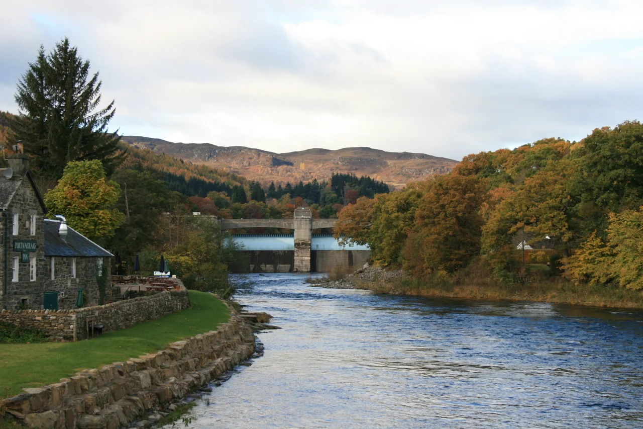
Pitlochry Dam, designed by the Edinburgh architect Harold Tarbolton as a bold modernist statement, was completed in 1950. Its 34-pool salmon ladder, with a viewing chamber where visitors can watch the fish climb, became a tourist attraction in its own right. Two automatic drum gates control the loch level, the first such arrangement used in Britain. The power station holds two 7.5-megawatt sets. Generated power runs underground to Clunie, so there are no overhead lines in Pitlochry to interrupt the views. A formal opening of the Pitlochry and Clunie sections was scheduled for 16 July 1951 with Lady MacColl performing the ceremony. The Board's chief engineer Sir Edward MacColl died the previous day, and the opening went ahead without him. The scheme he had built was expected to generate 635 gigawatt-hours per year. By 1986 it was averaging 663 gigawatt-hours, exceeding its design specification, and it continues to do so today under SSE's management. The objections of 1944 turned out to be wrong on every count. Pitlochry remains a thriving tourist town, salmon still climb the ladder, and the lights stay on across northern Scotland.
From the Air
The Tummel hydro-electric scheme covers a large area of Highland Perthshire roughly bounded by Dalwhinnie at 56.94 degrees N in the north, Rannoch Moor at 56.65 degrees N, 4.5 degrees W in the west, and Pitlochry at 56.71 degrees N, 3.73 degrees W in the east. Recommended viewing altitude 5,000 to 8,000 feet AGL to see the chain of lochs and dams in context. The major reservoirs from north to south are Lochs Cuaich, Ericht, Garry, Errochty, Rannoch, Tummel, and Faskally. Power stations are visible at Tummel Bridge and Pitlochry. Nearest airport is Perth/Scone (EGPT) approximately 35 nm to the south-southeast of Loch Tummel. Dundee (EGPN) lies about 50 nm east. Inverness (EGPE) sits about 55 nm to the north. The Cairngorms rise to the east of the scheme. Mountain weather; expect rapid changes in conditions over the higher reservoirs.
Nearby Stories
- Rannoch Railway Station 0.6 km away
- Huntingtower Castle 2.5 km away
- Comrie 6.6 km away
- Battle of Dalrigh 7.2 km away
- Braemar 9.4 km away
- Highland Folk Museum 14 km away
- Blairgowrie and Rattray 15 km away
- Inverness-shire 16 km away