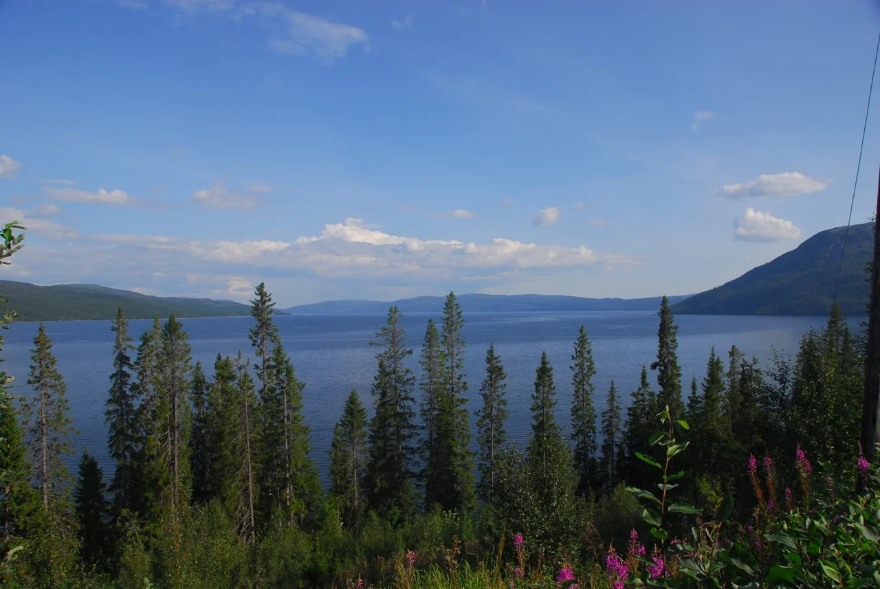

Tunnsjøen
Nowhere in Europe does an island stand this far above the water around it. Gudfjelløya rises from the middle of Tunnsjøen as a six-square-kilometre wedge of granite, its summit — Gudfjellet — reaching 812 metres above sea level, a full 454 metres above the lake lapping at its base. The usual rival for the title is Monte Isola in Italy's Lake Iseo, and it does not come close. But the measurement is the least interesting thing here. In Southern Sami the island is called Tjåehkere, and long before anyone thought to compare it with anything in Italy, it was a holy place.
A Mountain With Water Around It
Tunnsjøen fills a trough of 100.18 square kilometres in the far east of Trøndelag, split between the municipalities of Røyrvik and Lierne, close enough to the Swedish border that you could walk to it in a morning. It is Norway's seventh largest lake, sitting at 358 metres above sea level with the bigger Limingen just to the north. What the surface hides is depth: 222 metres at the deepest sounding, 87 metres on average, roughly 8.8 cubic kilometres of cold water held between rock walls. Gudfjelløya is not the only island. Litlfjelløya lies to its southwest, a smaller hump rising 177 metres above the surface — modest until you remember that most lake islands anywhere in the world barely clear the waterline. This is a drowned mountain range with the tops still showing.
Tjåehkere
Gudfjellet means god-mountain, and the Norwegian name is a translation of what the Southern Sami already knew. The island has long been a religiously important place, remembered as an old sacrificial site, and near the top of the plateau sits the feature that gives the whole thing its popular name: the Tunnsjøguden, a large, almost perfectly square block of stone. Sami spiritual practice here is not a closed chapter with a date on it. In 2011 the reindeer grazing district formerly called Østre Namdal renamed itself Tjåehkere sijte — taking the island's Southern Sami name as its own. The people who herd reindeer across this country chose to be identified by this mountain. The island became a nature reserve in 1981, which protects the ground but was never the reason it mattered.
The Lake Is Also a Battery
Look at the shoreline in late winter and you may notice a pale band of scoured rock above the ice. Tunnsjøen is a regulated reservoir, the lowest in a chain of managed lakes that drain west into the Namsen river system through the Tunnsjøelva toward Namsskogan. Its surface is allowed to move between roughly 357.6 and 352.6 metres above sea level, a five-metre swing that represents about 440 million cubic metres of usable storage. That is the modern arrangement laid over an ancient one: a lake that was a sacred landscape long before it was a unit of stored electricity, now doing both jobs at once. The stone block on Gudfjelløya has not moved. The water beneath it goes up and down on a schedule set somewhere else.
Border Country
At 64.7 degrees north, the light does most of the work. Midsummer here means a sun that barely bothers to set, the granite flanks of Gudfjelløya holding a low orange glow past midnight. In December the reverse — a few blue hours, then the lake goes dark and hard. Røyrvik and Lierne are among the emptiest inhabited corners of Trøndelag, birch and pine giving way to open fell within a few hundred metres of climbing. Sweden begins just over the ridge, and the border here has always been more of a legal fiction than a physical one, crossed for centuries by reindeer that recognise grazing but not customs posts. The Southern Sami name for the lake itself, Dåtnejaevrie, has never been convincingly explained. Some names outlast the language that would tell you what they mean.
From the Air
Tunnsjøen lies at 64.714°N, 13.366°E, at 358 m elevation in eastern Trøndelag, roughly 15 km west of the Swedish border. The lake is unmistakable from the air: a 100 km² sheet with a single conical island, Gudfjelløya, rising 454 m from its centre to 812 m — the standout visual landmark for the entire district. The much larger Limingen sits immediately north, making the pair a reliable navigation fix. Best viewing is 4,000–7,000 ft AGL, where the island's relief still reads as a mountain rather than a smudge. Nearest airfields are Namsos Airport, Høknesøra (ENNM) to the west, Mosjøen Airport, Kjærstad (ENMS) to the north, and Trondheim Airport Værnes (ENVA) well to the southwest. Expect rapid mountain weather, orographic cloud on the fell tops, and low sun angles year-round at this latitude; winter operations here mean short daylight windows and icing risk.
Nearby Stories
- Stora Blåsjön 6.9 km away
- Namsskogan Familiepark 8.4 km away
- Jetnamsklumpen 12 km away
- Majavatn 16 km away
- Wideroe Flight 710 58 km away
- Wideroe Flight 744 62 km away
- Namsos Campaign 98 km away
- Lapplandsleden 116 km away