
Turmi
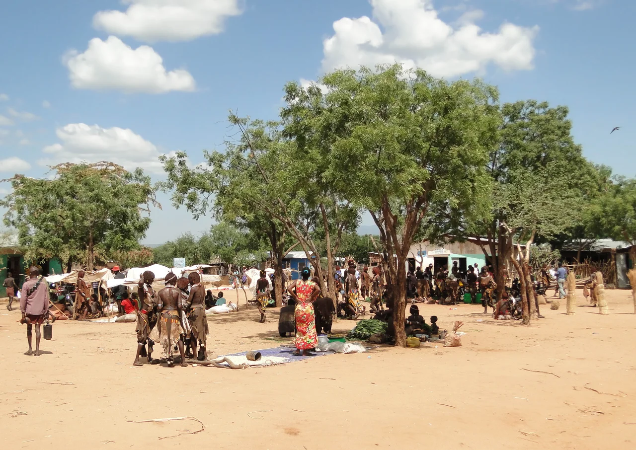
On a Monday morning, the road into Turmi fills with people who have walked since before dawn. Women balance grain and tobacco on their heads, their hair worked into ochre-red ringlets stiffened with butter and clay. Men lean on the long staffs that double as stools out on the grazing lands. They are mostly Hamar, the people of this corner of southwestern Ethiopia, and they have come to the weekly market that gives this small town its rhythm. Turmi is barely more than a scatter of buildings around a junction at 925 metres above the savanna, a thousand-odd residents in the largest settlement of Hamar woreda. But on market day it becomes the social heart of the surrounding hills, the place where news travels and deals are struck under the acacias.
Monday at the Market
The Turmi market is not staged for outsiders. It is a working exchange, the kind that has knit pastoral economies together for generations. Among the sorghum and the coffee husks, you find incised gourds, hollowed and scored with fine geometric patterns, which Hamar women carry as shopping baskets and water vessels. Goats change hands. Honey and butter are weighed by eye. The talk is in Hamar, a tongue belonging to the Omotic family, with Amharic threading through the bargaining. It is easy to read a market like this as a spectacle, but to do so misses the point. This is infrastructure. For families whose wealth is measured in cattle and whose calendar is set by rains, the market at Turmi is where the abstract economy of the herd becomes the daily economy of the household.
Becoming a Man Across the Backs of Bulls
Turmi is best known for a ceremony the Hamar call ukuli bula, the bull jumping. When a young man is ready to cross from boyhood into adulthood, his family lines up a row of cattle, often ten or more, flank to flank. He must run naked across their backs four times or more without falling. Succeed, and he earns the right to own cattle, to marry, to take his place among the adults. The ceremony is no quiet rite. Before the leap, the young man's female relatives ask to be whipped with thin switches, taking the strokes willingly as a bond of loyalty that the man will be obliged to honor for life. Afterward comes the evangadi, a night dance of singing and stamping feet and the jingle of metal ornaments. These are not performances arranged for visitors. They are the architecture of a life, the moment a community recognizes one of its own as grown.
The Gathering of the Herders
In January 2005, Turmi hosted something larger than itself. Roughly 200 pastoralists, government officials, and representatives from United Nations and donor organizations gathered here from 23 countries across four continents, in what was billed as the largest meeting of its kind. They came to discuss a shared dilemma: how to sustain a herding way of life in a world of fences, droughts, and shifting borders. The choice of Turmi was fitting. Few places embody the question so plainly. The Hamar, like pastoralists from the Sahel to Central Asia, move with their animals and read the land for water, a knowledge that is at once ancient and increasingly pressured. The conference produced a report with a hopeful title, "Rain, Prosperity and Peace," but the underlying tension it named has only grown sharper across the Omo in the years since.
A Town Between Worlds
Turmi sits on the edge of change. The wider Omo Valley has drawn growing numbers of travelers, and with them have come cameras, payments for photographs, and the slow commercial reshaping of cultural life. The Hamar navigate this with their own agency, choosing what to share and what to keep. They are not relics, and they are not a stop on someone else's itinerary. They are farmers and herders and parents living a present that happens to carry deep roots. To pass through Turmi on any day but Monday is to find a quiet junction in the heat. To be here when the market wakes is to glimpse a society organizing itself on its own terms, in its own language, at its own unhurried pace.
From the Air
Turmi lies at 4.97°N, 36.48°E in Ethiopia's South Omo, on the savanna at roughly 925 m elevation. The nearest airfield is Jinka (Baco) Airport (ICAO HABC / IATA BCO) some 100 km to the north, the main gateway to the Omo circuit; Arba Minch Airport (HAAM / AMH) lies farther north. From the air the town reads as a small grid at a road junction amid open acacia grassland, with the Omo River basin to the west and the broken volcanic hills toward Lake Turkana to the southwest. Best viewing in the dry season (roughly November to February) when haze and dust are lowest.
Nearby Stories
- Lower Valley of the Omo 39 km away
- Ilemi Triangle 59 km away
- Konso 69 km away
- Omo National Park 81 km away
- Lake Turkana 88 km away
- Lomekwi 93 km away
- Nech Sar National Park 112 km away
- Chalbi Desert 197 km away