.jpg)
Uist
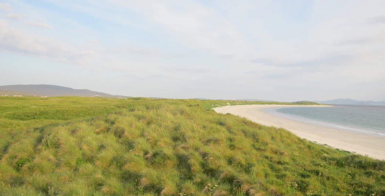
From the air, Uist looks less like land than like a slow argument between rock and ocean. Six inhabited islands - Eriskay, South Uist, Grimsay, Benbecula, Flodaigh, the other Grimsay, North Uist, Baleshare, Berneray - stitch themselves together with bridges and causeways across tidal narrows that the sea still tries to reclaim. The Gaelic names are different from the English ones, and both are correct: Uibhist a Tuath in the north, Uibhist a Deas in the south, Beinn nam Faoghla between them, the islands of crossings.
A Country Cut by the Sea
Writing in 1549, Sir Donald Monro, High Dean of the Isles, called Uist a fertile country, full of high hills and forests on the east coast and freshwater lochs without number. He noted the caves and hollows in the earth of the north, covered with heather, that fostered many rebels - a description more atmospheric than flattering. Monro's geography assumed one island where modern maps now show several. The sea, as he wrote, enters and cuts the country by ebbing and flowing through it. Today causeways span those cuts, but at spring tides the Atlantic still asserts itself, sluicing across the machair and reminding you that this is borrowed ground.
Hounds and Hidden Anchorages
Lochmaddy on North Uist takes its name from Na Madaidhean, the wolves or hounds - rocks in the bay that early sailors thought looked like crouching beasts. It became a Royal Fishing Station under King Charles, then the island's ferry port, and remains the gateway: Caledonian MacBrayne's MV Hebrides plies the route to Uig on Skye. South of there, the population scatters along the west coast where the machair meadows allow crofting, while the rocky east coast stays mostly empty. Together the six islands hold 4,723 people, a number that has trembled lower over the centuries and stubbornly held.
Flora's Crossing
In June 1746, after the Battle of Culloden ended the last serious Jacobite rising, Prince Charles Edward Stuart - Bonnie Prince Charlie - was fugitive in the Western Isles with a British price on his head. From Benbecula, a young woman named Flora MacDonald disguised him as her Irish maid Betty Burke and sailed him across the Minch to Kilbride on Skye. She was arrested and held in the Tower of London. He escaped to France, never returned, and the rising never resumed. The Uists remember her not as a footnote but as the islander who turned an ordinary boat trip into one of the most repeated stories in Highland memory.
A Living Place
The settlements read like a Gaelic litany - Dalabrog, Baile a' Mhanaich, Càirinis, Solas, Loch nam Madadh - each name carrying the cadence of a language that two-thirds of the population still speak. The hospital at Balivanich on Benbecula serves all six islands. The airport there connects to Glasgow and Stornoway. The single-track A865 runs the full length of the archipelago, hopping causeways, demanding patience from drivers, granting views that justify the slow going. Loch Bi on South Uist stretches eight kilometres and nearly cuts that island in two. Whatever Uist is, it is not one thing.
From the Air
Centred at 57.45N, 7.32W. The chain runs roughly 50 nautical miles north-south. From cruise altitude on clear days the causeways and the bright sand beaches of the west coast stand out distinctly against the dark peat and the inland lochans. Benbecula Airport (EGPL) sits in the middle of the chain and serves all the inhabited islands. Stornoway (EGPO) lies to the north on Lewis. Atlantic weather is volatile; visibility can drop within minutes as fronts sweep in from the southwest, and crosswinds at EGPL frequently challenge approaches.
Nearby Stories
- SS Politician 6.2 km away
- Dunvegan Castle 8.2 km away
- Canna 11 km away
- Leverburgh 16 km away
- Duntulm Castle 20 km away
- St Kilda, Scotland 54 km away
- German submarine U-516 138 km away
- German submarine U-764 163 km away