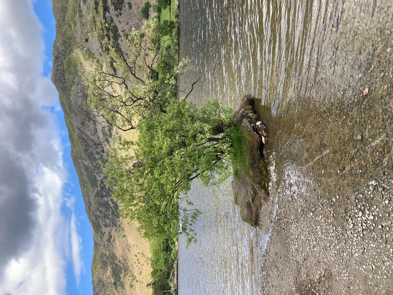

Ullswater
In April 1802, Dorothy Wordsworth and her brother William were walking back along the western shore of Ullswater after visiting their friend Thomas Clarkson - the anti-slavery campaigner whose Cumbrian house, Eusemere, sat just south of Pooley Bridge. Dorothy stopped to write in her journal. "I never saw daffodils so beautiful," she wrote. "They grew among the mossy stones about and about them; some rested their heads upon these stones as on a pillow for weariness; and the rest tossed and reeled and danced." Two years later her brother would turn that walk into a poem - the one with the cloud and the host of golden daffodils - that has been taught to more schoolchildren over the past two centuries than any other piece of English verse. The daffodils were here. The lake was here. They are both still here.
A Lake Made by Three Glaciers
Ullswater is the second-largest lake in the Lake District - about seven miles long, three-quarters of a mile wide, with a maximum depth of sixty-three metres - and one of the most strikingly shaped. It is a Z, or an elongated S, depending on how you describe it: three distinct reaches, each carved by a different Ice Age glacier, meeting at sharp bends that hide each reach from the next. From any one point on the lake you can see only one third of it. The surrounding hills give it its shape; the glaciers gave it its depth. The lake drains north into the River Eamont, which joins the Eden, which reaches the Solway Firth at Carlisle. For much of its length Ullswater used to mark the border between the historic counties of Cumberland and Westmorland; today, more prosaically, it sits within the unitary authority of Westmorland and Furness.
Wolf's Lake, or Maybe Ulf's
The name's origin is genuinely uncertain. The leading scholarly guess is that it derives from Ulfr, an Old Norse personal name (also the noun for wolf), plus the Old English waeter influenced by the Norse vatn - giving "Ulf's lake." Several historical figures named Ulf have been proposed: a Norse chief who supposedly ruled the area, a Saxon Lord of Greystoke called Ulphus whose land bordered the lake. Other theories invoke the Norse god Ullr, or a Celtic word ulle meaning elbow - which would describe the lake's bent shape rather well. There is even a 19th-century theory that the lake was once a haunt of wolves. The truth is probably long lost. Hodgson Hill, an earthwork on the northeast shore, may be the remains of a Viking fortified settlement; the area was certainly settled by Scandinavian incomers. Whoever Ulf was, his name has outlived him by at least eleven hundred years.
Steamers, Kaisers, and Anti-Slavery
The Ullswater Steamers fleet still runs all year. The boats were originally working vessels, from the 1850s carrying mail and miners and goods along the lake to and from the Greenside lead mine at Glenridding. When the mine closed in 1962, the steamers reinvented themselves as tourist craft. The oldest of the fleet, the Lady of the Lake, has been in service since 1877. In 1912 the lake had an unexpected royal visitor: Kaiser Wilhelm II, German Emperor, toured Ullswater on the MY Raven, temporarily re-fitted as a royal yacht for the occasion. The local landowner, Hugh Lowther, the 5th Earl of Lonsdale, built him a shooting lodge at Martindale. Two years later the Kaiser would be at war with Britain. The lodge, called The Bungalow, still stands. The connection at Pooley Bridge is older and arguably more honourable: Thomas Clarkson, who lived at Eusemere from 1796 to 1804, was one of the central figures in the campaign to abolish the British slave trade. He spent years travelling the country collecting evidence, addressing audiences, and helping William Wilberforce build the political case in Parliament. The lake gave him a view, a refuge, and friends who walked over from Grasmere to visit.
Bluebird at 200 mph
On 23 July 1955, the British speed-record pursuer Donald Campbell drove a jet-propelled hydroplane called Bluebird K7 down the calm waters of Ullswater at 202.32 mph, setting a new world water speed record. The lake was chosen for its length, its straightness through the central reach, and its sheltered surface. Campbell would go on to break further records on other lakes - Coniston in particular - until he was killed there in 1967 attempting to push past 300 mph. Bluebird K7 itself was eventually raised from Coniston in 2001, restored over two decades, and returned to Coniston Water in May 2026 — running under her own power for the first time since the day Campbell died. Ullswater hosts no jet-powered hydroplanes today. The lake is a sailing and rowing centre: the Ullswater Yacht Club runs the Lord Birkett Memorial Trophy, a two-day round-the-lake regatta held every July, that regularly attracts more than two hundred boats. The trophy commemorates the lawyer who, in 1962, gave his final speech in the House of Lords campaigning against a proposal to turn Ullswater into a reservoir. He won the vote. He died the next day. The lake remains a lake.
Aira Force, Geese and the View
Midway along the western shore the Aira Beck falls down a wooded ravine in a series of cascades known as Aira Force. The National Trust owns the falls and the surrounding land. The path through the gorge is short, atmospheric, and remarkably loud after rain. Nearby Lyulph's Tower is a castellated 18th-century pele-tower lookalike, built by a former Duke of Norfolk as a shooting box - an architectural folly with the bones of a fortification. In 2022 the lake's resident greylag geese began disappearing in disturbing ways - witnesses on several occasions saw birds dragged under the water. Theories were aired: a very large pike, an introduced wels catfish, an otter, fishing-line entanglement. Nobody is sure. The geese continue to live on the lake, watchful. Wordsworth, who knew this lake well, called it "perhaps, upon the whole, the happiest combination of beauty and grandeur which any of the Lakes affords." From the western shore on a still spring day, with the daffodils still blooming and the Helvellyn range across the water, you would struggle to make a case against him.
From the Air
Ullswater stretches from 54.57 degrees north, 2.90 degrees west across a Z-shaped basin about 7 miles long oriented roughly south-west to north-east. From the air the lake reads as three distinct reaches connected at sharp bends, with steep hills on both sides. Glenridding sits at the southern tip, Pooley Bridge at the northern end. Helvellyn (950 m) rises directly west of the southern reach; the High Street range (828 m) rises east. Aira Force is on the western shore midway. Nearest airfields: Carlisle Lake District (EGNC) approximately 20 nm north-west, Newcastle (EGNT) about 50 nm east. Cruise altitudes of 4,500-6,500 feet give views over the full lake and surrounding fells. The valley is sharply incised and orographic cloud forms quickly on the surrounding ridges.
Nearby Stories
- Parton railway station 4.4 km away
- Brough Castle 11 km away
- Cartmel Racecourse 13 km away
- Caerlaverock Castle 15 km away
- Vindolanda 18 km away
- Yorkshire Dales 25 km away
- Cashtal yn Ard 55 km away