Unaí
The name Unai is a Tupi word meaning black river - a translation of the Portuguese Rio Preto, the district's earlier name. The renaming happened in 1923, when the town that was then part of Paracatu district was told to drop its duplicate-sounding Portuguese name and adopt something indigenous instead. The town kept both pasts anyway. Outside the city limits, in a cave called Gentio II, archaeologists have found evidence of hunter-gatherers who lived here more than 10,000 years ago, and of gardeners around 4,000 years ago who grew corn, peanuts, pumpkin, and gourd. The oldest pottery found in Brazil outside the Amazon was made here, 3,500 years ago. The Rio Preto that gave Unai its name flows out of a lake called Lagoa Feia near Formosa and joins the Paracatu River, and the whole landscape has been shaping lives since long before any European had heard of either.
Before the Portuguese
Gentio II is only one of several caves around Unai. There is also Gentio I, the Cave of Tamboril - 1,178 meters of mapped passages - the Lapa do Sapezal, the Cave of the Monkfish, the Cave of Quilombo. The last of those got its name in the nineteenth century, when enslaved Africans fleeing the terrible working conditions of the Paracatu gold mines took refuge inside it; quilombo is the word for a community of runaway slaves. Before the colonial era, the central Brazilian plateau belonged to the macro-Ge language peoples - the Acroa, Xakriaba, Xavante, Kayapo, Javae, and others who had hunted, gardened, and made pottery in these cerrado uplands for millennia. The bandeirante expeditions that swept through from the sixteenth through eighteenth centuries came for gold, precious stones, and, brutally, enslaved indigenous laborers to work them.
White Grass to Black River
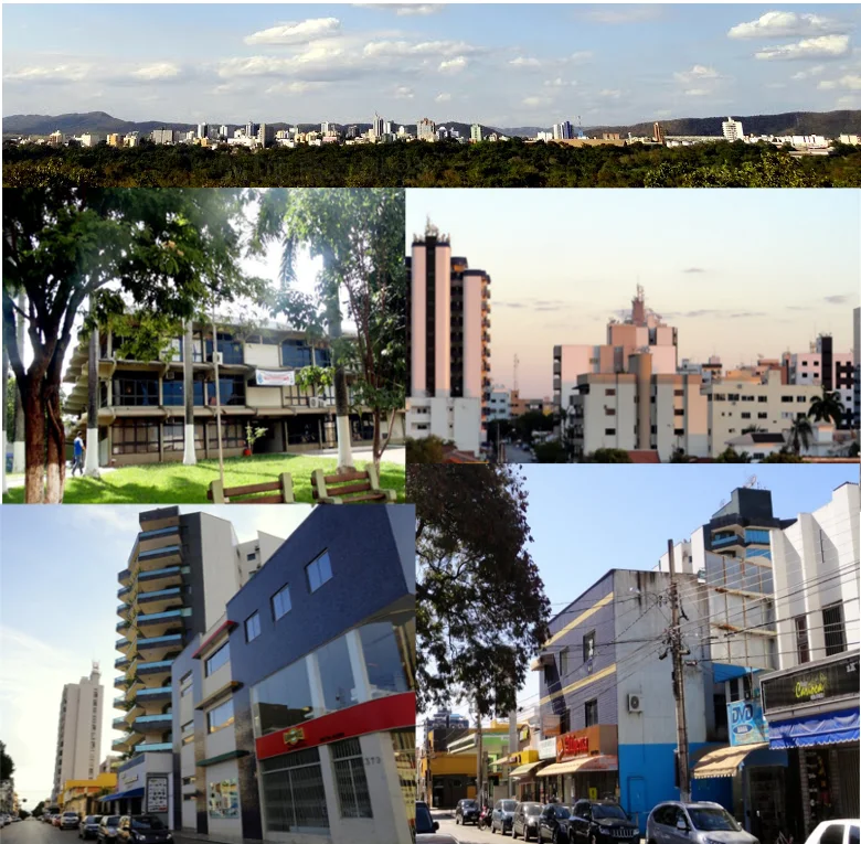
The modern town came later. In the nineteenth century a farmer named Domingos Pinto Brochado settled with his family in an area near the Rio Preto that he called Capim Branco - White Grass. In 1873 the village was upgraded to a district within Paracatu and named Rio Preto after the river. In 1923 the district got renamed Unai - the Tupi translation of the same name. In 1943 Unai split from Paracatu to become its own municipality. The population is around 85,000, modest by Minas Gerais standards, but the city has unusual economic weight because of its location: 590 kilometers from Belo Horizonte, the state capital, but only 164 kilometers from Brasilia, tying it more closely to the federal capital than to its own state.
The Slaughter of Unai
On January 28, 2004, three federal labor inspectors and the driver who brought them were shot dead in rural Unai while investigating working conditions on farms in the region. Brazilian labor law is supposed to distinguish legitimate employment from conditions "analogous to slavery" - workers held by debt, stripped of documents, prevented from leaving. The Unai inspectors were checking for exactly that. Four men - Nelson Jose da Silva, Joao Batista Soares Lage, Ailton Pereira de Oliveira, and their driver Eratostenes de Almeida Goncalves - were ambushed and killed. The crime became known as the Chacina de Unai, the Slaughter of Unai, and shocked the country. It forced a reckoning about how dangerous the inspectors' work had become, and about the farmers willing to kill to avoid scrutiny. Convictions came slowly, some after years of appeals. Every January 28 is now observed in Brazil as the National Day of Combat Against Slave Labor in honor of the men who died.
Waterfalls and Record Heat
The landscape around Unai is cerrado cut by rivers. The Jiboia Waterfall on the Ribeirao Jiboia about 80 kilometers outside town drops 140 meters in free fall. The Rio Preto waterfall is two kilometers from the city center. The Serra Geral do Rio Preto separates the drainages of the Rio Preto and the Urucuia. The climate is hot, and getting hotter. Unai's all-time low was 5.1 degrees Celsius on June 9, 1981; its all-time high of 42.6 degrees has been matched six separate times, twice during the October 2020 drought and four times during 2023 - in late September and in November on the 14th, 15th, and 17th. The economic story follows the climate: ever-larger soybean plantations (83,000 hectares in 2006), ever-larger herds (305,000 cattle, 35,000 milking cows), ever more pressure on the remaining cerrado and the remaining water. Unai resists droughts, locals will tell you, because the Rio Preto flows through a vast forest reserve. For now.
From the Air
Located at 16.36°S, 46.89°W in northwestern Minas Gerais, Brazil, 164 km southeast of Brasilia via BR-251 highway. At cruising altitude the surrounding landscape shows as a classic cerrado-converted-to-soybean pattern - vast geometric fields with strips of riparian forest along the Rio Preto and its tributaries. The Jiboia waterfall is visible as a distinctive cliff break in the landscape about 80 km from town. Nearest major airport: Brasilia/Presidente Juscelino Kubitschek (SBBR, approximately 164 km northwest).
Nearby Stories
- Cristalina 18 km away
- IBGE Ecological Reserve 51 km away
- Luziânia 56 km away
- Formosa, Goias 83 km away
- Vazante 143 km away
- Pirapora 171 km away
- Das Velhas River 189 km away
- Mambaí 190 km away