Uzunköprü Bridge
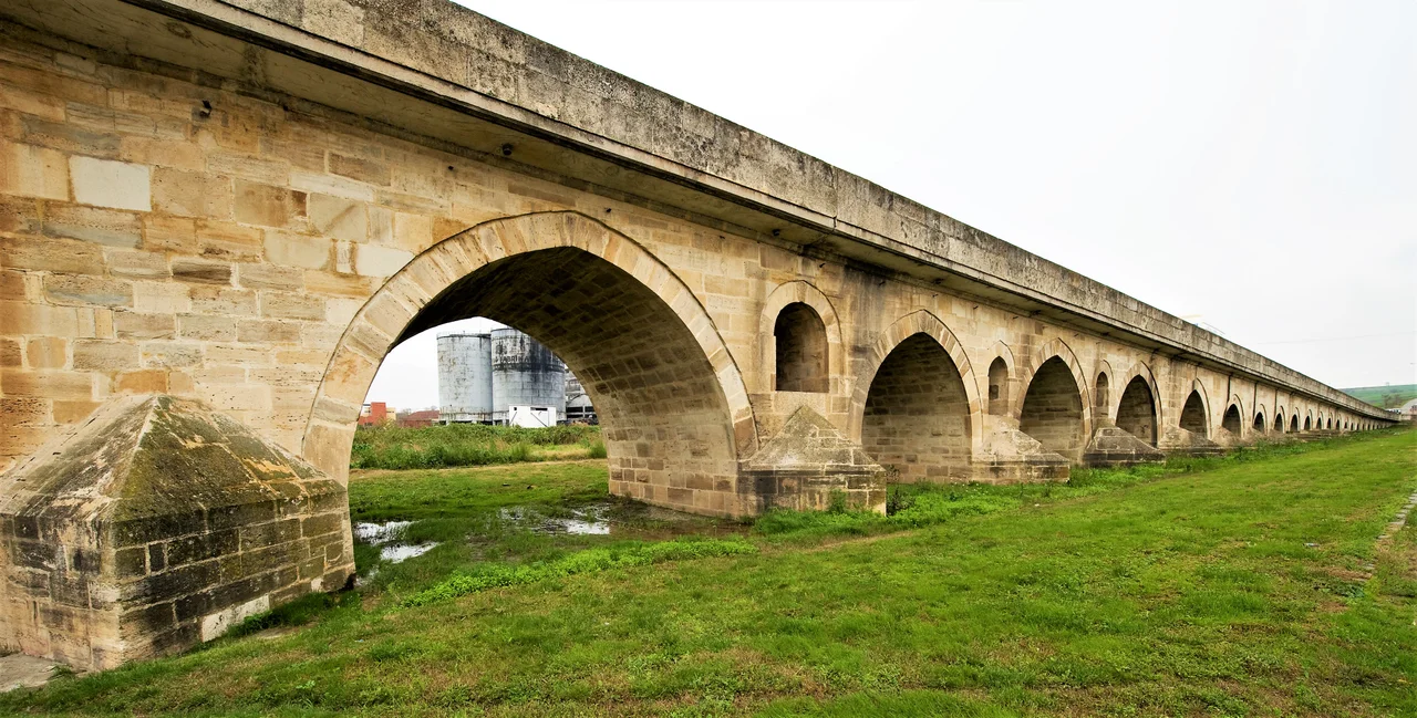
It took seventeen years to build, from roughly 1426 to 1443, and when the masons finally laid the last stone the bridge stretched 1,392 meters across the marshy floodplain of the Ergene river. One hundred and seventy-four arches in a long parade, the longest stone bridge anyone had ever attempted. Sultan Murad II had ordered it because his armies kept getting stuck. Wooden bridges across the Ergene rotted, washed away, or burned down. Floods would isolate troops on the wrong side of the river for days. So the sultan said: build me one made of stone, and build it long enough that the spring floods cannot overwhelm it. The masons obliged. Almost six centuries later, traffic still crosses it, though by 2021 it had to be closed for restoration after cracks began appearing in stones placed there before Columbus sailed.
Why a Bridge Here
The land around the Ergene was nobody's idea of a good place to live. Swampy, choked with thorny vegetation that hid bandits and wolves, given to seasonal flooding that turned firm ground into impassable mire, it had stayed empty while people built villages on the higher hills nearby. But the river sat directly across the Gallipoli-to-Edirne road, the route Ottoman armies took when crossing into Europe. Every spring the river rose, and every spring the wooden bridges either disappeared or were burned by enemies. Sultan Murad II's chief architect Muslihiddin and the master craftsman Mehmed surveyed the soft clay and sandstone bed and concluded that only a long, low stone causeway would survive. The ground was first cleared of its thorn thickets — work that, by Ottoman accounts, also cleared out the highwaymen who used those thickets for cover.
The Numbers
There are still arguments about the exact length. Different surveys have given different answers as the river has shifted, as some arches buried themselves in silt, and as restorations have changed the structure. In 1978, surveyors measured 1,266 meters. In 1989, they got 1,254. In 2018, when the Guinness Book of Records sent its team, the answer came back at 1,306.2 meters. The Ottoman traveler Evliya Çelebi, who walked across in 1658, said it was 2,000 stretched steps long, which works out close enough to suggest he was not exaggerating much. Two viewing balconies were built into the parapet — one above arches 40 and 41, another above arches 102 and 103, the longer of the two stretching nearly ten meters. Places to pause, look down at the water, let a horse cart pass.
Centuries of Patches
Earthquakes shook some arches loose. Floods undermined others. Over the centuries the bridge was patched and shortened and raised and patched again. In 1971, in an attempt at modernization that locals would later regret, the entire deck was widened to 6.8 meters and paved with steel and concrete, smoothing the old worn stones under a slick new surface that did the underlying structure no favors. By 2013 the cracks were visible enough that heavy vehicles were banned, and a separate concrete bridge was built a kilometer away to take the truck traffic. In 2018 someone at the Turkish Ministry of Interior tried to put a picture of the bridge on the cover of the new national passport, and accidentally used a photo of the wrong bridge entirely — the Meriç in nearby Edirne — while still labeling it Uzunköprü. The mistake made the news for a week.
What's Underneath
When the 2021 restoration began, one of its goals was to dig out arches that had sunk into the riverbed and silted over, returning the bridge closer to its original profile. Workers also planned to pull up the asphalt and replace it with stone, and to replace any blocks that had cracked or fallen out. The bridge waits on UNESCO's tentative list for World Heritage status, a recognition that this is something more than a regional monument. It is among the longest stone bridges humans ever built before the industrial age. The figures and motifs carved into individual stones — animals, geometric patterns, family marks left by the masons themselves — were replaced over the centuries as stones wore out, so what stands today is layer on layer of repair, a stone bridge as palimpsest, still carrying weight.
From the Air
Uzunköprü Bridge: 41.2761 N, 26.6767 E, spanning the Ergene river just east of the town of Uzunköprü in Edirne Province, northwestern Turkey. Best viewed below 3000 feet. Identifiable as a long, low stone causeway crossing a meandering river — the bridge stretches roughly 1.3 km, far longer than any other stone bridge in the area. The much shorter modern concrete bridge runs parallel about a kilometer to the south. Çorlu airport (LTBU) lies about 75 nm east, Edirne city about 60 km north. Class G airspace; check NOTAMs near the Greek border to the southwest.
Nearby Stories
- Ottoman conquest of Adrianople 20 km away
- Ganos 32 km away
- Battle of Kardia 49 km away
- Samothrace temple complex 65 km away
- Şarköy District 69 km away
- 1928 Chirpan-Plovdiv Earthquakes 101 km away
- Battle of Imbros 110 km away
- Battle of Constantinople (922) 166 km away