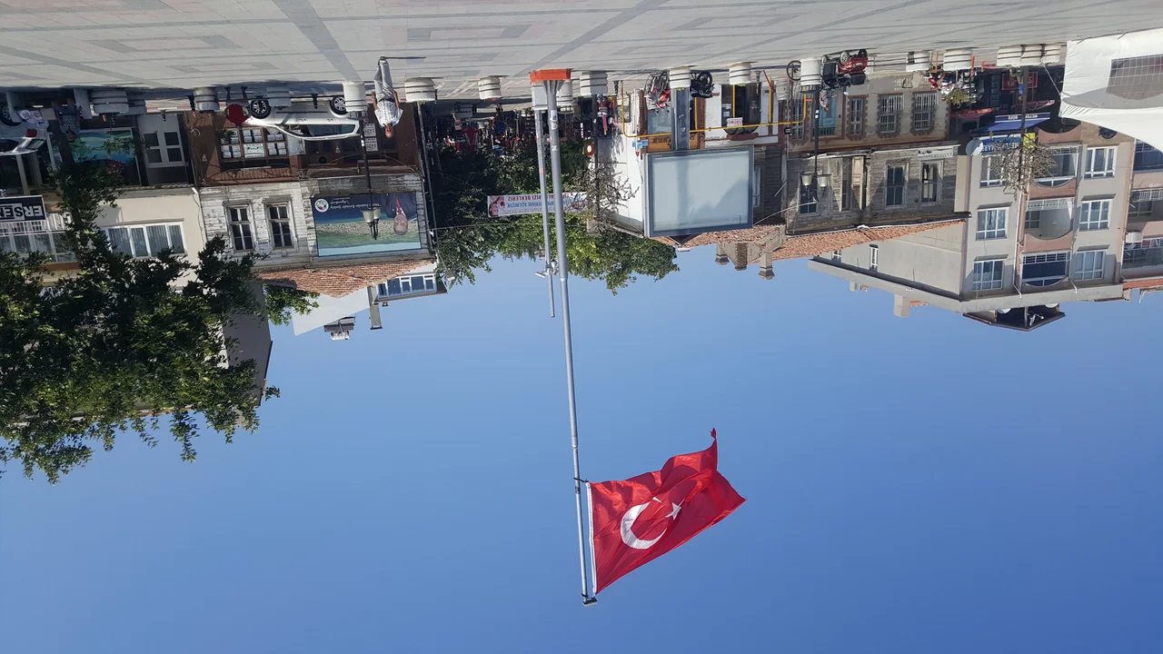

Şarköy District
Every village along the Şarköy coast has two names: the one it carries now and the one it had before. Mürefte was Myriophyton — "a thousand vineyards" in Greek. Hoşköy was Hora. Gaziköy was Ganos, which paired with Hora to form the Greek metropolis of Ganohora. The renaming happened in 1923, when the Treaty of Lausanne formalized a brutal exchange: Greeks were deported from Şarköy, and Turks were deported from Macedonia to take their place. The wine survived. The vines planted by Greek farmers along this Marmara shore were already old enough that it made no sense to pull them out, and the new arrivals kept them going.
The Shape of the Coast
Şarköy District occupies a narrow coastal strip on the European side of the Sea of Marmara, in what Turks call Trakya — Thrace. The Sea of Marmara forms the northern and eastern boundary; low mountains, none reaching 1,000 meters, close in from the south. The main town, also called Şarköy, sits at the western end of the district with a population around 17,000, and the coastal road links a chain of smaller settlements running east toward the Ganos fault scarp and Mount Işıklar.
The climate is the same one that made Greek farmers plant vines here two millennia ago: hot, mostly dry summers with enough moisture to bring the grapes through, and mild-to-chilly winters that the vine tolerates well. Olive trees fill in wherever vines don't, and the hillsides above the coast alternate between the two in a pattern that has not changed much in centuries. Istanbul lies two to three hours northeast — close enough for weekend tourism, far enough to feel genuinely removed from the city.
Layers of Settlement
From antiquity, this coast attracted Greek colonists who built fishing villages and pressed oil and wine from what the land offered. By the 19th century, the Greek-speaking population formed the majority along the shore. Then came the wars: the First Balkan War in 1912 — the year the Ganos Fault also shook the coast with a magnitude 7.4 earthquake — brought the Ottoman front lines to within earshot. The Greek-Turkish War that followed World War I culminated in the Treaty of Lausanne and its population transfers.
The Greeks who left took their icons, their recipes, and the memory of villages they had lived in for generations. The Macedonian Turks who arrived found an unfamiliar coast with someone else's vineyards and someone else's churches slowly falling into ruin. At Hoşköy, St. Ioannis Theologos Monastery — built in 1865, on a Byzantine or earlier religious site — stands as a ruin in the hills above the Melen winery, whose owners have spoken of restoring it. The two things coexist without much drama: a ruined Greek monastery and a working Turkish winery, on the same hillside, sharing the same rain.
Wine Country, Turkish Style
Turkey does not use geographically protected wine appellations the way France or Italy does, so "Şarköy wine" is more a category of local practice than a regulated designation. The district's producers grow both internationally recognized varieties — Cabernet Sauvignon, Merlot — and local cultivars that have adapted to this specific hillside climate over many decades. Karasakız is the red variety most closely associated with the region; Narince, a white grape, also grows here.
Melen Winery, based in Hoşköy, runs tours from May through October. Chateau Kalpak and Cansin's Vineyard both sit on the D-120 road toward the Gelibolu peninsula, not far from where the coast begins to bend toward the Dardanelles. The Kutman Wine Museum in Mürefte — Myriophyton, the town that once bore the name meaning "a thousand vineyards" — occupies a historic winery building on the waterfront and displays the equipment that made this coast productive long before anyone thought to give the wine a label. The continuity is imperfect and complicated, but it is genuine.
Life Along the Shore
For most visitors, Şarköy is a place to slow down. The main town has a waterfront harbor; the beaches east of the harbour are the district's best. Small dolmuş minibuses rattle along the coast road between Şarköy and Gaziköy every thirty minutes through the warm months, thinning out as you go east. The winding coastal road west of Şarköy has no public transport at all, and the mountainous route over the hills from the north — newly surfaced as of 2023, but still full of hairpin bends and loose gravel — rewards the persistent traveler with near-solitude and views across the Marmara.
At Hoşköy, a lighthouse built by the French in 1861 — a 20-meter tower on a cliff above the village — still functions. Paragliders from the Tekirdağ Paragliding Club launch from the hills above Yeniköy and land at Ayvasıl beach. Mount Işıklar, called Ganos by the Greeks who named it, rises behind Uçmakdere and offers a hiking route that most Istanbul visitors have never heard of. This coast has been getting by on its own terms for a long time, with or without the attention.
From the Air
Şarköy District stretches along approximately 40.60°N, 27.11°E on the Thracian Marmara coast. At 3,000–5,000 feet, the vineyard-covered hillsides are visible running parallel to the sea, with Mount Işıklar (Ganos) rising noticeably behind the coastal strip near Uçmakdere. The Hoşköy lighthouse on its cliff is a useful visual marker. The Sea of Marmara stretches away to the north and east, and the narrow Gallipoli Peninsula is visible to the southwest. Nearest airport: LTBU (Tekirdağ Çorlu Airport, ~65 km northeast); regional alternative LTBH (Çanakkale Airport, ~70 km southwest); LTFM (Istanbul Airport) for the broader Marmara region.
Nearby Stories
- Battle of the Granicus 2.9 km away
- Kapıdağ Peninsula 9.2 km away
- Battle of Aegospotami 14 km away
- Lake Kuş 18 km away
- 2025 Istanbul Earthquake 39 km away
- Gallipoli Campaign 45 km away
- Uzunköprü Bridge 55 km away
- Didymoteicho Fortress 90 km away