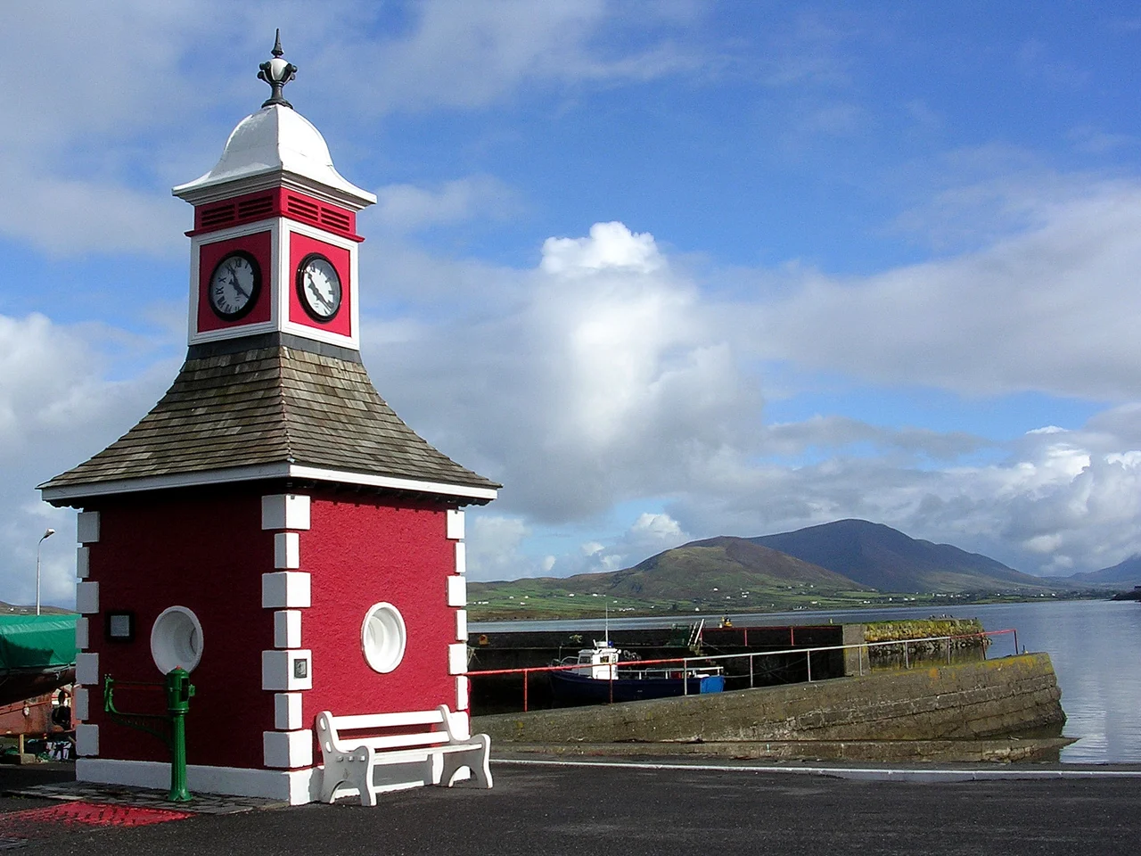

Valentia Island
On 27 July 1866, an operator at Foilhommerum Bay tapped out a message in Morse code. Seconds later, more than 1,800 miles away in Heart's Content, Newfoundland, the dots and dashes arrived. The ocean had just become a wire. Until that moment, news between Europe and North America traveled at the speed of a steamship; a query and its answer could take a month. After that moment, it took seconds. The eastern end of that transformation lay on this small island off the Kerry coast, where a copper cable came ashore in a slate-and-quartzite cove and changed how the world kept time.
The Cable That Shrank an Ocean
The success of 1866 came after a string of failures that would have broken less stubborn men. In 1857, a cable paid out from a ship between Ballycarbery Strand and Valentia snapped in deep water. The 1858 attempt, landed at Knightstown, carried only a few faint messages before the insulation failed. A heavier cable laid in 1865 broke and sank halfway across. Then in July 1866, the steamship Great Eastern, a vast iron ship designed for a different trade, paid out a new cable from Foilhommerum Bay and reached Newfoundland without incident. Within weeks, the engineers grappled the lost 1865 cable from two miles deep, spliced it, and completed it too. Valentia suddenly had two working lines to North America. The cable station that grew around them operated for exactly one hundred years, closing only in 1966.
Longitude, Finally Solved
There is a quieter consequence of that cable, important to anyone who has ever flown a great-circle route. Before 1866, American maps and European maps disagreed about where America was, by roughly half a mile. The error came from chronometers carried by ship across the Atlantic; even the best clocks drifted at sea. In October 1866, an American astronomer named Benjamin Gould and his partner A. T. Mosman arrived on Valentia with telescopes and a transit instrument. Beside the Foilhommerum cable station, they built a temporary observatory. On 24 October, after weeks of rain, the skies cleared. Gould's team in Valentia and a partner team in Heart's Content exchanged star-timing signals through the cable in real time. For the first time, the longitude of North America was tied accurately to Greenwich. Pilots and navigators still feel the consequences of that night.
Older Footprints
The cable is not the oldest news on Valentia. In 1993, an undergraduate geology student found something extraordinary on a coastal slab at Dohilla on the island's north shore: a line of footprints in Devonian stone, made about 385 million years ago by a primitive four-limbed creature wading along a river margin in what was then a sub-equatorial floodplain. The animal would have been small, slick-skinned, and a long way from anything that yet existed in Ireland, because Ireland did not yet exist. The Valentia trackways are among the oldest evidence of vertebrate life on land anywhere on Earth. They are still where the student found them, weathering slowly under the same Atlantic spray that brought down the cable ships.
Lindbergh's First Sight of Europe
On 21 May 1927, Charles Lindbergh, flying alone in the Spirit of St. Louis, raised land for the first time after thirteen hours over the Atlantic. The land he saw was Dingle Bay and Valentia Island. His chart, drawn before the spelling had fully settled, labeled it Valencia. He continued on to Paris and into the kind of fame that no transatlantic message had ever produced before. Today the island's main settlement, Knightstown, has a permanent population of 658, a car ferry from Reenard Point, and a heritage centre where visitors can see fragments of the original cable. The island also recorded Ireland's first walrus sighting, on 14 March 2021, drifting in from the Arctic in the middle of a quiet pandemic spring.
Standing on the Cliff at Foilhommerum
The cable house at Foilhommerum is gone, but the cove is still there, and the slate cliffs above it still angle into the swell exactly as they did when the cable came ashore. Storms here come in straight off the open Atlantic; the next landfall west is Newfoundland, where the other end of the line once landed. The transatlantic cable is on UNESCO's tentative list, a recognition still pending for a place that, for one hundred years, was the easternmost door of a global nervous system.
From the Air
Valentia Island sits at 51.90 N, 10.35 W in Dingle Bay off the Iveragh Peninsula. Best viewed at 2,000-4,000 ft with the island's slate cliffs visible on the northwest side. Look for the Maurice O'Neill Memorial Bridge at the southwest end connecting to Portmagee, the Skellig Islands eight miles further west, and Knightstown at the eastern tip. Nearest airport is Kerry (EIKY), 35 nm northeast. North Atlantic weather is changeable; clear mornings often give way to cloud and shower by afternoon.
Nearby Stories
- 1955 RAF Shackleton aircraft disappearance 3.8 km away
- Ballynavenooragh 5.4 km away
- French Expedition to Ireland (1796) 9.4 km away
- Tralee 12 km away
- Uragh Stone Circle 18 km away
- The Laki Eruption: The Volcano That Changed World History 1385 km away
- The Northern Lights: The Sky Show That Vikings Thought Was Bridge to the Gods 1487 km away
- Sao Miguel 1921 km away