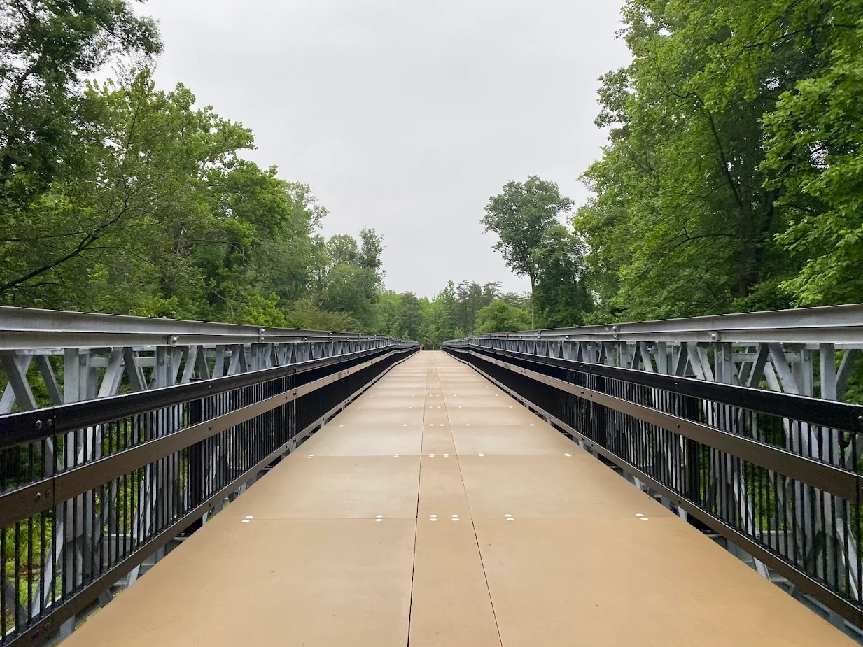

Washington, Baltimore and Annapolis Trail
The name is misleading. The Washington, Baltimore and Annapolis Trail does not actually reach any of the three cities in its name. It runs 11.7 miles from a wooded terminus near Lanham, Maryland, to a parking lot at Odenton Road, paralleling power lines and threading through the suburbs of Prince George's and Anne Arundel counties. What it does follow is the right-of-way of the Washington, Baltimore and Annapolis Electric Railway - a state-of-the-art interurban that carried commuters between Washington and Baltimore from 1908 until the railway died in 1935, killed by the rise of the automobile and the same Route 1 that would later be called one of the deadliest roads in the world. The trail's path traces what was once one of the most modern transportation projects of the early twentieth century. The trail itself took a quarter century to finish because of a property dispute over a single section of riverbank.
The Electric Railway
Between 1908 and 1935, the Washington, Baltimore and Annapolis Electric Railway ran some of the most advanced interurban trains in the country. Powered by overhead electric lines, the cars could move passengers between the District and Baltimore in less than ninety minutes - faster than any steam train on the parallel route, and certainly faster than the rutted dirt roads then in service. The railway operated three lines: the main between Washington and Baltimore, a branch east to Annapolis, and a freight connection to the Baltimore wharves. The Great Depression and the rise of cheap automobile travel ended it. The last train ran on August 20, 1935. The tracks were lifted; the right-of-way persisted, owned in pieces by Amtrak, the State of Maryland, and the Washington Suburban Sanitary Commission. The same WB&A right-of-way is also the basis of the Baltimore and Annapolis Trail, the South Shore Trail, the Poplar Trail, and the Odenton Bike Path.
Morris Warren's Trail
The idea of turning the WB&A right-of-way into a rail trail came from a Prince George's County advocate named Morris Warren, who began pushing the county in the 1980s. Warren founded the Prince George's WB&A Trail Club before 1991. State Delegate Marsha Perry of Crofton introduced bills to study the conversion, and by 1990 had secured a commitment from the developers of Piney Orchard to donate their stretch of right-of-way. County Executive Parris Glendening announced definitive plans in July 1991. Constellation Real Estate gave 4.1 miles of right-of-way in Anne Arundel County to that county in 1994 as part of their Piney Orchard development. The first 5.6 miles of trail, from MD 450 in Glenn Dale to Race Track Road in Bowie, opened on November 8, 2000. That was the easy part.
The Bridge That Took Twenty-Five Years
The trouble started at the Patuxent River. A conservationist and trail opponent named Buz Meyer owned land next to the right-of-way. Meyer and his brother Robert argued that the original deed granting the railroad easement included a reversion clause - that if the tracks went unused, the land returned to them. The Meyers also argued, repeatedly and publicly, that unprotected hiker-biker trails evolve into mugger-thugger trails and would bring unbridled bandits to the area. Anne Arundel County thought it held a good deed and sued Meyer in May 2001 to begin condemnation. The county was racing a June 20 deadline for nearly $1 million in state funding. After a letter-writing campaign by area hunters supporting Meyer, the county withdrew the lawsuit. Officials decided to route the trail around the disputed property. Design of an alternative bridge began in 2002. Construction took until spring 2025 - twenty-five years after the first trail section opened, the two halves of the WB&A Trail were finally connected by a single bridge across the Patuxent.
Power Lines and Tunnels
Walk the trail and the WB&A's history is constantly underfoot, and overhead. The electric railway's original 33kV distribution line still parallels the path for most of its length - some sections active, some out of service, all of them following the same alignment the trains once used. The trail passes a major BG&E substation near Lanham, where the original distribution line gives way to a much larger transmission line. There are truss bridges, several tunnels, and a series of grade crossings that require trail users to stop. The longest bridge on the trail spans MD 197 west of Bowie. The trail surface is mostly asphalt, with parking lots at most major road crossings. Cyclists and walkers share the path, separated only by signage. The whole route is now part of the East Coast Greenway, a planned 3,000-mile route from Calais, Maine to Key West, Florida, and the American Discovery Trail, which crosses the country from Delaware to San Francisco.
Future Connections
Phase IVb of the WB&A would extend a 2.06-mile spur from Strawberry Lake Way through the Odenton Natural Area and the grounds of Arundel High School and Middle School to connect with the South Shore Trail, which would in turn extend the route to Annapolis. Planning for that phase was completed in March 2024; construction has no schedule. The Bowie Heritage Trail would connect the WB&A to Bowie State University and the Bowie MARC station. A long-discussed extension northward, paralleling the road all the way to the BWI Trail, was included in the 1995 West County Trail Master Plan but dropped from the 2013 Anne Arundel County Bicycle and Pedestrian Master Plan; it returned in 2019 as a county feasibility study called the BWI to Odenton Trail. A southern extension along Maryland Route 704 to the Marvin Gaye Park Trail in Washington appears in both the 2009 and 2016 Prince George's County bike master plans. None has a confirmed construction date as of 2025. The full vision - a continuous rail-to-trail spine from D.C. to Baltimore to Annapolis, on the bones of the same railroad that connected them a century ago - remains a few decades and several funding cycles away.
From the Air
The WB&A Trail runs roughly southwest to northeast between Lanham, Maryland (38.97 N, 76.86 W) and Odenton, Maryland (39.07 N, 76.70 W). The trail passes through Glenn Dale, Bowie, and Piney Orchard, with its midpoint at the new bridge across the Patuxent River. The corridor sits well outside the inner Washington Flight Restricted Zone but within the surrounding Special Flight Rules Area. BWI Marshall (KBWI) is 10 miles north of the Odenton terminus. From altitude, the trail's BG&E transmission line right-of-way appears as a long, mostly straight green-and-brown strip threading northeast across Prince George's and Anne Arundel counties.
Nearby Stories
- Reston, Virginia 1.7 km away
- Thomas Viaduct 9.2 km away
- Monocacy Aqueduct 9.7 km away
- Stafford County, Virginia 26 km away
- Harriet Tubman Underground Railroad 28 km away
- Gunston Hall 30 km away
- Adkins Arboretum 31 km away
- Bombay Hook National Wildlife Refuge 71 km away