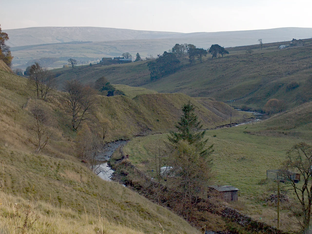

Weardale
The word fluorescence comes from Weardale. When 19th-century scientists studied the bluish glow that fluorite crystals from this dale produced under ultraviolet light - a glow caused by trace europium in the lattice - they coined a new term for what they were seeing. Weardale fluorite from mines like Frazers Hush, Boltsburn, Heights, Cambokeels, Blackdene, West Pastures, Greenlaws, Billings Hill and Groverake is still considered among the world's finest. The dale that gave the phenomenon its name lies on the east side of the Pennines in County Durham, draining the high fells around Burnhope Seat (2,454 feet) down through Bishop Auckland to the North Sea at Sunderland.
Bishops, Vaccaries, and a Failed Campaign
Anglo-Saxon settlements existed at Stanhope and Wolsingham before the Norman Conquest. After 1066 the Normans extended farming up the dale, and by the medieval period the upper dale was cleared for vaccaries - the specialised cattle farms whose Latin name still clings to the land. The Bishops of Durham owned the mineral rights and kept them through the entire effective life of the lead industry, leasing them to miners and companies. The villages of Eastgate and Westgate mark the former entrances to the bishop's hunting preserve. In 1327 Edward III led his very first military campaign here against the Scots - the Weardale Campaign was a tactical failure but a strategic catalyst that led to the politically important Treaty of Edinburgh-Northampton. The chronicler Jean Le Bel marched with the king and described it. In the 18th century John Wesley visited repeatedly, and the dale became a Methodist stronghold. High House Chapel near Ireshopeburn has been called the Methodist chapel with the longest continuous use anywhere in the world; it houses the Weardale Museum with a room of Wesley memorabilia. The young W.H. Auden walked here between the wars and found in the wild country and the ruins of the lead industry a lifelong source of poetry.
Lead, Silver, and the Glowing Stone
Lead mining in the Northern Pennines is documented from the 12th century, when silver mines worked the ground at Alston Moor just west of Weardale. By the 18th and 19th centuries the London Lead and Beaumont companies dominated the dale, with 28 separate lead-smelting operations active at the peak. Declining prices closed the major companies during the 1880s; the Weardale Lead Company carried on until 1931. The last commercial mine had effectively closed by 1919. Silver, ironstone (heavily worked at Rookhope to feed the ironworks at Consett during the Industrial Revolution), ganister sandstone and dolerite all came out of these hills. Cornish miners came east when their tin work failed, bringing hard-rock techniques to Pennine ore. Many later emigrated again - to the better-paid coal mines of the North East, or across the Atlantic. The Killhope lead mining museum (pronounced "Killup") preserves the Park Level Mine and the great 1870s waterwheel - the Killhope Wheel - that once crushed grit to separate ore. The museum displays spar boxes: showcases miners made of the crystals they pulled from the ground. Fluorspar, long a worthless byproduct, eventually found use in steelmaking, in non-stick frying-pan coatings, in CFC refrigerants. The decorative fluorite specimens went to collectors who pay handsomely for the best. Until 2016 the finest green fluorite came from Rogerley Mine; the nearby Diana Maria Mine still works for specimens.
The Dale After Lead
When the lead and silver gave out, Stanhope and Frosterley turned to carboniferous limestone, quarried at scale from the 1840s when rail links to Teesside and Consett opened. The Eastgate cement works ran for decades; Lafarge closed its rail traffic in 1993 and the works themselves shut later. Today the major industry is cattle and sheep farming. The Weardale Railway, rescued by enthusiasts in the 1990s and bought by the Auckland Project in 2020, runs heritage and community trains between Bishop Auckland and Stanhope. Weardale Motor Services buses run Monday to Saturday from Bishop Auckland and Crook up to Cowshill at the head of the dale, and continue to Killhope when the museum is open. Wildlife thrives in the gaps people left: black grouse on the moors, sea-trout and salmon in the Wear, adders sometimes on the rough ground. Botanists find wood cranesbill, meadow cranesbill, mountain pansy on shorter grass, and smaller marsh marigolds in damp ground. The tiny spring sandwort - tolerant of heavy metals - colonises the old lead workings. Most of Weardale falls within the North Pennines National Landscape, the second-largest in England and Wales. Winters here can be hard and long; skiers use Swinhope Head when there's snow. Frosterley Marble - a black fossil-bearing limestone quarried from Norman times for ornamental use - still appears in Durham Cathedral and a hundred churches. The dale's industrial peak is gone. What remains is the country, the chapels, the fluorite that taught science a new word, and the long memory of work.
From the Air
Coordinates 54.716N, 1.925W (mid-dale). Weardale runs roughly east-southeast for about 25 miles, draining the North Pennines from Burnhope Seat (2,454 ft) down through Wearhead, St John's Chapel, Stanhope, Wolsingham and Crook to Bishop Auckland. The dale and surrounding fells lie within the North Pennines National Landscape. Best viewed at 3000-5000 ft AGL to see the long valley axis, the high moorland to north and south, and Killhope at the head of the dale. Watch for orographic cloud and turbulence over the upper dale in westerly winds. Nearest aerodromes: Newcastle (EGNT) about 27 nm northeast, Durham Tees Valley (EGNV) about 26 nm southeast, Carlisle Lake District (EGNC) about 32 nm west.
Nearby Stories
- RAF Ouston 3.9 km away
- Cross Fell 6.1 km away
- RAF Spadeadam 9 km away
- Seaham 10 km away
- Howgill Fells 11 km away
- Mount Grace Priory 14 km away
- Richmond Castle 16 km away
- SM UB-115 22 km away