
Wells Harbour
The channel into Wells Harbour changes. Not metaphorically — literally. The sand shifts, the buoys move, and skippers who navigated it last season may find a different depth over the bar this time. The harbourmaster monitors channel 12. That note has appeared in sailing directions for Wells-next-the-Sea for years, a reminder that this is a harbour that demands attention, as it always has from the ships that made it one of England's major ports during the Tudor period.
Six Hundred Years at the Quay
There has been a port at Wells for more than 600 years. Protected by salt marshes and sheltered behind a sand bar from the unpredictable North Sea, it offered a natural refuge that Tudor mariners valued highly. By the 18th century the harbour was a thriving centre for shipping and maritime industry. Its greatest prosperity ran from around 1830 to 1860, when the Granary — a building with a distinctive gantry that allowed grain to transfer between ships and warehouse without disrupting road traffic — was the working heart of the quay. That Granary, built around 1904, now contains apartments.
The stone quayside was constructed in 1845 following an Act of Parliament the previous year. When the railway arrived in 1857, it began the long decline of coastal trade at Wells, as goods could move more reliably and cheaply by rail. The harbour saw a resurgence between 1960 and 1989, when coasters bringing fertilizer and animal feed revived the commercial traffic, but the permanent loss of the railway in 1964 accelerated the shift toward leisure rather than industry.
The Commissioners and the Port of Wells
Wells Harbour has been administered by the Wells Harbour Commissioners since 1663, when an Act of Parliament established them to repair and preserve the quay, creeks, channel and landing place of the Port of Wells in the County of Norfolk. They celebrated 350 years of operation in 2013. Operating under the trading name Port of Wells, the commissioners employ a harbourmaster, three deputy harbourmasters, and a beach patrol of five uniformed officers who walk the harbour, creek and beach, offering guidance and enforcing the by-laws.
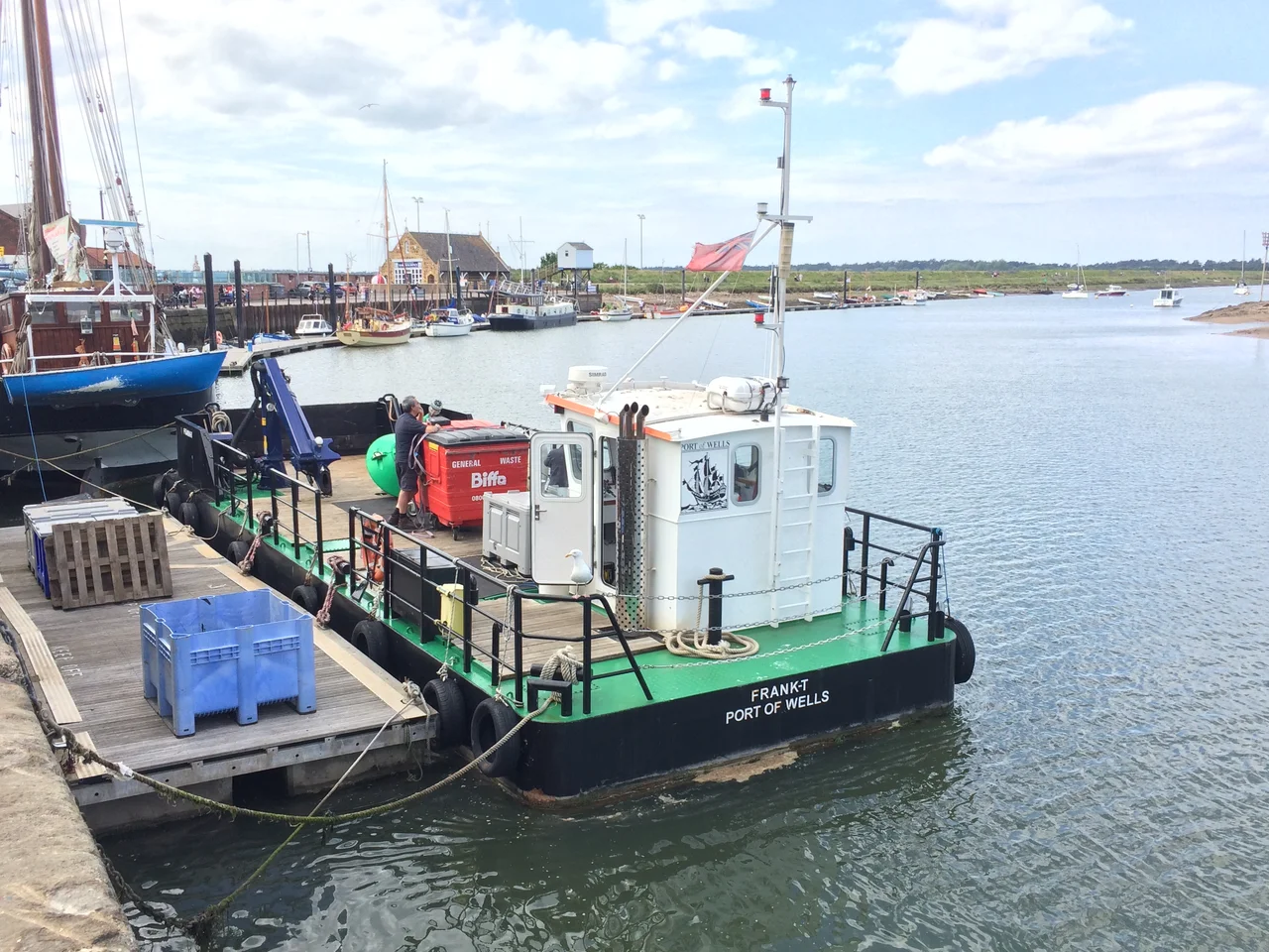
The Port currently operates six vessels, from the 24-metre heavy barge Kari Hege with its dredging equipment, to the Frank-T — a 14-metre navigational buoy vessel with a 9-tonne crane — to a 4.8-metre inshore rescue RIB used by the beach patrol. Dredging is a constant necessity. As part of the development of the Sheringham Shoal Offshore Wind Farm in the late 2000s, the harbour and channel were dredged to accommodate wind farm maintenance vessels, and a 150-metre pontoon jetty was built, completed in early 2010.
Reading the Channel
Approaching Wells by sea remains a navigational exercise requiring care. Skippers must make for the Wells Leading Buoy before turning into the channel, keeping to port for the deepest water over the bar. The buoy system usually holds constant even when the channel shifts; temporary pellet buoys and beacons mark changes as they occur.
Inside the entrance, the approach past the 'Knock' at buoy number nine bends toward the southeast. The wide sweep eastward past the lifeboat house must be taken with red beacons close to port, where the channel narrows. Spring tides allow vessels drawing up to 10 feet, neap tides rather less. The harbour gives generously to those who read it correctly, and less so to those who don't. That has been its character for six centuries.
From the Air
Located at 52.95°N, 0.85°E. From altitude, Wells Harbour appears as a channel cutting through the salt marsh east of the Holkham pines, with the quayside visible just south of the tidal flats. The distinctive bend in the channel and the harbour entrance at the northern end of town are identifiable from 1,500–2,000 ft in clear conditions. Norwich International Airport (EGSH) is approximately 43 km southeast. The shallow bar at the harbour entrance is visible at low water.
Nearby Stories
- Wroxham 3.2 km away
- East Dereham Windmill 8.5 km away
- Alford Windmill 11 km away
- Mundesley 14 km away
- Batemans Brewery 14 km away
- Wisbech 15 km away
- HMS Cobra 24 km away
- SM U-97 118 km away