Westmorland, California
Westmorland is the kind of small city where the police department consists of the chief and five officers — a number that reflects not inadequate safety but rather the reality of a community of about 2,000 people living in a desert agricultural landscape far from the pressures that demand larger forces. The city sits in the western Imperial Valley, surrounded by the same irrigated fields and flat desert terrain that define the region, largely unknown outside the county except to people who study earthquake history. In 1981, an earthquake centered near Westmorland put the city briefly on seismological maps. Otherwise, it proceeds quietly with the work of a small agricultural community.
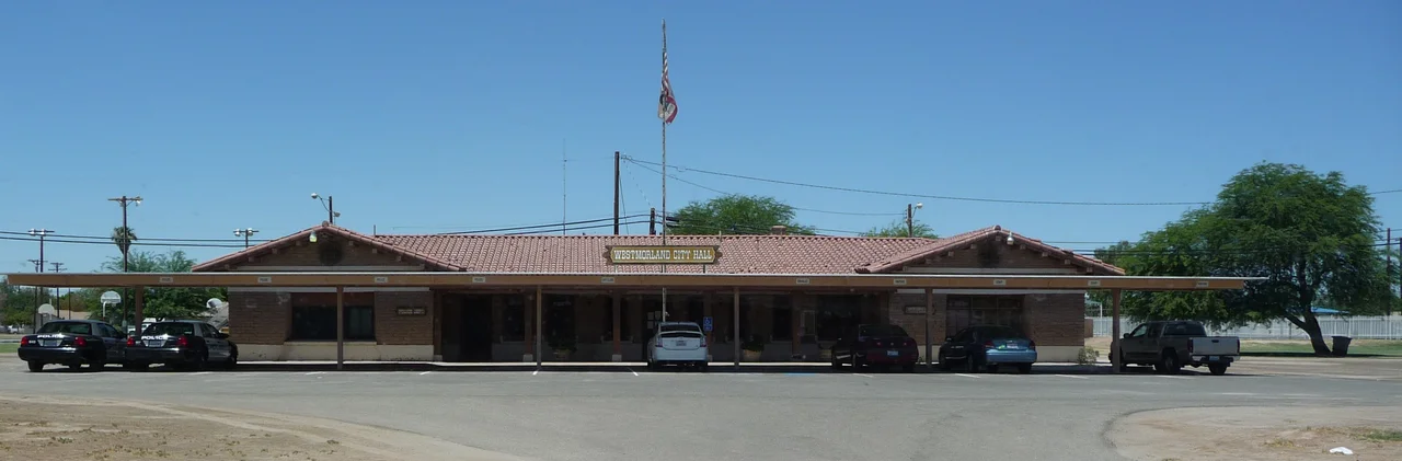
A Valley Town
Westmorland incorporated as a city — giving it a formal governmental structure that many of its neighbors in the Imperial Valley lack as unincorporated communities. With a population around 2,014 people (2020 census), it is one of the smallest incorporated cities in California by population. Approximately 88.7 percent of residents identify as Hispanic or Latino, reflecting the valley's broader demographic character shaped by generations of agricultural labor. The city provides municipal services, including its small police department, within a budget constrained by the modest tax base of a small agricultural community. This balance between formal city status and practical small-town scale defines much of daily life in Westmorland.
The 1981 Westmorland Earthquake
In 1981, a magnitude 5.6 earthquake struck near Westmorland, adding the city's name to the list of Imperial Valley communities associated with seismic events in the region. The Imperial Valley sits atop an active fault system — the same tectonic boundary that produced the much larger 1940 El Centro earthquake and the 1979 Imperial Valley earthquake — and smaller events are a recurring feature of life here. For residents of Westmorland and the surrounding communities, earthquakes are not a distant or theoretical risk but a practical reality that shapes how buildings are constructed and how emergency planning is conducted. The 1981 event was not catastrophic, but it was a reminder that the flat agricultural landscape sits on geology that moves.
Water and the Desert Economy
Like every community in the Imperial Valley, Westmorland's existence depends on the Colorado River water delivered through the Imperial Irrigation District's canal system. The city sits in the center of what would otherwise be uninhabitable Colorado Desert, transformed by irrigation into some of the most productive farmland in the United States. The surrounding fields grow vegetables, alfalfa, sugar beets, and other crops through a growing season that essentially runs year-round, thanks to the warm winters and reliable sunshine. Farm labor employment drives the local economy, tying Westmorland's fortunes directly to agricultural markets, crop prices, and the ongoing negotiations over Colorado River water allocations that affect the entire region.
The Scale of Smallness
A police chief and five officers. A city council managing a modest municipal budget. Community events at a scale where everyone who attends knows most of the other attendees. These are the textures of life in Westmorland that do not appear in census data or earthquake catalogs but define the experience of living there. Small cities in agricultural regions serve functions that larger urban centers do not: they are gathering places, service providers, and social anchors for surrounding farming communities that would otherwise have no nearby hub. Westmorland's modest scale is not a sign of decline but of a particular kind of stability — a community that has found its appropriate size and maintained it.
From the Air
Westmorland sits at approximately 152 feet below sea level at 33.037°N, 115.621°W in the western Imperial Valley, roughly 12 miles northwest of Brawley. From the air, the city is a small cluster of structures amid the valley's agricultural grid, with the Salton Sea visible to the northeast. The flat terrain makes landmarks sparse, but the intersection of major roads near the city center provides orientation. Nearest airports include Imperial County Airport (KIPL) about 12 miles southeast. The Salton Sea's distinctive shoreline is visible from altitude and helps locate the surrounding communities.
Nearby Stories
- Camp Salvation 2.9 km away
- Niland, California 3.4 km away
- Cooke's Wells Station 4.3 km away
- Carrizo Impact Area 5 km away
- Desert View Tower 8.8 km away
- Thomas L. "Pegleg" Smith 28 km away
- Old Plank Road 29 km away
- Poston War Relocation Center 100 km away