Thomas L. "Pegleg" Smith
Every April, people gather in the Anza-Borrego Desert for the Pegleg Smith Liars Contest, where competitors compete to tell the most elaborate lie with a straight face. The contest is held in honor of Thomas L. Smith — Pegleg — a man whose entire later career was, by most reliable accounts, one extended performance in creative misdirection. Smith died in 1866 in San Francisco, having spent his final decades selling maps to a gold mine in the Colorado Desert that no one has ever definitively located. He sold a lot of maps. People are still looking.
The Leg That Made the Name
Smith earned his nickname around 1827 when his leg was shattered — accounts vary on whether by a Native American arrow or a rifle ball — in the fur-trapping country of the Rocky Mountains. In the version that has become legend, Smith performed a field amputation on himself with minimal assistance and fashioned a wooden peg from a rifle stock to walk on. The operation's details vary with the telling, but the wooden peg is consistent across accounts. The name stuck. Smith had already been working as a mountain man and trapper, moving through the same Rocky Mountain territory as Kit Carson and Jim Bridger, both of whom he reportedly knew. The fur trade that defined the American West's first wave of non-indigenous exploitation — a world of rendezvous, beaver pelts, and hard travel — was Smith's professional context.
The Greatest Horse Thief in the Southwest
In the 1840s, Smith organized what historians have described as the largest horse theft operation in the history of the American Southwest. California missions and ranchos had accumulated enormous horse herds, and Smith's operation moved animals from California east across the desert in quantities that staggered observers. At one point, accounts suggest his operation moved as many as 3,000 horses and mules in a single raid. The animals were driven across the desert — a brutal journey — and sold to buyers who did not ask precise questions about provenance. Smith operated with a boldness that bordered on the theatrical; the scale of the operation made concealment irrelevant. He was arrested, prosecuted, and convicted at various points, but the combination of charisma, legal maneuvering, and the general chaos of pre-statehood California repeatedly kept him from long imprisonment.
The Lost Mine
At some point in the 1850s, Smith claimed to have stumbled upon a deposit of black gold-bearing rocks in the Colorado Desert near what is now the Anza-Borrego area. The story varied in its particulars — sometimes he had found float gold, sometimes nuggets, sometimes an outcropping — but the core claim remained consistent: there was gold in the desert, and for the right price, Smith could indicate where to look. He sold maps. He guided expeditions, to varying degrees of actual helpfulness. The mine became known as the Lost Pegleg Mine, and it entered the canon of California lost mine legends alongside other treasures that have never been conclusively found. Whether Smith had actually discovered gold, half-remembered a discovery made in different circumstances, or simply fabricated the story from the beginning remains unresolved.
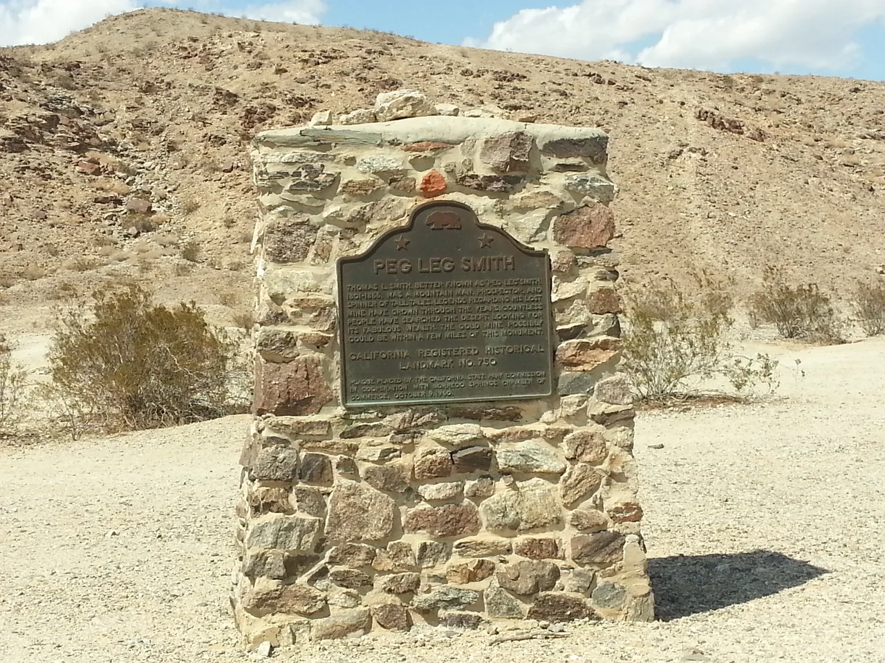
The Monument and the Liars
Peg Leg Smith Monument stands in the Anza-Borrego Desert as California Historical Landmark No. 452 — a pile of stones that travelers are encouraged to add to, preserving the tradition of a marker that Smith himself reportedly asked people to build on the spot where he found his gold. The marker is at 33.296°N, 116.298°W, within Anza-Borrego Desert State Park. The annual Pegleg Smith Liars Contest, held in April near the monument, invites participants to outdo each other in mendacity — a celebration of the spirit Smith embodied in his later years. It is genuinely affectionate. Smith the horse thief, Smith the self-amputating frontiersman, Smith the map salesman — Anza-Borrego has decided to honor him by turning his most distinctive quality into an annual competition.
From the Air
The Peg Leg Smith Monument stands at approximately 33.296°N, 116.298°W in the northern Borrego Valley of Anza-Borrego Desert State Park, San Diego County. The monument is a cairn visible on the desert floor, but the surrounding landscape is undifferentiated Colorado Desert — flat terrain requiring close attention to locate from altitude. Borrego Valley Airport (L08) in Borrego Springs is approximately 5 miles to the south. The Borrego Valley's flat floor and surrounding mountain ridges are clearly visible from any altitude on a clear day. Spring flying conditions over the desert are generally excellent, which makes the April Liars Contest period a fine time for low-altitude desert flying.
Nearby Stories
- Westmorland, California 4.2 km away
- Jacqueline Cochran Regional Airport 6.5 km away
- Niland Geyser 8.6 km away
- San Diego County, California 9.2 km away
- Mud Caves of Anza-Borrego 14 km away
- Mountain Fire (2013) 15 km away
- Rancho Guejito 24 km away
- Chuckwalla Mountains 27 km away