Mud Caves of Anza-Borrego
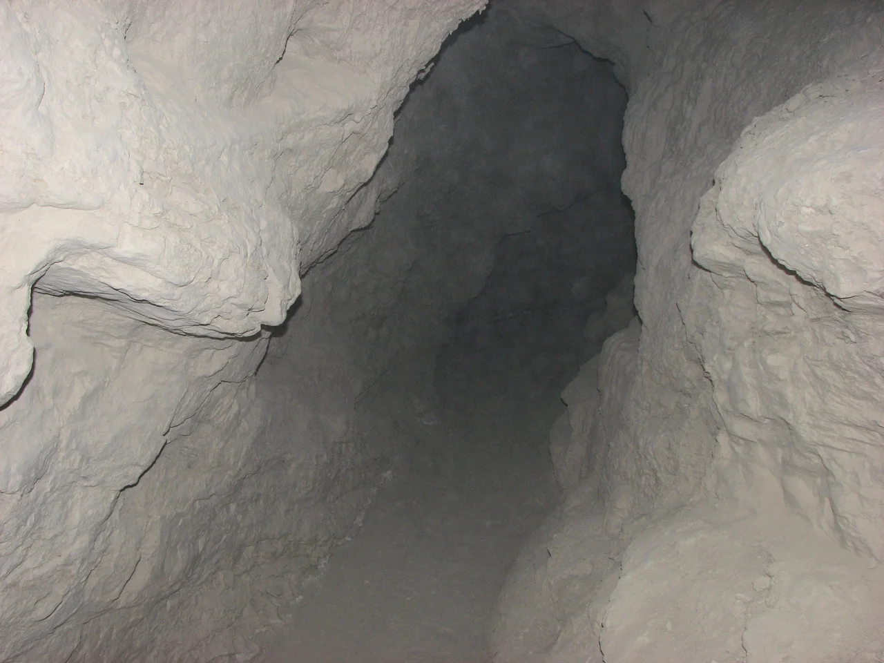
Not all caves form in limestone. In the Carrizo Badlands of Anza-Borrego Desert State Park, a different geology produced a different kind of cave: pseudokarst, where water has carved passages not through chemical dissolution of rock but through the mechanical erosion of soft sedimentary material. The Arroyo Tapiado drainage contains more than 22 of these mud caves, formed in the ancient marine sediments of the Imperial Formation. Some run 1,000 feet long. Some reach 80 feet in height. All require a willingness to get dirty.
What Makes a Mud Cave
True karst caves form when slightly acidic water dissolves soluble rock — typically limestone or dolomite — over geological timescales, leaving behind a network of passages and chambers. Pseudokarst achieves similar results through different means. In the Carrizo Badlands, the Imperial Formation's fine-grained marine sediments — deposited when an ancient sea covered the Salton Trough between 6.3 and 4.3 million years ago — have been carved by water moving through cracks and joints in the soft material. The mechanical erosion that created these passages is fundamentally different from limestone dissolution, but the result is recognizably cave-like: passages, chambers, tight squeezes, and darkness.
Big Mud Cave and Its Neighbors
The most substantial cave in the Arroyo Tapiado system is Big Mud Cave, which extends deep enough and wide enough to give a genuine sense of underground space. Chasm Cave offers a skylight — an opening in the ceiling that lets sunlight enter the interior, creating a dramatic visual effect and allowing plant life to colonize what would otherwise be entirely dark space. Hidden Cave lives up to its name, requiring more effort to locate than the others. The system's 22-plus individual caves range from passages barely large enough to crawl through to chambers substantial enough to stand in, creating a varied underground landscape within the badlands terrain.
Getting There
The mud caves require a high-clearance vehicle for the approach road into the Carrizo Badlands and a physical willingness to enter confined spaces that are, by definition, made of unstable material. The caves are not developed tourist attractions — there are no lights, no improved pathways, no interpretive signage inside. Visitors bring their own headlamps and navigate passages that can be narrow, wet in season, and occasionally subject to partial collapse. The reward for this effort is something genuinely unusual: the interior of a geological process that most visitors to Anza-Borrego never encounter, a cave system formed not from ancient coral reefs but from an ancient seafloor.
The Badlands Context
The mud caves exist within the Carrizo Badlands, a landscape of eroded clay and silt hills that represents one of Anza-Borrego Desert State Park's most distinctive geological zones. The badlands formed as the same Imperial Formation deposits that are being eroded to create the caves have been carved by water into a maze of gullies, ridges, and isolated formations. The pale tan and gray tones of the badlands contrast with the rocky, darker terrain of the surrounding mountains, making the zone visually distinctive even from a distance. The caves are the underground expression of the same erosional process that creates the badland topography above ground.
A Record in Sediment
The material that forms the mud cave walls carries an extraordinary record. These sediments were deposited in a shallow marine environment millions of years before the current desert landscape existed — when the Pacific Ocean connected to the Salton basin and marine organisms lived and died in the water that covered this ground. The Imperial Formation preserves fossils of those organisms: shells, fish remains, invertebrate traces that erode from the badland surfaces and from the cave walls themselves. Exploring the mud caves means moving through a record of a vanished sea, carved into legibility by the slow work of water in a landscape that now receives only a few inches of rain each year.
From the Air
The Arroyo Tapiado mud caves lie at approximately 32.92°N, 116.19°W in the Carrizo Badlands section of Anza-Borrego Desert State Park, Imperial County. The badlands terrain is visible from the air as low, pale-colored eroded hills distinct from the rocky mountains to the north and east. Borrego Valley Airport (L08) is approximately 30 miles to the northwest. Access to the cave area requires high-clearance vehicles on desert roads that may be impassable after rains.
Nearby Stories
- Mount Signal Solar 3.3 km away
- Capitan Grande Reservation 3.8 km away
- Jacumba Valley and Jacumba Wilderness Area 4.5 km away
- Westmorland, California 9.6 km away
- Niland Geyser 11 km away
- Thomas L. "Pegleg" Smith 13 km away
- Richard J. Donovan Correctional Facility 24 km away
- Antique Gas and Steam Engine Museum 50 km away