Chuckwalla Mountains
The Chuckwalla Mountains take their name from the large lizard that basks on the ancient rocks throughout the range — the chuckwalla, a portly, docile creature that wedges itself into rock crevices when threatened and inflates its body to resist extraction. The mountains run roughly forty miles in a northwest-southeast direction through Riverside County, just south of Interstate 10, rising to 4,504 feet at Black Butte. They are not high mountains by California standards, but they are genuinely wild, cut by canyons and washes that contain water long enough to support the improbable variety of life that desert springs attract.
Friar Garcés and Corn Springs
On February 28, 1776, Franciscan friar Francisco Garcés reached Chuckwalla Springs — a water source in the range's interior — as part of his remarkable solo exploration of the Southwest. Garcés traveled through the Colorado Desert and the Sonoran Desert with a confidence in the local peoples he encountered that was unusual among Spanish explorers; he dressed simply, ate what was offered, and made himself a guest rather than an intruder. His journey through what is now Riverside County was part of a broader effort to establish overland routes connecting Spanish California to the rest of New Spain. Corn Springs, another water source in the Chuckwalla Mountains, was also known to Garcés and to the Native Americans who had used it as a resource for generations before European contact.
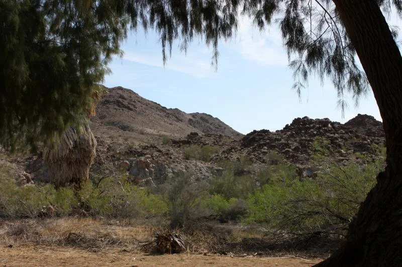
The Sleeping Bird
In 1946, the naturalist Edmund C. Jaeger discovered something that ornithologists had not believed possible: a common poorwill hibernating in a rock crevice in the Chuckwalla Mountains. Birds were not supposed to hibernate. The prevailing scientific understanding held that birds managed winter through migration or daily torpor at most, not the sustained metabolic reduction that characterized hibernation in mammals. Jaeger's discovery of a poorwill in a state of hibernation — its body temperature down to near ambient, its metabolism dramatically reduced — overturned a piece of received wisdom and opened a new area of avian physiology. The location in the Chuckwalla Mountains became famous in scientific circles. Jaeger returned for years to study the same area. When he died in 1983, his ashes were scattered in the canyon where he had made the discovery.
The Edmund C. Jaeger Nature Sanctuary
The canyon where Jaeger discovered the hibernating poorwill is now preserved as the Edmund C. Jaeger Nature Sanctuary, a recognition of both the scientific significance of the discovery and the naturalist who made it. Jaeger was a prolific writer and naturalist who produced foundational texts on the natural history of the North American desert — books that remained standard references for decades. His work in the Chuckwalla Mountains and surrounding desert was part of a career devoted to understanding the desert Southwest at a level of detail that required years of patient observation. The sanctuary carries his name in a landscape he knew intimately.
Mining and Geology
The Chuckwalla Mountains produced modest amounts of gold during the nineteenth century mining rush that sent prospectors into every California desert range. The Red Cloud, Aztec, and Granite mines represent the range's mineral history — small operations that extracted enough to justify the effort but never enough to create the kind of boomtown economy that a major strike would have produced. The geology that hosted these deposits is ancient: the mountains sit near the San Andreas Fault, and their rocks record the complex history of a zone where tectonic plates interact. Desert tortoise, rosy boa, and kangaroo rat inhabit the rocky terrain today, sharing the landscape with the chuckwalla lizards that gave the mountains their name.
From the Air
The Chuckwalla Mountains extend from approximately 33.5°N to 33.7°N south of Interstate 10 in Riverside County, east of Desert Center. Black Butte, the highest point at 4,504 feet, is visible from altitude. The range lies south of the highway corridor between Desert Center and Blythe. The Salton Sea is visible approximately 30 miles to the southwest. Desert Center Airport is the nearest landing facility, approximately 10 miles to the west.
Nearby Stories
- Lost Horse Mine 11 km away
- Mecca, California 12 km away
- Niland Geyser 15 km away
- Cadiz Dunes Wilderness 26 km away
- Thomas L. "Pegleg" Smith 29 km away
- Poston War Relocation Center 52 km away
- Felicity, California 74 km away
- Laguna Diversion Dam 99 km away