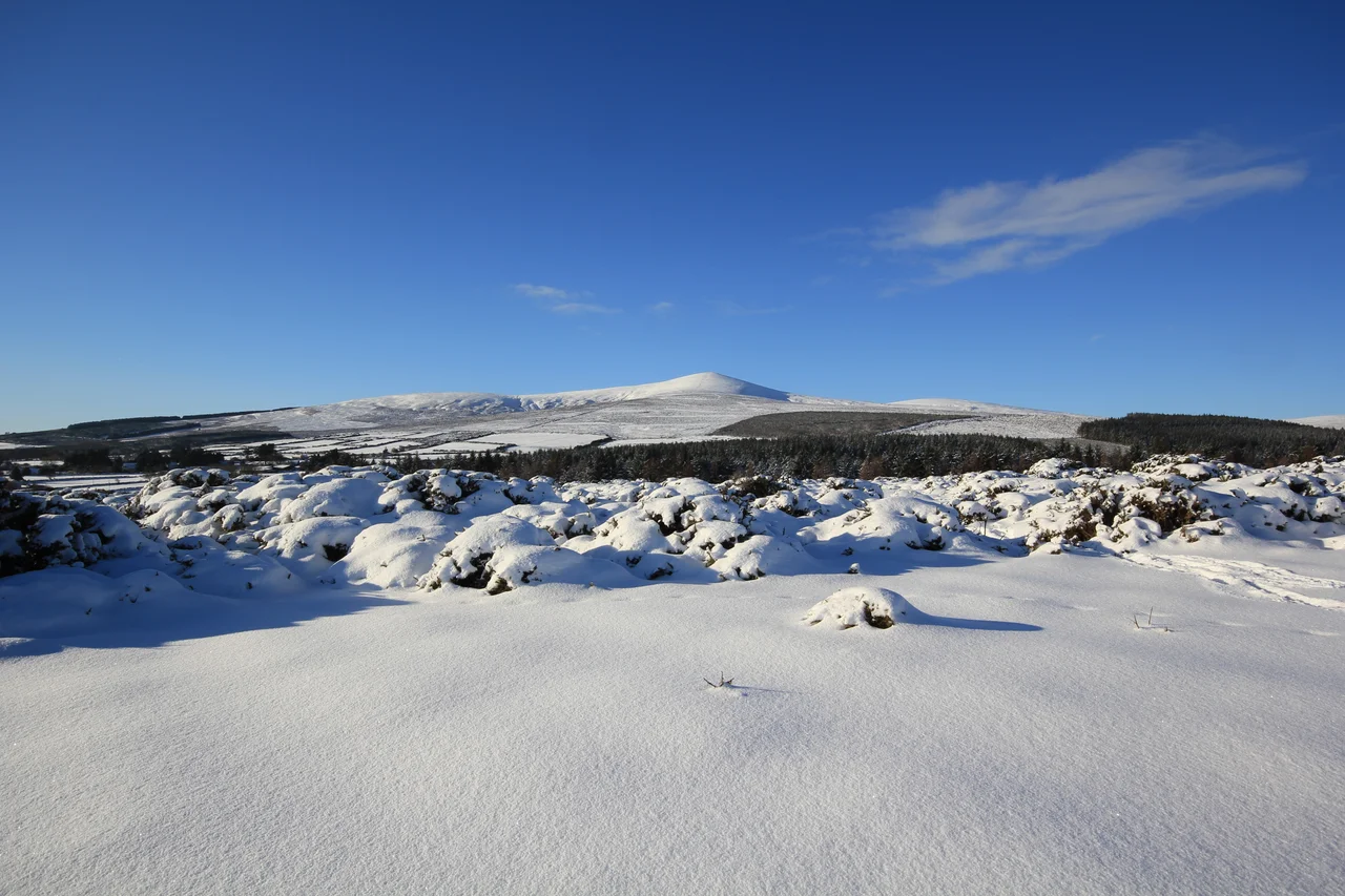

Wicklow Mountains
Pour rain on these mountains and it does not soak in. The thin blanket bog cannot hold much water, so the rivers here rise quickly and angrily after storms: hydrologists call it a flashy hydrograph, but it just means the streams fill in minutes and the waterfalls run hardest in the worst weather. The Wicklow Mountains form the largest continuous upland area in Ireland, sprawling across the centre of County Wicklow and spilling into Dublin, Wexford, and Carlow. Their granite was forced up four hundred million years ago when the continents of Baltica and Laurentia collided. The ice cut the rest.
How a Continent Folds a Mountain
The Iapetus Ocean closed at the end of the Silurian period. The continents on either side smashed together, and the heat of that collision pushed up a vast batholith of granite known as the Leinster Chain - 1,500 square kilometres of slow-cooled magma that runs from Dun Laoghaire to New Ross. This is the largest single mass of granite in Ireland or Britain. The surrounding slates and shales were cooked into the schist that today sits as a thin shell around the granite core. Erosion has scraped most of the schist roof off the higher peaks, exposing the granite below. The contrast is visible from the road: round granite-topped peaks like War Hill, sharper schist peaks like Djouce next door. The most recent shaping came from the Pleistocene ice. Glaciers carved the U-shaped glens of Glendalough, Glenmacnass, and Glenmalure, and left small corrie lakes - Lough Bray, Lough Nahanagan, the Three Lakes on Table Mountain - dammed by moraines.
Saint Kevin's Valley
In the late 6th century, a member of the Dal Messin Corb tribe named Cobh - later venerated as Saint Kevin - crossed the mountains from Hollywood village via the Wicklow Gap and founded a monastery beside the Upper and Lower Lakes at Glendalough. By the 8th century the monastic city had 500 to 1,000 inhabitants, a Round Tower, and a reputation across Christendom. It was attacked by local clans and by Norse raiders. The English burned it in 1398. Settlement continued there until the end of the 16th century, and the ruins now draw around a million visitors every year. The Saint Kevin's Way pilgrim path retraces his crossing through the Wicklow Gap. Standing among the surviving stone churches at dusk with the light fading off the granite walls of the upper lake, you understand why the monks chose this place.
Land of War
After the Norman invasion of 1170, the Gaelic O'Byrne and O'Toole families were displaced from Kildare and moved into the Wicklow Mountains - the O'Byrnes in the east, the O'Tooles in the west. From their mountain strongholds they conducted a centuries-long campaign of harassment against the invaders. The mountains became known as the terra guerre, the land of war. At the Battle of Glenmalure in 1580, Fiach McHugh O'Byrne's men inflicted a crushing defeat on the English. In January 1592, Red Hugh O'Donnell escaped from Dublin Castle and crossed the mountains in a blizzard, heading for O'Byrne's stronghold at Glenmalure. His companion Art O'Neill died from exposure during the crossing; Red Hugh lost several toes to frostbite. A cross and plaque mark the spot where O'Neill perished. The annual Art O'Neill Challenge - a winter hill race in O'Neill's memory - follows their route. The clans' dominance ended only with the 1652 Act of Settlement, when Cromwell's commonwealth confiscated their land.
Gold, Granite, and a Nugget the Size of a Fist
In 1795, workers felling timber on Croghan Kinsella mountain found gold in a tributary of the River Aughrim. The river was renamed the Goldmines River. During the brief Wicklow Gold Rush, local prospectors recovered about 80 kilograms of gold, including a single nugget weighing 682 grams - the largest lump of gold ever discovered in Ireland or Britain. The British government then seized the workings and extracted a further 300 kilograms. The motherlode has never been found despite repeated attempts. Mining at Avoca dates back to the Bronze Age - copper, iron, and lead extracted from this metalliferous belt for three thousand years. The last copper mine at Avoca closed in 1982. Granite from the mountains built the Bank of Ireland on College Green, the Dun Laoghaire lighthouse, the Liverpool Cathedral, the Thames Embankment in London, the General Post Office on O'Connell Street, and the paving stones of Dublin Corporation.
Sally Gap and the Modern Mountain
The Wicklow Military Road, built between 1800 and 1809 to give British troops access to rebel hideouts after the 1798 rising, still runs from Rathfarnham across the Sally Gap to Aghavannagh. It is one of the most spectacular drives in Ireland - black peat bog, glacial valleys, the long straight lines of military engineering across mountain landscape. The mountains see fifty or more days of snow each winter on the higher peaks, and the easterly winds that bring it have given Wicklow some of the heaviest snowfalls in the country. Two reservoirs - Poulaphouca on the Liffey and the Vartry above Roundwood - supply Dublin's drinking water. A pumped-storage hydroelectric plant at Turlough Hill, built between 1968 and 1974, pulls water uphill from a natural corrie lake at night when electricity is cheap and releases it through turbines during peak demand. The Wicklow Way, opened in 1980, was Ireland's first national waymarked trail. It runs 131 kilometres from Marlay Park in Dublin to Clonegal in Carlow, crossing the mountains north to south, and walking it from one end to the other is the long way to read the geology.
From the Air
Centroid 53.08N, 6.33W. Lugnaquilla peaks at 925 m, Kippure at 757 m - cruise above 5,000 ft AGL minimum when over the central uplands. Mountain weather is fickle: orographic rain off Atlantic systems, sudden snow in winter. Visual references include the granite quarry at Ballyknockan, Powerscourt Waterfall (121 m), Lough Tay (the dark 'Guinness Lake'), Poulaphouca Reservoir, and the long straight line of the Wicklow Military Road across the Sally Gap. Nearest airport is Dublin (EIDW), 25 km north of the range.
Nearby Stories
- Straffan 7.7 km away
- Gowran 12 km away
- 2008 Irish Pork Crisis 14 km away
- Monasterevin 16 km away
- Edward Pakenham 29 km away
- HMS Tyler 41 km away
- German submarine U-1051 58 km away
- Irish Sea Bridge 65 km away