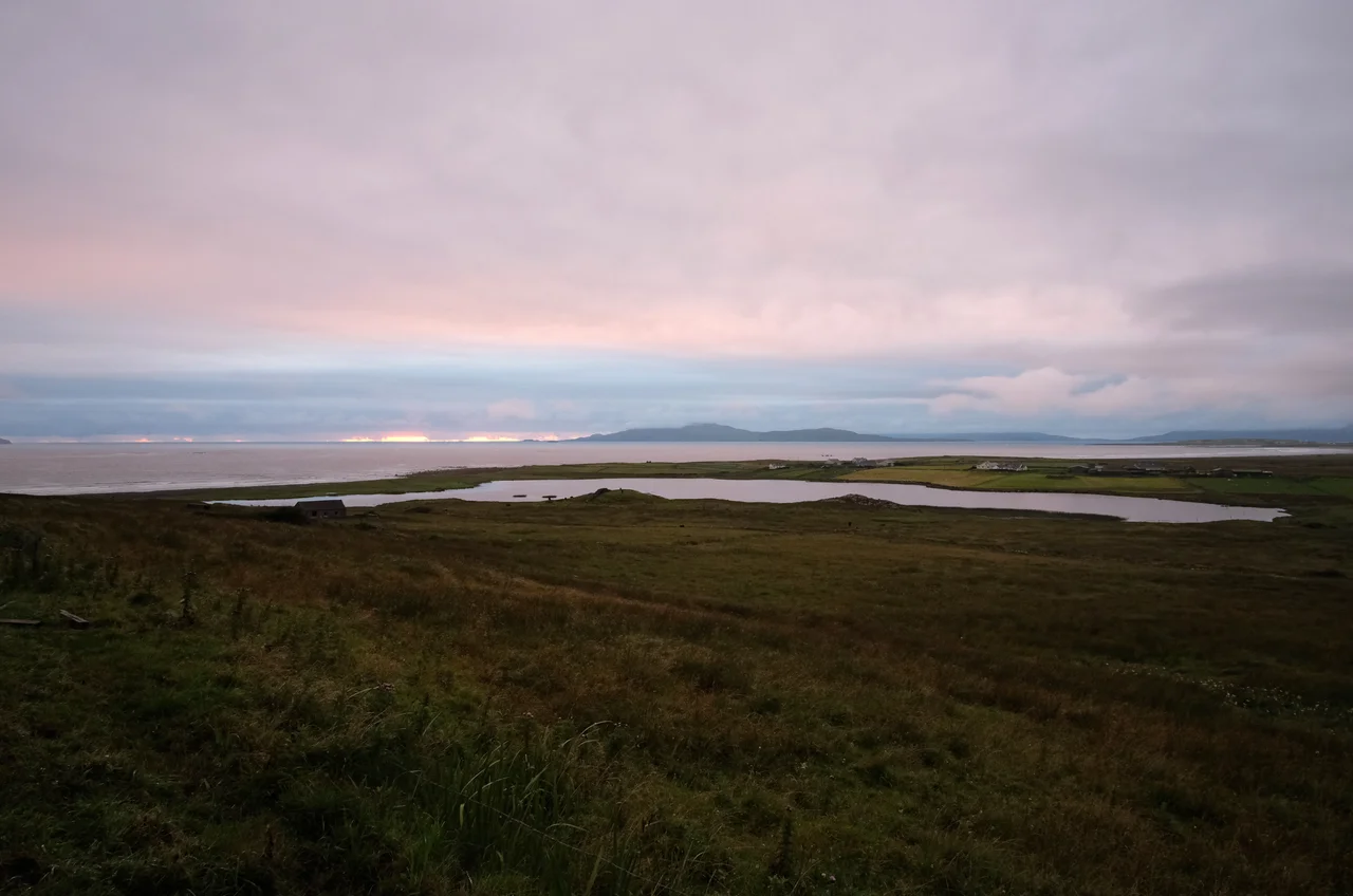

Wild Atlantic Way
Failte Ireland's marketing team in 2014 had a problem. Galway needed no introduction. Donegal did. Mayo did. Counties Clare and Kerry had pieces of the story - the Cliffs of Moher, the Ring of Kerry - but smaller places along the west coast were invisible. Who had ever heard of Dungloe, Kilkee, or Castletownbere? The solution was to invent a single road - or rather, to invent the idea of a single road - that would unify roughly 2,500 kilometres of fractal Atlantic coastline under one brand. They called it the Wild Atlantic Way. Some hoped people would actually drive the whole thing on Harley-Davidsons, Top Gear-style. Most do not. The real value turned out to be the brand itself, which gave villages in the west of Ireland a way to be noticed in a global travel marketplace - and a chance, finally, to be visited by people who had heard their names.
Not a Road, A Brand
The Wild Atlantic Way is not really a fixed route. The Atlantic coast of Ireland twists and turns and winds, a coastline so jagged that the actual mileage runs to many times the straight-line distance between Inishowen Head in north Donegal and the Old Head of Kinsale at the southern end in County Cork. There is generally a main highway a few miles inland, with loops and dead-end lanes branching off to coves, fishing villages, headlands, and islands linked by causeway. The Way's signposting varies in quality - sometimes thorough, sometimes vanishing entirely. The intent is that a visitor will branch off when curiosity strikes and rejoin the main line when fatigue sets in, treating the brand as a suggestion rather than a prescription. Driving the entire route at speed would defeat the point. You would have gone to the Isle of Man TT if you wanted to drive Ireland in a hurry.
How Many Inlets
Few visitors attempt the full 2,500 kilometres in one trip. There are hundreds, if not thousands, of rocky inlets on this fractal coastline, and the human capacity to appreciate them in series is genuinely finite. Most travellers pick a region and base themselves there - Donegal in the far north, Connemara around Galway, the Burren in Clare, the Iveragh Peninsula in Kerry, west Cork. Each region offers inland sights that the coastline tourist might otherwise miss: prehistoric stone circles, ruined abbeys, mountain passes, old market towns. The route lies entirely within the Republic of Ireland, but Donegal's stretches are often easier to access through Northern Ireland, especially via City of Derry Airport. The border is unpatrolled. Documentation rules changed in 2021 after Brexit, so passports and proof of insurance matter again in a way they did not for the previous two decades.
The Counties in Order
From north to south, the Way passes through County Donegal (the main hub for the northern stretches), County Leitrim (with just a few kilometres of coast), County Sligo (cloud-wraithed hills, prehistoric remains, W.B. Yeats country), County Mayo (the wildest coast, ruined abbeys, abandoned villages, the drumlins of Clew Bay), County Galway (the city, Connemara, and Westport), County Clare (Cliffs of Moher, Aran Islands ferries, Loop Head), County Limerick (mostly bypassed via the Shannon ferry, but Limerick city makes a base), County Kerry (Dingle, the Ring of Kerry, Killarney inland), and County Cork (three peninsulas of west Cork, Michael Collins's birthplace at Clonakilty, the Old Head of Kinsale at the route's southern terminus). Each county anchors itself with one or two main towns; the smaller villages are the reward for those willing to drive the back lanes.
Drive Safely
Failte Ireland's brochures discreetly omit the part where a visitor straight off a long-haul flight tries to drive from Dublin Airport to the west coast on the same day. The first two hours on the motorway are fast but monotonous - exactly the kind of road that lulls a jet-lagged driver to sleep. Then the motorway ends and the speed limits drop and the lanes narrow. The main roads are undivided highways with blind hills, blind turns, and few overtaking opportunities. The back lanes are narrower still, with bracken brushing both wheel wells. Always assume that around the next corner is a tractor towing something wide, or loose sheep, or a parked van whose owner is having tea inside the cottage and whose vehicle blocks the road. The tractor driver is the only person who knows where your accommodation is - because his daughter owns it. The Wild Atlantic Way works when it is taken slowly. The whole point, brochures aside, is to let one of the most spectacular coastlines in Europe unfold at the pace it deserves.
From the Air
Coordinates 54.95 degrees N, 7.73 degrees W near Letterkenny, marking a representative point along the Way's Donegal stretch; the route runs roughly 2,500 km from Inishowen Peninsula in the north to Old Head of Kinsale in the south. Best viewed for orientation at 5,000 to 10,000 feet for sense of Ireland's fractal western coastline. Nearest airports for the northern stretches are City of Derry (EGAE) and Donegal (EIDL). For middle and southern stretches: Shannon (EINN), Kerry (EIKY), Cork (EICK). Atlantic weather varies dramatically along the coast.
Nearby Stories
- Donegal Castle 2.2 km away
- Greencastle, County Donegal 3.1 km away
- Dungiven 6.8 km away
- Dunaff 9.7 km away
- Tory Island 12 km away
- Omagh 18 km away
- Gweedore 19 km away
- Castlecaulfield 22 km away