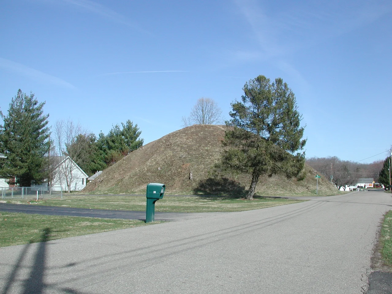

Wolf Plains Earthworks
Thirty earthworks. Twenty-two conical burial mounds. Nine circular ditched enclosures. All built between roughly 200 BC and AD 100 by the people archaeologists call the Adena culture, on a flat glacial terrace just north of where Athens, Ohio, now stands. The terrace was itself an accident of the last Ice Age: glacial outwash flowing down the Hocking River got dammed at this point, the river found a new outlet to the northeast, and a wide flat shelf of fine sediment was left behind in country that is otherwise sharp ridges and tight hollows. The Adena built the densest concentration of mounds in southeastern Ohio on this terrace - a sacred landscape so concentrated that nineteenth-century surveyors had trouble drawing it all in. The town that grew up on the terrace later took its name from the geography. It is called, simply, The Plains.
Squier and Davis Drew It Wrong
The earliest published documentation of the Wolf Plains group appeared in Ephraim George Squier and Edwin Hamilton Davis's 1848 Smithsonian publication Ancient Monuments of the Mississippi Valley - the first scientific archaeological monograph ever published in the United States, and a book that essentially launched American archaeology as a discipline. Squier and Davis based their plate of Wolf Plains on a sketch drawn by S. P. Hildreth in 1836. The drawing contains errors. Some mound clusters are rotated relative to their actual positions. Some mounds are missing. Some are placed incorrectly. The mistakes did not diminish the book's impact - Ancient Monuments became the standard reference for Eastern American earthworks for the next century - but they did mean that subsequent archaeologists worked for decades from a map that was not quite right.
What the Adena Built and Why
The Adena culture flourished in the Ohio Valley roughly from 1000 BC to AD 200. They were among the earliest American peoples to build substantial earthworks at scale: conical mounds that covered burials of important individuals, and circular ditched enclosures that probably served ceremonial functions. The Wolf Plains group is unusual in its density. Most Adena sites consist of one or two mounds, sometimes with a single enclosure. At Wolf Plains, the Adena built more than two dozen mounds and nine enclosures within walking distance of each other - a sacred or ceremonial landscape where multiple generations could be buried over centuries on the same flat terrace. The size of individual mounds varies. The largest, the Connett Mound, was historically among the most impressive in the state.
What Has Been Lost
When the Wolf Plains group was added to the National Register of Historic Places on May 31, 1974, only 25 of the original 30 earthworks remained intact enough to count as contributing properties. The losses came from the same causes that destroyed mounds across the Ohio Valley: nineteenth-century settlers digging for treasure, twentieth-century farmers leveling earthworks to clear fields, twentieth-century construction projects taking pieces of terrace for residential and commercial development. In 2019, a Native American mound on a clearcut site near The Plains was apparently damaged during logging operations, prompting local outrage. The remaining mounds are a mix of privately owned and protected. Some sit in suburban yards. One occupies a public park. Several are in pastures. The whole complex is more visible to satellite imagery than to a visitor driving through The Plains.
A Sacred Landscape in a Suburban Town
The Plains, Ohio, today is a small unincorporated community of about 3,100 people, just north of Athens off State Route 33. The town's residential streets and businesses sit on the same flat terrace the Adena chose. Many residents have a mound in or near their backyard. The Plains Lions Club has run an annual Indian Mound Festival to celebrate and educate about the earthworks, though awareness of the site's importance remains uneven. Local educators and historians have pushed for more formal recognition and protection. The Archaeological Conservancy has worked to acquire and preserve some mounds. The challenge is that this is a living place: a working town occupying the same ground that an earlier civilization treated as sacred. The two uses do not always coexist comfortably.
Flying Over the Flat Terrace
From the air, the Plains terrace is a noticeably flat green-and-residential area surrounded by sharp wooded ridges - a geological anomaly visible at a glance against the rolling Allegheny Plateau context. The Hocking River curves past the southern edge before swinging east toward Athens. Individual mounds are hard to identify from cruising altitude unless you know where to look, but a few of the larger ones cast small conical shadows in late afternoon light. The circular enclosures are mostly visible as faint vegetation differences, particularly in spring before mowing. The whole flat - perhaps a square mile of even ground - is one of the densest ceremonial landscapes the Adena ever built.
From the Air
Located at 39.38°N, 82.12°W on the flat terrace immediately north of Athens, Ohio, around the unincorporated community of The Plains. The flat terrace itself, contrasted with the surrounding ridges, is the most visible feature. Individual mounds are too small to identify from cruising altitude. Nearest airport: Athens-Albany (KUNI) about 8 nm south. Best viewed from 3,000-5,000 feet AGL in early morning or late afternoon when low-angle light shows the slight conical shapes of remaining mounds.
Nearby Stories
- Julia-Ann Square Historic District 1.9 km away
- Lakin State Hospital 7.7 km away
- Ratcliffe Mound 9.8 km away
- Burning Springs Complex 21 km away
- Hardin Village Site 41 km away
- The Y-Bridge of Zanesville 44 km away
- Columbus: The Test Market Where America Tries Things First 56 km away
- West Virginia Penitentiary 81 km away