
Yancey County, North Carolina
When Hurricane Helene came up the Toe River Valley in September 2024, it didn't care that this was high country. The storm dumped enough rain on Yancey County to wash out bridges, isolate hollows, and shutter Micaville Elementary School permanently. Recovery, the county newspaper kept reporting through 2025, would take years. Yet drive past the wreckage today and Mount Mitchell still rises beyond Burnsville at 6,684 feet, the highest summit in eastern North America, exactly as it has since Elisha Mitchell first measured it. Five of the ten tallest peaks east of the Mississippi all sit within this single county's lines.
Yellow Jacket and the Naval Hero
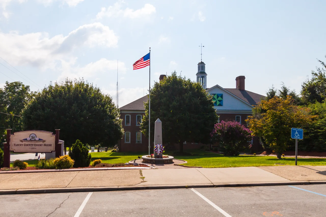
The county seat got its land from a man named John Bailey, locally known as Yellow Jacket for his famous temper. On March 6, 1834, he conveyed one hundred acres for the new county seat. The town was named Burnsville not for Bailey but for Captain Otway Burns, a War of 1812 naval hero from Onslow County on the coast who, while serving in the General Assembly, had voted to carve this western county out of Burke and Buncombe. Burns never lived here. He never saw these mountains. But in 1909 his grandson Walter Francis Burns donated a statue, and in 1930 the county commissioners formally named the surrounding square Bailey Square. The forty-ton Mount Airy granite pedestal still anchors the town center. The inscription reads, in part: He guarded well our seas, let our mountains honor him.
The Black Mountains
The Black Mountains are not the Blue Ridge. They are a distinct sub-range running roughly north to south, blacker than the surrounding peaks because their thick spruce-fir forests give the slopes a darker cast from a distance. Mount Mitchell anchors them at 6,684 feet. Behind it stand Mount Craig, Balsam Cone, Mount Gibbes, and Potato Hill, each over 6,400 feet, each within Mount Mitchell State Park or the Pisgah National Forest game lands. Bare Dark Sky Observatory operates on a remote ridge in the county, a designated international dark sky site where on cloudless nights the Milky Way arcs unbroken from horizon to horizon. The South Toe and Cane rivers drain west into the Nolichucky, which crosses into Tennessee through one of the deepest gorges in the eastern United States.
Bee Log and Blue Ridge
In 2018, Bee Log Elementary School closed with an enrollment of 42 students, making it at the time the smallest public school in North Carolina. The county school board had decided two years earlier to consolidate Bee Log, Bald Creek, and Clearmont into a single new school called Blue Ridge Elementary. Clearmont and Bald Creek closed the following year. These were not abstract decisions in distant offices. Bee Log served a community deep in the mountains where children had walked or ridden the same roads to the same school for generations. The mathematics of small populations and shrinking budgets eventually overrode that history. Then Hurricane Helene closed Micaville Elementary permanently in 2024. Yancey County had fewer schools afterward than it had a decade earlier, and fewer ways for a hollow to define itself.
Pride, Helene, and a Library Fight
Yancey County is small. In 2020 the census counted 18,470 people across 313 square miles. The median age was 48. More than a quarter of residents were 65 or older. In this kind of place, library board decisions can become county-defining controversies. After a Pride display at the local branch in June 2023, county commissioners began the process of taking over the regional Avery-Mitchell-Yancey library system, which had served the three counties together since 1961. Some residents sued. One reason given for opposing the change was simply that the county had bigger problems, that Helene recovery deserved every available hour and dollar. The library is scheduled to become a county library on July 1, 2025. The lawsuit continues. The mountains, indifferent, look on.
Flight Context
Centered near 35.90 degrees north, 82.31 degrees west, in the Black Mountains of western North Carolina. Mount Mitchell at 6,684 feet MSL is the highest obstacle in eastern North America and a critical reference point. Asheville Regional (KAVL) lies roughly 30 nautical miles south. Tri-Cities Regional (KTRI) is about 40 nautical miles north across the Tennessee line. Spruce Pine Avery County Airport (7A8) is closer for general aviation in the Toe River Valley. Expect mountain wave turbulence on west-northwest winds aloft and rapid afternoon cumulus development in summer. The Black Mountains form a narrow north-south spine; the Cane River and South Toe River valleys cut deep into the western and southern flanks.
From the Air
Coordinates 35.90N, 82.31W. Mount Mitchell (6,684 ft MSL) is the dominant feature and highest peak in eastern North America. Recommended VFR altitude 9,500 to 11,500 feet to clear the Black Mountains comfortably. Nearby airports: KAVL (Asheville Regional) 30 nm south, KTRI (Tri-Cities Regional) 40 nm north, 7A8 (Avery County) in the Toe River Valley. Watch for mountain wave on west winds, severe icing in winter near the summit, and afternoon thunderstorms in summer.
Nearby Stories
- Black Mountain College 9.3 km away
- Watauga County, North Carolina 19 km away
- Gray Fossil Site 20 km away
- Grandfather Mountain 20 km away
- Forest City, North Carolina 39 km away
- Great Smoky Mountains National Park 42 km away
- The Titanic Museum: The Ship That Docked in Tennessee 57 km away
- Cumberland Gap 76 km away