Yser
Two men opened the sluices at Nieuwpoort in late October 1914, and the sea did what the Belgian Army could not. Karel Cogge, an aging local lockkeeper who knew the polder waterways the way a violinist knows fingerings, and Hendrik Geeraert, a barge skipper who handled the heavy iron gates by hand at night, let the North Sea pour eastward across the farmland between the Yser and the railway embankment running south from Nieuwpoort to Diksmuide. The water rose slowly, deceptively, salty against the German trenches dug into the lower fields. By the time the Kaiser's officers understood what was happening, the polders had become an unmarchable lake. The Yser river itself never overflowed its banks. The country around it drowned instead.
A Quiet River with Loud Memories
The Yser is short for a river so famous. It rises near Buysscheure in French Flanders, in the Nord department, and runs only seventy-eight kilometres before reaching the North Sea at Nieuwpoort. About thirty of those kilometres are French; the rest are Belgian, threading the West Flemish countryside through Diksmuide and out through the Ganzepoot, the 'goose-foot' lock complex where six waterways converge on a single sluice. The basin covers 1,101 square kilometres of polder and low farmland, two-thirds of it in Belgium. Most of the year, the Yser looks like nothing remarkable: a slow brown line between willows, drained by canals, marked by a tower here, a brick farmhouse there. The drama is entirely under the surface, in the level of the water and the network of locks that decides which way it goes.
The Inundation of 1914
By mid-October 1914 the Belgian Army had been pushed back across almost the entire country, dragging itself westward in front of the German advance. The last unoccupied corner was the strip of polder west of the Yser. The Battle of the Yser opened on 18 October. Within ten days the Belgians were exhausted, outnumbered, and running out of artillery shells. The proposal came from a local investigating judge in Veurne: open the sluices at high tide, close them at low, and let the sea climb a few centimetres a day until the polder was uncrossable. Karel Cogge guided the engineers through the maze of waterways. Hendrik Geeraert worked the gates at night under fire. By 30 October the inundation had risen enough that the German lines became islands. The advance stopped. For the next four years the front along the Yser barely moved, and a tiny strip of Belgium remained free.
Four Years on the Embankment
The Belgian army held its trenches on the railway dike for the rest of the war, a thin wet line of mud and duckboard between flooded fields. Behind them, the British and French dug in further south at Ypres. The fighting along the Yser was less famous than the Somme or Verdun, but no less terrible. Positions were taken and retaken at brutal cost. Diksmuide changed hands repeatedly and was eventually levelled. Today the Yser Tower at Diksmuide, an 84-metre brick pylon rebuilt after the original was dynamited in 1946, stands as the chief Flemish memorial to those years. Beneath it runs the Death March route where soldiers waded through chest-deep water to relieve forward positions. The names on the crypts are mostly Flemish farm boys who never saw home again.
Buried Borders
Long before the Great War, the Yser was already a frontier river. In the medieval period the country between the river and the coast was called Veurne-Ambacht. After the fall of Ostend in 1604, Spanish forts went up along the banks to hold off raiders from the Protestant north. Veurne passed to Louis XIV after the Peace of Aix-la-Chapelle, and the Yser briefly formed the northern edge of the French empire, defended by Fort Knokke. The Austrian Netherlands inherited it next, and by then the river had lost its border meaning. In May 1940, French and British engineers blew the bridges and locks one more time, trying to slow another German advance. This time the trick did not work. The line collapsed in days.
Celtic Name, Drained Land
The name is older than any of the wars fought across it. IJzer is of Celtic origin, a cousin of the Isar in Bavaria, the Jizera in Bohemia, and the Isère that runs through Grenoble. The Menapii, a Celtic people, lived here before the Romans arrived. Standing on the bank at Diksmuide today you can see almost nothing of any of it: just a slow river through reclaimed farmland, a country church tower, lines of poplars marking the canals. It is a landscape that has been engineered for centuries, an entire province held just below sea level by pumps and gates. The Yser is the small thread that ties the whole machine together.
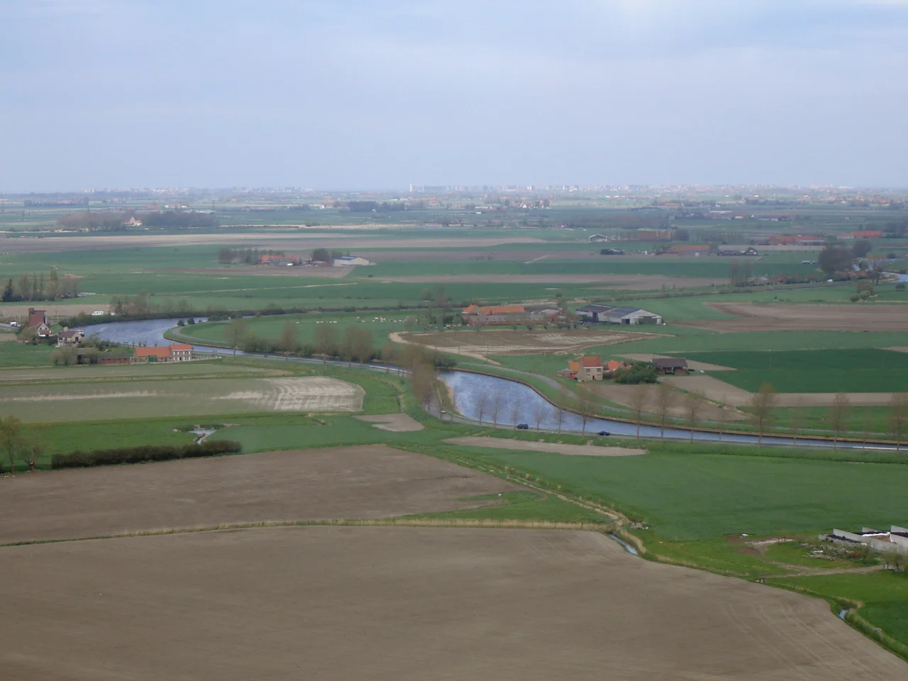
From the Air
Coordinates 51.15N 2.72E at Nieuwpoort river mouth. The Yser runs roughly north-south through West Flanders, ending at the distinctive Ganzepoot lock complex on the Belgian coast. From altitude the polder grid of canals and rectangular fields makes the basin easy to identify. Nearest airfields: Ostend-Bruges (EBOS) 25km north, Lille (LFQQ) 60km southwest, Wevelgem (EBKT) 30km east. The 84m Yser Tower at Diksmuide is a visible landmark on the riverbank.
Nearby Stories
- Bruges Public Library 5.3 km away
- Westhoek 8.9 km away
- 1382 Dover Straits Earthquake 14 km away
- Battle of Ardres 16 km away
- Battle of Courtrai (1814) 18 km away
- Westhove Castle 26 km away
- Four Days' Battle 35 km away
- Battle of the Gabbard 55 km away