Zeila
In 1410, in the port town of Zeila, Emperor Dawit I of Ethiopia caught up with the last sultan of Ifat, Sa'ad ad-Din II, and killed him. The sultan's children escaped by boat to Yemen; five years later they returned and rebuilt the sultanate at Dakkar, inland. One of those children would eventually lead the armies that reshaped the Horn of Africa. This is the kind of history that Zeila carries, in layers, in its dust and coral walls. The Moroccan traveller Ibn Battuta described the town in the fourteenth century as a big metropolis with many great markets filled with wealthy merchants. The Benjamin of Tudela, a twelfth-century Jewish traveller, identified Zeila with the Biblical land of Havilah. The Italian explorer Ludovico di Varthema visited in the sixteenth century. Somali, Afar, Arab, and Persian merchants lived here simultaneously, speaking different languages, praying in the same mosques.
Avalites
The first-century Greek travelogue known as the Periplus of the Erythraean Sea names a trading port called Avalites on the coast of what the Greeks called Barbaria, and most modern scholars identify Avalites with Zeila. The Periplus describes the inhabitants, whom it calls Barbaroi, as competent seamen who sailed the Red Sea and Gulf of Aden, trading frankincense and other commodities with Ptolemaic Egypt, Greece, Parthian Persia, Saba, Nabataea, and the Roman Empire. Their governance system, the document records, was decentralized, essentially a collection of autonomous city-states whose inhabitants were, in the Greek author's words, 'very unruly,' meaning independent. The Somali maritime tradition runs deep here. Merchants sailed ships called beden, a vessel design used along this coast for perhaps two thousand years, and coastal towns like Heis, Maydh, Abasa, and Amud formed a network that predated Arab migration to the region by millennia.
The Adal Capital
In the late ninth century, the Arab geographer Al-Yaqubi wrote that Muslims were living along the northern Somali coast and that the kingdom of Adal had its capital in Zeila. By this reckoning the town was already a Muslim political center when the Abbasid caliphs were still ruling from Baghdad. Adal's rulers, according to I.M. Lewis, were local dynasties of Somalized Arabs or Arabized Somalis, and Adal's history is a long series of wars with the Christian Ethiopian empire to the west. Under Al-Umari, writing in Cairo in the 1340s, Zeila appears as the capital of a land whose inhabitants cultivated their fields twice a year using the rainy seasons they called Bil and Karam. The seasonal names Karan and Bil still carry the same meaning in Awdal today. This is history whose terminology survives in living language.
Imam Ahmad Gran
In the sixteenth century, Zeila produced Imam Ahmad ibn Ibrahim al-Ghazi, known to his enemies as Ahmad Gurey and to Ethiopians as Ahmad Gran, the Left-Handed. From the inland Adal capital at Harar, Ahmad led an army that invaded the Christian Ethiopian highlands between 1529 and 1543, burning monasteries and nearly overthrowing the imperial line. Zeila itself, though no longer the capital, remained a crucial port for Adal's trade in incense, myrrh, enslaved people, gold, silver, and camels. The Portuguese sacked the city in 1517 and again in 1528; after each attack, Zeila rebuilt. The port's ruler, Garad Lado, eventually hired 'Atlya ibn Muhammad to construct a sturdy wall around the town, a wall that, while much eroded, would still stand in fragmentary form into the twentieth century. The Adal civil war brought another sack, this one by rival Somali clans, and the city's walls were damaged again.
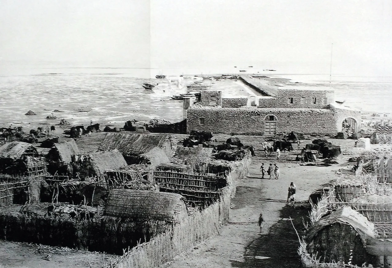
Haji Sharmarke and the Colonial Pivot
By the first half of the nineteenth century, Zeila had been reduced to, in one British description, 'a large village surrounded by a low mud wall, with a population that varied according to the season from 1,000 to 3,000 people.' Still, it served as the principal maritime outlet for Harar and the Ethiopian highlands of Shewa. In the 1840s, Hajji Sharmarke Ali Saleh took the governorship after intimidating the previous Turkish-appointed governor by firing cannons near the city walls: Mohamed El-Barr had never seen such weapons and fled. Sharmarke monopolized regional trade and extended his reach toward Harar and the Ogaden. He was succeeded, ousted, and reinstalled, before being finally removed in 1861 after a French consul died under suspicious circumstances. In 1885, the British and French competed here with treaties and threats of landings, until the 1888 Anglo-French agreement fixed the boundary between their protectorates. Zeila became part of British Somaliland. Djibouti became the French capital.
What Remains
The Djibouti-to-Addis Ababa railway, completed in the early twentieth century, bypassed Zeila and carried the trade that had once made the port wealthy. By 1911, the Encyclopaedia Britannica described Zeila as a shadow of itself, with camels of old Somali women still bringing water from wells three miles distant every morning. Italian troops occupied the town briefly in 1940. Today Zeila sits in the Awdal region of Somaliland, on a sandy spit surrounded by the sea, home to the Gadabuursi and Issa clans, both subclans of the Dir. The Issa regard Zeila as the seat of their traditional Ughaz coronation; the Gadabuursi hold the Ughazate seat here too. The coral reefs, mangroves, and the offshore Sa'ad ad-Din islands, named for the sultan killed in 1410, remain. Much of what Ibn Battuta saw is gone, or buried. The port endures, as it has for four thousand years, as what it has always been: a meeting point.
From the Air
Coordinates: 11.35°N, 43.47°E. On the Gulf of Aden, near the Djibouti border. Djibouti-Ambouli International (HDAM) is the nearest major airport, 160 km east. Berbera Airport (HCMI) is 170 miles east along the coast. Recommended viewing altitude: 5,000-8,000 feet AGL for coastal detail; 12,000+ feet for regional context including the Sa'ad ad-Din archipelago. Coastal conditions generally clear; afternoon thermals over land.
Nearby Stories
- Tadjoura 20 km away
- Port of Djibouti 30 km away
- Lake Assal (Djibouti) 62 km away
- Berbera 136 km away
- British Attack on Berbera (1827) 154 km away
- Aden 176 km away
- Somaliland 184 km away
- Adal Sultanate 200 km away