Lake Assal (Djibouti)
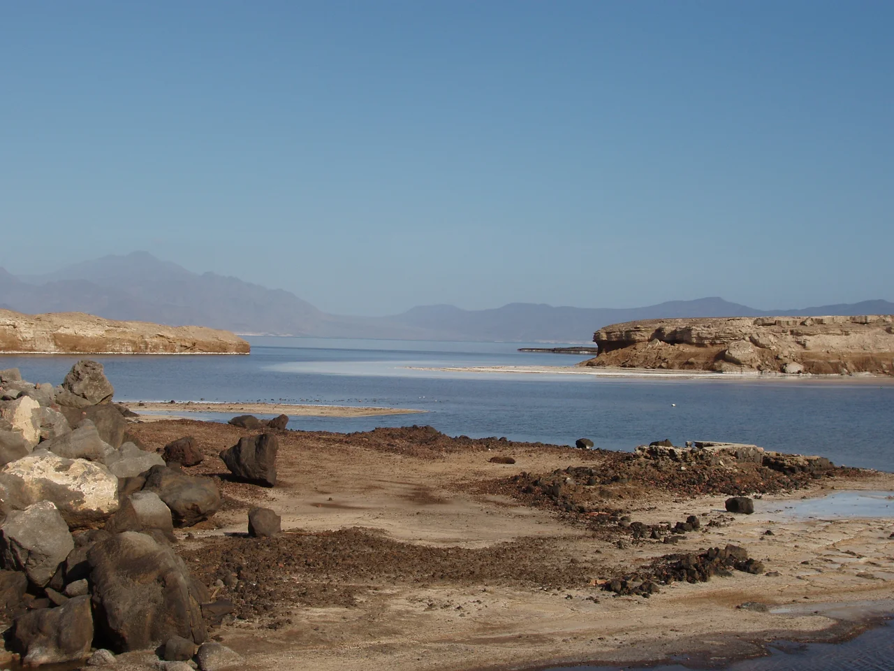
Stand on the shore of Lake Assal and look up, and the mountains do not tower. They loom. You are 155 meters below sea level, in a bowl at the top of the Great Rift Valley where Africa is actively pulling itself apart, and the water at your feet is ten times saltier than the ocean. Only the Dead Sea and the Sea of Galilee lie lower on solid ground. The name - Assal - means Honey Lake, and on certain afternoons the surface picks up impossible fluorescent hues from the evaporating brine. But honey is not what the Afar people harvest here. They harvest salt. And during wars they have been unable to stop, that salt has been the most valuable thing in the neighborhood.
A Hole in the Continent
Lake Assal sits in the Danakil Desert, in a closed depression at the northern end of the East African Rift. The Afar Triangle around it is one of the few places on Earth where three tectonic plates meet at the surface, and the ground here is geologically active - basalt flows less than a million years old, the Ardoukôka volcano just three kilometers southeast, and the younger Ardoukoba volcano a short drive north, all markers of a continent splitting at roughly the pace a fingernail grows. The lake has no outflow. What comes in, stays, and evaporation has done the rest. Surface salt concentration reaches 276.5 grams per liter, slightly above the Dead Sea's 268.8. At twenty meters depth, Assal climbs to 398 grams per liter - brine so thick it clings to anything dipped in it.
How Fresh Water Became Salt
Assal was not always like this. French geologists studying the layered sediments found evidence of a lake that once held fresh water, sitting on a fifteen-meter mantle of tufa, marl, and calcrete. Fresh-water mollusks - Melanoides tubeculatus, Corbicula consobrina, Coelatura teretiuscula - left their shells in the higher deposits. As the lake transformed, those gave way to the species of saline marshes: Ervilius purpura, Cerithium. There are two competing explanations. One geologist, Degoutin, argued that the sea flooded in from nearby Ghoubbet el Kharâb. Another, Dreyfuss, proposed that rising sea levels pushed salty water underground into the basin. Either way, what is here now is not ordinary water. It is the final concentrated residue of an ancient Red Sea arm, slowly evaporating under one of the hottest, driest skies on Earth.
White Gold
The Afar have harvested salt from this region for as long as records exist. Semi-commercial extraction at Assal began in 1988, and then in 1998 something changed: war broke out between Eritrea and Ethiopia, cutting off Ethiopia's traditional salt sources in Eritrea. Djibouti stepped in, and Assal's salt suddenly sold for 250 percent of the earlier price. The traders called it white gold. Since 2002, four concessions have carved up the southeast end of the lake, with Société d'Exploitation du Lac and Société d'Exploitation du Salt Investment S.A holding nearly 80 percent of production. The workers who load the trucks labor in temperatures that regularly exceed 45 Celsius, on crusts that can collapse without warning, for an economy that turns on conflicts hundreds of kilometers away.
The Energy Underfoot
The same tectonic forces that dropped Assal into its depression also heated the rocks beneath it. The Fiale area, about eight kilometers north near the Lava Lake, shows extreme temperature gradients suitable for geothermal power, and plans exist for a 30-megawatt station there. A wind power plant has been proposed 500 meters from the lake itself. In 2001, Djibouti and an American company began exploring for gold in the volcanic rocks around the basin. The old Great Rift question - what are we sitting on, and what can we pull out of it - runs through every new plan for Assal. The area is also being shaped as a tourist destination, packaged with Ghoubbet El Kharab bay and the Ardoukoba volcano. So far the tourism has been restrained by the climate, which discourages casual visits.
The View From Below
Water levels are dropping. A marked line fifty feet up the bank shows where the surface used to reach. Runoff into Assal is only what occasional flash floods bring from the 900-square-kilometer watershed - there are no permanent streams feeding the lake, though the Kalou River valley has year-round springs. The water changes color through the day, shifting from the silver-blue of morning to fluorescent greens and pinks in strong afternoon light, as microscopic halophilic organisms react to heat and ultraviolet. Where the salt crust breaks, the underlying brine shines through. For most of the year, the lake is silent except for wind and the crack of temperature-stressed crystals. For centuries before satellite imagery made it famous, this was simply the place the Afar went when they needed salt. They are still the ones who know the paths across it.
From the Air
Lake Assal is centered at 11.65°N, 42.42°E, approximately 120 km west of Djibouti city. Surface elevation is 155 meters below sea level - the lowest point in Africa. From cruising altitude the stark white salt pans on the southeast end contrast sharply with the basalt desert around, making the lake unmistakable. Ambouli International (HDAM / JIB) at Djibouti city is the primary airport. The area is extremely hot (frequently over 45°C) and visibility is generally excellent. Ardoukôka volcano sits 3 km SE of the lake; the more recent Ardoukoba volcano (1978 eruption) is about 8 km north.
Nearby Stories
- People's Liberation Army Support Base in Djibouti 22 km away
- Camp Lemonnier 24 km away
- Lake Abbe 29 km away
- Sultanate of Aussa 46 km away
- Bab-el-Mandeb 85 km away
- Djiboutian-Eritrean Border Conflict 119 km away
- Zeila 121 km away
- Southern Red Sea region 203 km away