1915 Imperial Valley Earthquakes
The first shock came at 7:59 in the evening — eleven seconds that stopped clocks, cracked walls, and sent people pouring into the streets of El Centro and Calexico. Then, nearly an hour later, the second earthquake arrived. At 8:57 PM, another magnitude 6.25 shake rolled through the same ground. The people who had gone back inside their weakened buildings were injured. In Mexicali, where the nightlife had barely paused after the first shock, the collapse of walls and falling debris killed six people when the second quake struck. The date was June 22, 1915.
One Hour Apart
What made the 1915 Imperial Valley earthquakes particularly destructive was their sequence. A single large earthquake allows rescuers to begin immediately and allows survivors to understand what they face. Two earthquakes an hour apart create a crueler scenario: the first weakens structures and shakes loose the dangerous elements; the second finds people inside those compromised buildings. Both shocks measured 6.25 and were assigned VIII (Severe) on the Modified Mercalli intensity scale — strong enough that nearly every brick building in the El Centro area sustained damage. Poor construction methods throughout the valley, using techniques not designed to withstand seismic stress, amplified the destruction considerably.
From Calexico to Yuma
The earthquakes' reach extended far beyond the Imperial Valley. The two mainshocks were felt as far north as San Bernardino and Los Angeles, east to Parker and Yuma, Arizona, and south into Ensenada, Mexico, and likely beyond. The worst damage concentrated at El Centro, where losses reached an estimated $600,000. Calexico, Heber, and Mexicali all reported serious damage, but El Centro's larger building stock meant more structures to fail. Along the New River and Alamo River, banks slumped into the water. Fissures appeared in alluvial fans. In Mexico, residents reported steam rising from a cluster of mud volcanoes, and sounds like explosions echoed across the desert. Aftershocks continued through August.
The November Earthquake
June's twin earthquakes were not 1915's last geological event in the region. On November 21, a magnitude 7.0 earthquake struck Baja California, associated with a rupture on the Cerro Prieto Fault near the volcano of the same name. This larger event caused widespread ground slumping, landslides, and liquefaction around Cerro Prieto volcano, 20 kilometers south of the epicenter. Plumes of steam up to 200 meters high rose from Laguna de los Volcanoes. A massive fissure opened along both sides of the New River for three kilometers. Despite the earthquake's greater magnitude, it caused fewer casualties than June's paired shocks — the November epicenter centered in a relatively uninhabited area — though a levee was damaged and two witnesses at the laguna reported the ground moving too violently to stand.
A Fault That Doesn't Stop
The Imperial Fault Zone, a 69-kilometer right-lateral strike-slip fault running near Brawley, Imperial, El Centro, Calexico, and Mexicali, has never been a quiet seismic feature. It produced damaging earthquakes again in 1940 and 1979. In 1966, a magnitude 3.6 event caused a surface rupture — making it the smallest earthquake ever associated with such a feature, a distinction that reflects the fault's sensitivity. Research suggests the Imperial Fault Zone has a recurrence interval of roughly 30 years for significant events, while larger earthquakes comparable to the 1940 magnitude 6.9 occur on a scale of centuries. The 1915 earthquakes were not an anomaly. They were part of an ongoing story written in the geology beneath the most intensively farmed desert in California.
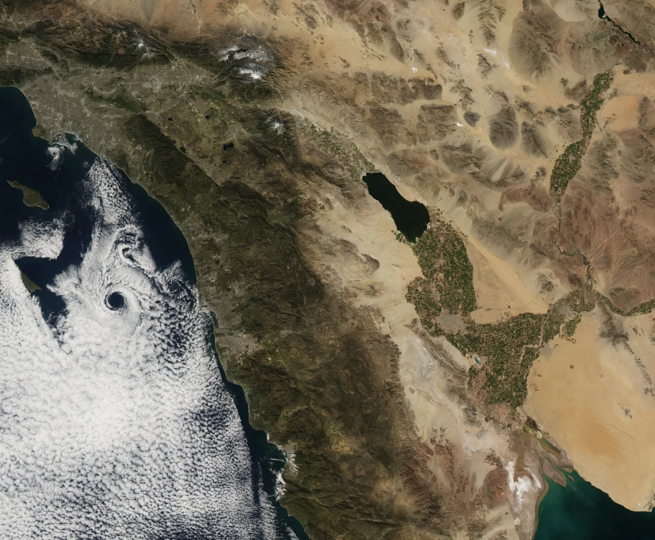
From the Air
The 1915 earthquakes centered near El Centro at approximately 32.8°N, 115.5°W in the Imperial Valley. From altitude, the Imperial Valley's flat agricultural landscape spreads in all directions, with the Salton Sea visible to the northwest. The Imperial Fault Zone runs roughly north-south through the valley, though it is not visible from the air. Nearest airports include Imperial County Airport (KIPL), Naval Air Facility El Centro (KNZJ), and Calexico International Airport (KCXL). The Mexican border and Mexicali — one of the hardest-hit areas in 1915 — lies about 15 miles south of El Centro and is clearly visible from altitude.
Nearby Stories
- Coyote Mountains 6.2 km away
- Calipatria, California 9.1 km away
- Old Plank Road 13 km away
- Ocotillo Wells, California 15 km away
- Hualapai Smith's 16 km away
- El Vallecito 22 km away
- Laguna Salada 24 km away
- Poston War Relocation Center 117 km away