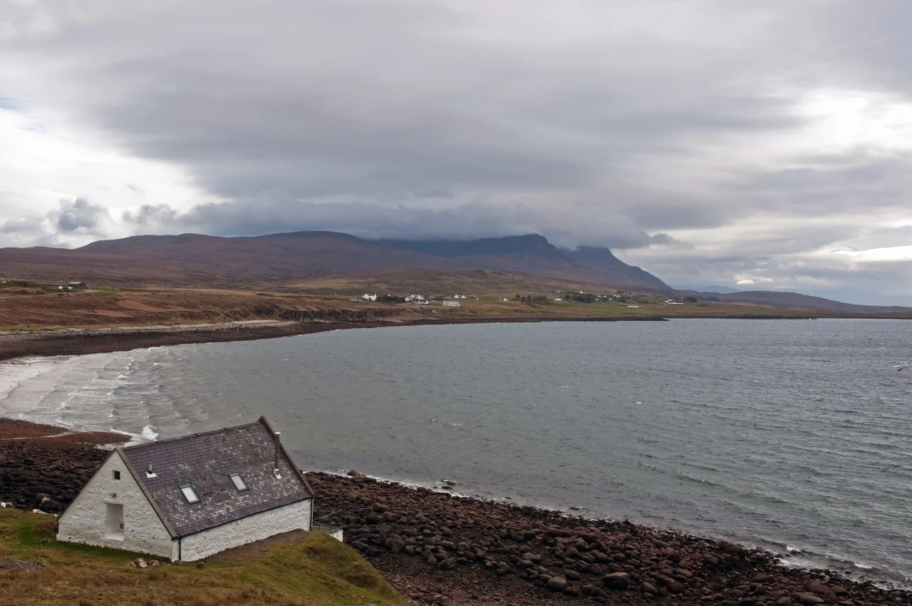

Achiltibuie
*Achadh a' Bhuidhe* - the field of the yellow-haired boy. That is what the name has meant in Gaelic for as long as anyone has bothered to write it down, and the boy is not identified. He is just there in the place name, like a face in an old photograph nobody can put a date to. The village that took his name strings itself along a single coast on the Coigach peninsula, north of Ullapool, looking west across the Summer Isles. The road to it is single-track, the mobile signal is patchy, and at the right time of year you can buy smoked salmon at one end of the village and catch your own mackerel at the other.
Getting to the Yellow-Haired Boy
There is no through road along the coast from Ullapool to Achiltibuie. The historic *postman's path* used to make the trip via Ardmair, and you can still hike its ten miles if you are properly equipped. By car, the route is to follow the A835 north from Ullapool - or south from Ledmore, the junction with the A837 - to the turn-off at Drumrunie, then take the narrow single-track lane west. From Lochinver in the north you can come south on a twisty, hilly, scenic lane that locals will tell you is well-tarmacked but never fast. KSM Bus 811 runs from Ullapool to Achiltibuie twice on weekdays and once on Saturday, taking 80 minutes. Ullapool itself is the hub for buses to Inverness and ferries to Stornoway on Lewis. The name *Achiltibuie* applies not just to the village but to the entire coast between Achduart and Reiff, taking in the hamlets of Polglass, Polbain and Altandhu.
The Mountain Above
Ben Mor Coigach rises behind Achiltibuie - the Table Mountain of this stretch of coast, a six-mile ridge of Torridonian sandstone weathered into a striking horizontal profile. The summit is 743 metres, or 2,438 feet, and it looks more prominent than that because it rears straight up from sea level. The simplest approach is to drive to the end of the road at Culnacraig and climb from the southwest. It can also be ascended from the car park at Bleughasary from the southeast. Trying to traverse the whole ridge - up one side and down the other - is much harder than it looks, with bogs, fast streams and small scrambles, and you should allow at least four hours. Rock climbers head instead to Reiff, where the sandstone sea-cliffs offer routes for every level of ability. A sense of where you are: this is one of the great walking corners of Scotland, and almost none of it is signposted in a way a casual visitor would notice.
Smoked Salmon and Iron Age Stones
The Summer Isles Smokehouse at Altandhu, at the western end of the parish, is famous beyond its size for what it does with a barrel of brine and a slow fire: smoked venison, lamb, beef, eel, haddock, sea trout, and five different smoked salmons. The Summer Isles Hotel does the kind of restaurant cooking that brings people back across the peninsula in the evening. The two bars in the area are Am Fuaran and the Summer Isles Hotel - that is the choice, both fine, neither pretentious. Down the coast, the Iron Age broch at Polglass is the rubble of a defensive tower built perhaps around 500 BC. Brochs are one of Scotland's distinctive contributions to archaeology - circular drystone towers with hollow walls and internal stairs, built across the north and west by people who needed both shelter and visible status. The Polglass example is no longer impressive in itself; you come for the coastal walk and the view over the Summer Isles.
Boats, Festivals and Almost-Dark Nights
From Bardentarbet Pier at the north end of the bay, boat trips run out to the Summer Isles - the cluster of small islands offshore that gave the coast its English name. The crossing from Achiltibuie is shorter than the one from Ullapool, and you can rent a cottage on the largest island if you want a few days of genuine remove. The Post Office is the contact point for booking. *Made in Altandhu* is a music festival held in the village in late summer - the 2025 dates are 29-30 August. The Highland Games at Achiltibuie come round in late June. As of August 2024, mobile coverage on the peninsula is patchy: a basic signal from Three, 4G from O2, nothing from EE or Vodafone, and no 5G. In high summer the nights barely get dark; in winter the skies above Coigach are among the best in Britain for the Milky Way and the Northern Lights, if the weather permits, which is the eternal Highland caveat.
From the Air
Achiltibuie lies at 58.021N, 5.347W along the western shore of the Coigach peninsula, looking out across the Summer Isles. From cruising altitude the long ridge of Ben Mor Coigach (743 m, 2,438 ft) dominates the eastern skyline, with the spiky profile of Stac Pollaidh further northeast. Nearest airport is Inverness (EGPE), 65 nautical miles east-southeast. Approach is via A835 north from Inverness past Ullapool, then west on the single-track lane from Drumrunie. Expect coastal weather - low cloud, Atlantic squalls, and lenticular cloud over the ridges.
Nearby Stories
- Dundonnell and Fisherfield Forest 10 km away
- Bayble Island 17 km away
- Ness, Lewis 20 km away
- Battle of Tuiteam Tarbhach 21 km away
- Loch Eriboll 22 km away
- Kinlochbervie 26 km away
- Skye Trail 27 km away
- Castle Leod 35 km away