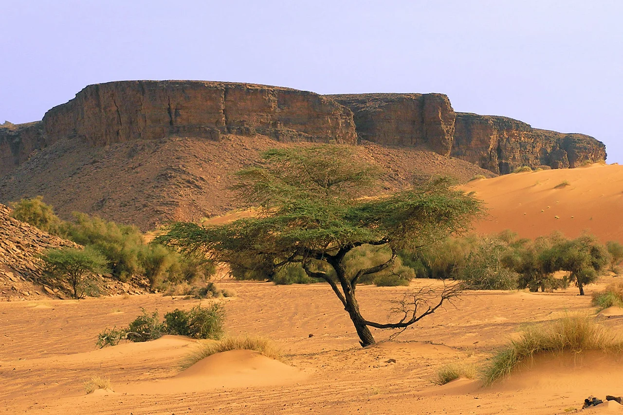

Adrar Region
Spread a map of Mauritania and the Adrar Region takes up a vast wedge of the north - bordered by Western Sahara, reaching toward Mali, sprawling across more desert than many entire nations contain. Then look at the population: around seventy thousand people, scattered across all that emptiness. The Adrar is a region defined by what it does not have. Almost no rain. Almost no soil. Almost no permanent water. And yet it holds four of the most storied towns in the Sahara, and a history of people who learned to live where living should be impossible.
Four Towns and a Capital
The region is named for the Adrar Plateau that forms its spine, and its life clusters where that stone meets water. The capital is Atar, the largest town and the gateway for almost everyone who comes here. Beyond it lie the others: Choum, where the great iron-ore train rumbles through on its way across the desert, and the two ancient caravan cities of Chinguetti and Ouadane, whose libraries and mosques once made them centers of learning revered across the Muslim world. Together these towns anchor a region that is otherwise almost pure horizon.
The Long Drought
For most of its history, the Adrar belonged to nomads. The desert offered no other way to survive - you moved with the rains, the grazing, and the seasons, carrying your home with you. Then the rains failed. Across the 1960s the region's annual rainfall slid downward, and the catastrophic droughts of the 1970s and early 1980s broke the nomadic world. Families who had moved freely for generations crowded into the towns, abandoning herds and tents for the hard permanence of urban life. It is a quiet disaster you can still read in the region's shape: a scattered, settled population gathered around a handful of places that have water.
Extremes of Sky and Sand
The numbers describe a brutal climate. Near the Tropic of Cancer in the north, perhaps 100 millimeters of rain falls in a year - the kind of total that might arrive in a single afternoon elsewhere. Daytime temperatures average well above body heat, yet desert nights can plunge toward freezing, the cloudless sky pulling every trace of warmth back into space. Between these extremes the dunes themselves move, shifting into temporary ranges and then unmaking them, so that the map of the sand is never quite the same from one decade to the next.
A Region Drawn on Paper
Modern Mauritania governs the Adrar through a system inherited from French colonial administration and reshaped since. The country is divided into fifteen regions, and the Adrar is one - itself split into four departments named for its towns: Atar, Chinguetti, Ouadane, and Aoujeft. Power that once rested entirely with appointed governors has, since the 1990s, been gradually pushed down to elected local councils, though political instability has interrupted the rhythm; the most recent local elections were held in 2023. It is an unremarkable bureaucratic structure laid over a profoundly unbureaucratic land.
Living on the Margin
Walk through one of the region's towns and the statistics resolve into faces. Mothers and daughters sell handicrafts in the shade of mud-brick walls. Roughly half the adults can read; far fewer children reach secondary school. Most households know the location of the nearest public telephone better than the nearest clinic. This is one of the least-developed corners of one of the world's harder countries, and yet people have chosen, again and again, to stay - drawn by the oases, the old towns, the deep roots, and a desert that, for all it withholds, has never quite let its people go.
From the Air
The Adrar Region occupies northern Mauritania, with its administrative center, Atar, near 20.52°N, 13.05°W. Atar International Airport (GQPA) is the principal airfield. The region's average terrain elevation is around 460 m, rising higher over the Adrar Plateau itself. From cruising altitude expect long stretches of featureless reg and shifting dune fields broken by the dark mass of the plateau and the green threads of oasis valleys near the towns of Atar, Chinguetti, and Ouadane. Visibility is typically excellent in the dry season but can collapse during dust events.
Nearby Stories
- Chinguetti Mosque 30 km away
- Maaden El-Irvane 43 km away
- Choum 63 km away
- Geography of Mauritania 73 km away
- Akjoujt 88 km away
- Zug, Western Sahara 101 km away
- Inchiri region 108 km away
- Ancient Ksour of Ouadane, Chinguetti, Tichitt and Oualata 109 km away