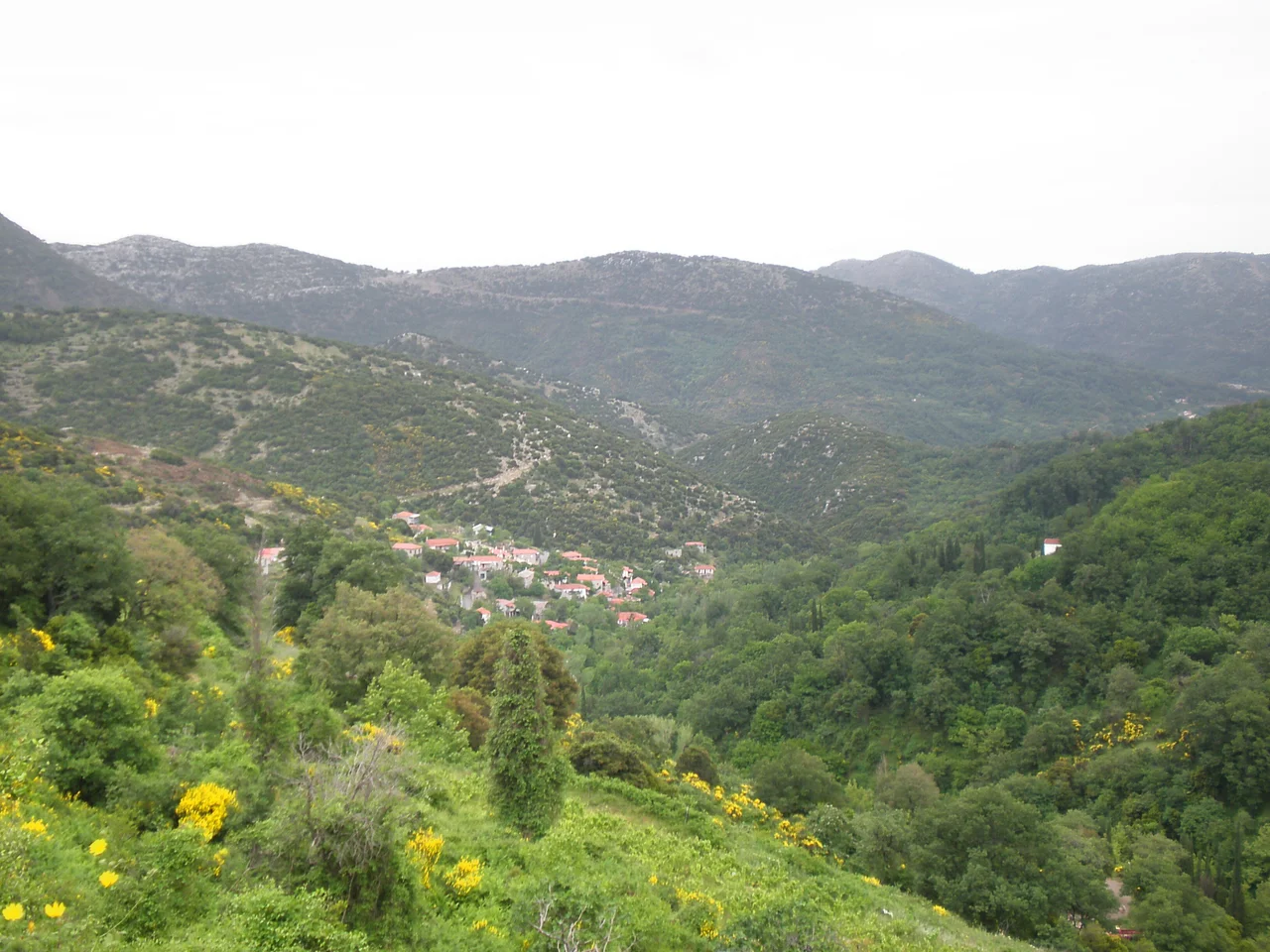

Agios Sostis
The excavations began because of a vision. Yannis Constantopoulos saw something — the sources don't elaborate on what — and when digging started, the ground yielded sixty cells, a golden tong, a chalice, and a limestone cross. Beneath the village of Agios Sostis, at 850 to 900 meters above sea level on a ridge where Arcadia, Elis, and Messenia converge, there had once been a Byzantine monastery. The Franks destroyed it in the 14th century. The discovery prompted its neighbors to build something new.
Where Three Regions Meet
Agios Sostis occupies an unusual position in the Greek landscape — it sits at the junction of three regional units that were, for most of history, distinct territories with their own identities. Arcadia to the east, Elis to the north, Messenia to the west: the village lies at the point where their borders converge, which is to say it lies at the edge of everything and the center of nothing obvious. The altitude — 850 meters at the bridge across the ravine, 900 meters at the upper part of the village — gives the place a high and exposed feeling even by the standards of the Arcadian interior.
Nearby, in the northwest of Mount Lykaion, archaeologists have identified the location of Gorena, the ancient region tied to the city of Lykoa, and the ancient settlement of Tsouraki sits adjacent — a name that comes from the Turkish word for a small hut, a reminder that this landscape has absorbed centuries of layers. Agios Sostis itself is a modern administrative part of the municipality of Oichalia in Messenia, which means its official identity belongs to one region while its geography belongs to three.
The Monastery Beneath the Church
When the Franks moved through the Peloponnese in the 14th century, they left a trail of destroyed Byzantine institutions behind them. The monastery that had stood on the site now occupied by the Church of Saint John — known locally as Ayannis — was one of their casualties. The structure was gone, and with it whatever community had prayed and worked there.
Centuries later, the vision came. Yannis Constantopoulos saw something that moved him to dig. What the excavations uncovered was substantial: sixty cells, suggesting a monastery of considerable size; a golden liturgical instrument; a chalice; and a carved limestone cross. The objects were physical confirmation of what the earth had hidden. The neighboring villages, pooling their effort and resources, built the Church of Saint John on the ruins — not erasing what had been there, but acknowledging it.
A Feast That Holds the Region Together
The church established a feast day on August 29, and in the calendar of a mountainous landscape where villages are separated by difficult terrain, such gathering points matter. Each year, people come from the surrounding villages — down from the ridges, up from the lower valleys — to observe a day that belongs to the community rather than to any single settlement. These annual feasts in rural Greece carry the social weight that shared institutions carry everywhere: they are the occasions when relationships are maintained, news travels, and the sense of belonging to something larger than one's own household is renewed.
For Agios Sostis, small enough that its Wikipedia article is brief, the August 29 feast is the primary event that draws attention outward. The village is not widely known, but its church holds a place in the ritual life of the immediate region that exceeds what its size might suggest.
Shadow of Mount Lykaion
The village exists in the geographic shadow of Mount Lykaion, the sacred mountain of ancient Arcadia that rises to the northwest. In antiquity, Mount Lykaion was the site of a sanctuary of Zeus and games that preceded the Olympics; in legend it was where Zeus was born, and where, according to ancient sources, those who entered the sanctuary's inner precinct lost their shadows. The mountain's northwest flank, where archaeologists have located the ancient region of Gorena, is the same terrain that Agios Sostis borders.
That proximity layers the village's relatively recent history — Byzantine monastery, Frankish destruction, 19th-century rediscovery — against a much deeper past. The bones of ancient Lykoa lie in this soil. The feast of Ayannis on August 29 is a few centuries old. The mountain above the village has been sacred for more than two and a half millennia.
Agios Sostis from the Air
Agios Sostis lies at approximately 37.44°N, 21.96°E on a ridge in the Arcadian highlands, close to where the terrain drops off into Messenia to the west. Kalamata International Airport (LGKL) is roughly 60 km to the southwest; approaching from that direction at 5,000–8,000 feet, the ridge the village occupies is visible as a distinct spine running roughly north–south. Mount Lykaion's summit, at 1,421 meters, rises visibly to the north-northeast. The village itself is small enough that the church of Ayannis, described in local sources as the dominant landmark, is the best visual reference from the air. The terrain here is heavily forested, with cultivated clearings around the ridge settlements.
From the Air
Agios Sostis: 37.44°N, 21.96°E. Nearest major airport: LGKL (Kalamata International), ~60 km southwest. Recommended viewing altitude: 5,000–8,000 ft. Mount Lykaion (1,421 m) is the dominant landmark to the north-northeast. The village sits on a forested ridge near the Arcadia/Messenia/Elis triple border; terrain drops toward Messenia to the west.
Nearby Stories
- Battle of Meligalas 5 km away
- Battle of Picotin 13 km away
- Kastanitsa 13 km away
- Phlius 14 km away
- Cleitor 16 km away
- Pyramid of Hellinikon 16 km away
- Agios Andreas, Katakolo 19 km away
- Strofades 39 km away