
Aitoliko
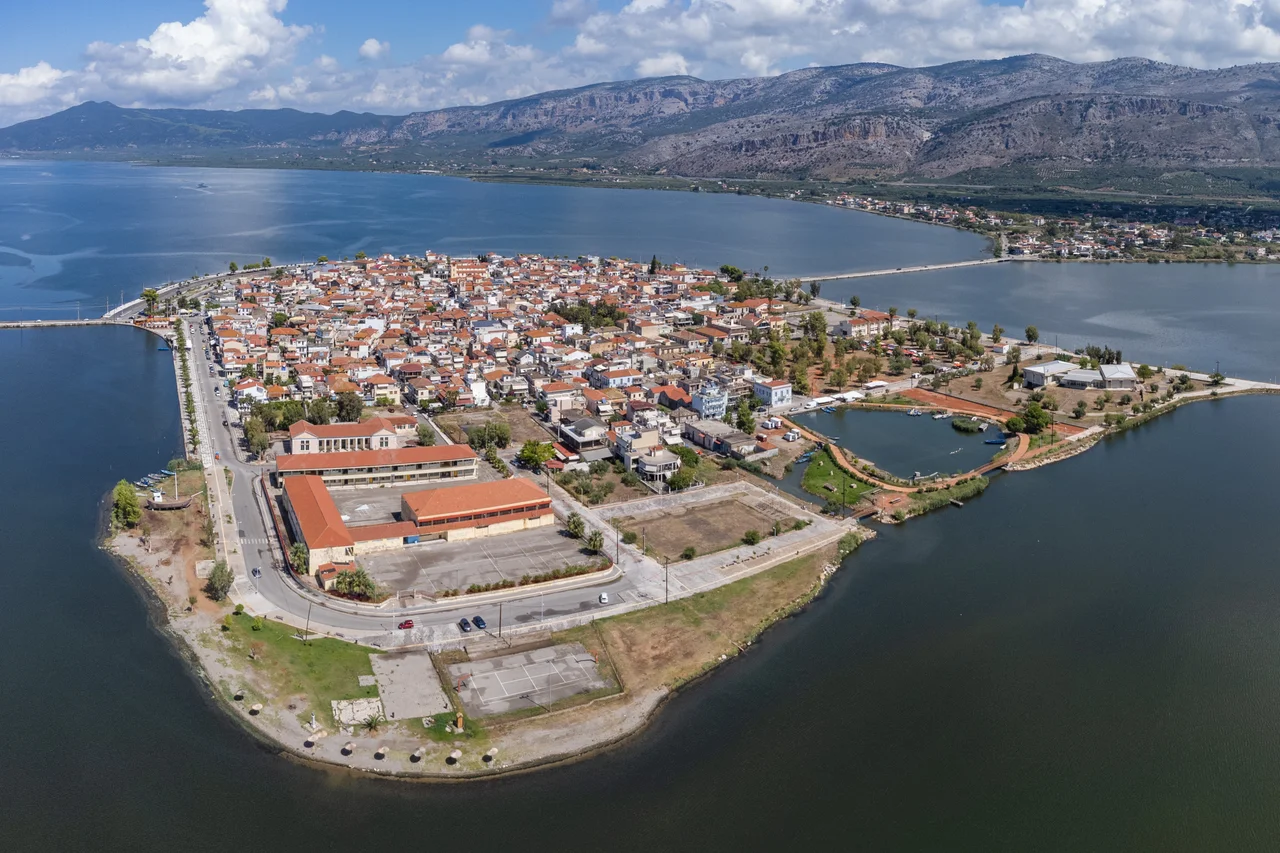
The town floats between two lagoons. To the north lies the Aitoliko Lagoon, deep and dark at 30 meters; to the south the Missolonghi Lagoon, shallow at 1.5 meters, one of the largest in the entire Mediterranean, its salt water renewed each day by tides flowing in from the Gulf of Patras. In the middle of all this water — connected to the mainland by a bridge on each side — sits Aitoliko, a town built on an island so old that its name predates the Greek state itself. Until Greek independence, it was called Anatoliko, meaning eastern. The change of a single syllable marked a new era.
Island of Ancient Standing
The island's strategic position was recognized long before the Byzantine era. Aitoliko's location with respect to the ancient towns of Pleuron and Oiniadai suggests it was part of the Aetolian world for centuries before the Common Era, and its name in antiquity gave the lagoon its modern designation. The fortress potential of a town surrounded by water was clear: an attacker approaching across open lagoon is visible, slow, and vulnerable. Around 900 AD, the Byzantine fleet from Naupaktos — the port known to Venetians as Lepanto — was active in the area. By the twelfth century the island fortress had grown into a genuine city. In 1406, the city was sold to Carlo I Tocco of Kefallinia, passing through the hands of the Ionian Greek nobility that controlled much of western Greece at the time. The Venetians followed, drawing income from the saltworks and fishing waters of what they called Anatoliko until 1430.
The Little Venice of the Wetlands
The comparison to Venice is about more than water. Like its Adriatic counterpart, Aitoliko is a place where the boundary between land and water is not fixed but negotiated. Boats navigate where streets might otherwise run. Wooden huts stand on stilts over the shallows. The two lagoons that surround the island — the Aitoliko to the north and the Missolonghi to the south — are not merely scenic: they are the local economy, preserved over centuries in a form that has changed remarkably little. Fishing is the central activity. The lagoons are described as the richest waters in Greece for fish, and the methods used here — small boats, nets, intimate knowledge of the water — are those of generations. The saltworks east of the island, operating along the old road between Agrinion and Messolonghi, add another layer of traditional production to a place that has always lived from the water around it.
Three Sieges in One Generation
The Greek War of Independence brought extraordinary pressure to this region. During the war, Aitoliko faced three Ottoman sieges — a concentration of military attention that reflects both the town's strategic position in the wetlands and the ferocity of the conflict across western Greece. The first siege saw roughly 500 Greek defenders against an Ottoman force of around 15,000. It was repelled. The second siege was also repelled. The third was not. On the night of April 10–11, 1826, Aitoliko fell to the Ottomans as Messolonghi — the city to the south whose fall, memorialized across Europe as the death site of Lord Byron, became one of the war's most resonant episodes. The defenders of Aitoliko and Messolonghi faced that same April assault together. The cost was severe. Greek general Georgios Liakatas was among those who participated in the defense.
Lagoon, Delta, and Sky
Today Aitoliko is a municipal unit within the larger municipality of Messolonghi, a small town of bridges and lagoon light. The Achelous River delta to the west — the most extensive delta in Greece — feeds fresh water into the system, balancing the salt water flowing in from the Gulf of Patras. A large area of this wetland complex is under nature protection; hunting is banned across much of it. Within these protected zones, 170 species of birds have been recorded — waders, waterfowl, raptors making use of the vast shallow flats. On the island itself, everyday life continues in the narrow streets and central square: schools, a lyceum, churches, a post office. The town that held off fifteen thousand attackers now holds a few thousand residents, the lagoons still surrounding them, the water still the defining fact of the place.
From the Air
Aitoliko sits at 38.4369°N, 21.3536°E, clearly visible from the air as a compact island town surrounded by the two lagoons — the Aitoliko Lagoon to the north and the Missolonghi Lagoon to the south. The Achelous delta and the Messolonghi wetlands form a distinctive landscape visible from considerable altitude: flat, reflective water broken by the island and its two causeway bridges. Messolonghi is approximately 20 km to the southeast. The nearest major airport is LGRX (Araxos), approximately 55 km to the southeast along the coast past the Gulf of Patras. A viewing altitude of 2,000–2,500 feet reveals the full extent of the lagoon system, the saltworks east of the island, and the contrast between the water world of the wetlands and the rocky hills to the east. The Rio-Antirrio Bridge is visible to the southeast on clear days.
Nearby Stories
- Taphians 2.4 km away
- Nafpaktos 3.2 km away
- Ithaca (island) 6.6 km away
- Achaea (Ancient Region) 8.5 km away
- Battle of Manolada 13 km away
- Castle of Saint George, Cephalonia 17 km away
- Acarnania 18 km away
- Greece 41 km away