Alamor
The Puyango River is not much of a river in the dry season - a silver thread through the Loja foothills, easy to wade across. Follow it west, though, and it gathers water from the Alamor, the Ingenio, the Cochurco, and by the time it crosses into Peru it has changed its name to the Tumbes and found the Pacific. Alamor sits 1,380 meters up in the mountains above this quiet waterway, serving as seat of the Puyango canton in the south-western corner of Loja Province, Ecuador. It is a town where the border with Peru feels close because it is close - a short drive west, a muddy river, another country.
The Canton in Its Corner
Puyango canton covers 643 square kilometers of coffee farms, cattle pastures, and steep mountain country, with about 16,800 residents across the urban parish of Alamor and five rural ones - Vicentino, Mercadillo, El Limo, Ciano, and El Arenal. Alamor itself, home to roughly 6,000 people, is the canton's administrative and commercial heart. To reach the provincial capital of Loja, you drive 214 kilometers through mountain switchbacks. To reach the coastal city of Machala, 140 kilometers. Most of the canton's economy runs on the strength of two crops: coffee and corn. Add bananas in the lowlands, brown sugar cane pressed for rum in village mills, and citrus groves where the slopes soften. Cattle, pigs, and horses round out what the ledger calls production and the town simply calls living.
The Two Ridges
Two ranges rise above Puyango - the Alamor ridge itself and a second range where Cerro Curiachi shows darker stone. South of town, the mountain range of El Limo splits into branches with names like Canoas, Puerto Nuevo, Banderones, Gentil, and Achiral. These are not the postcard Andes. The peaks here round off rather than spike; the vegetation stays greener than the high páramo further east. Average temperature in Alamor sits at a comfortable 18 degrees Celsius, climbing to 26 in the lowland valleys and dropping into the mid-teens where the altitude demands a jacket. This is tropical mountain country, warm and humid enough to grow coffee well and mild enough to work through the afternoon without the coastal swelter.
A Calendar of Saints and Crops
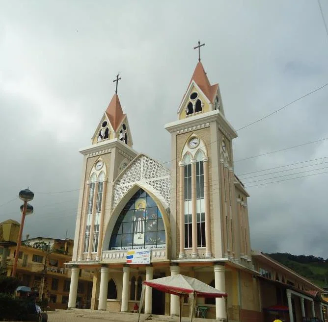
Alamor marks its year by five festivals. January 23 is cantonization day, when Puyango became an administrative unit distinct from its neighbors - a date preserved in civic speeches and parade routes. July 16 belongs to the Virgen del Carmen; August 15 to the Virgin of the Assumption. September 14, in the rural parish of Mercadillo, honors the Señor del Girón. December 8 brings the Immaculate Conception out into the street. Each festival blends religious observance with commercial gathering - markets set up alongside processions, cane rum poured where coffee sellers set out their harvest. The heraldic shield of Alamor carries symbols of exactly this life: the Puyango River, the sun, farming tools and cattle, a branch of coffee and a stalk of corn. The flag shows three horizontal bands - yellow above, green across the middle, white below. The anthem, written in 1979 by Dr. Marcelo Reyes Orellana, was made official in December 1989.
Where the Border Runs
The Puyango River does something specific: it forms part of the international border between Ecuador and Peru. Cross to the opposite bank and you are in the Republic of Peru - a fact that has shaped Alamor's history in ways both obvious and subtle. Commerce flows across the border in both directions, formal and otherwise. Kinship networks do not stop at the river. The 1995 Cenepa War between the two countries, fought further east and north, is the kind of event people here remember having heard on the radio rather than witnessed directly, but the border remains a presence. To the west of Alamor lies the canton of Zapotillo; to the north, El Oro Province and the coast. To the south sit Celica and Pindal. The town is a hinge, and hinges show wear on both sides.
Coffee, Rum, and the Quiet Economy
If you pass through Alamor on the Loja-Arenillas highway, you will likely stop for a meal at one of the simple restaurants on the main street and find yourself handed a cup of local coffee - the region's signature crop, grown on small farms where elevation and climate conspire to produce beans with considerable character. The brown sugar cane pressed for rum is another signature; bottles sold in modest establishments carry labels from operations that never reach export markets. Beyond the valuable export commodities, the canton produces what it needs: oranges, lemons, tropical fruit, cattle. There is no airport. The roads are mostly narrow. The Old Bridge over the Puyango has been lost - the highway network calls that crossing The collapsed Puyango. But the new routes reach. And life here continues in a register that Ecuador's larger cities have largely forgotten: small-town, small-scale, close to the land.
From the Air
Coordinates: 4.02°S, 80.02°W. Elevation: 1,380 meters (4,527 feet). Recommended viewing altitude: FL180-FL240 for terrain appreciation. Nearest airport: SERO (Catamayo - Camilo Ponce Enríquez, Loja region), SESM (Santa Rosa - Machala area). The Puyango River running west-southwest marks the Peru border; follow it downstream and it becomes the Tumbes entering the Pacific. Typical clear mornings give way to afternoon cumulus; dry season (June-October) offers the best visibility over the ridge country.
Nearby Stories
- Gonzanamá 2.4 km away
- Department of Tumbes 12 km away
- Saraguro People 25 km away
- Loja, Ecuador 28 km away
- El Oro Province 29 km away
- Ayabaca province 55 km away
- Ignacio Escudero District 81 km away
- Las Vegas culture (archaeology) 167 km away